MyTopo
Nowlin South Dakota US Topo Map
Couldn't load pickup availability
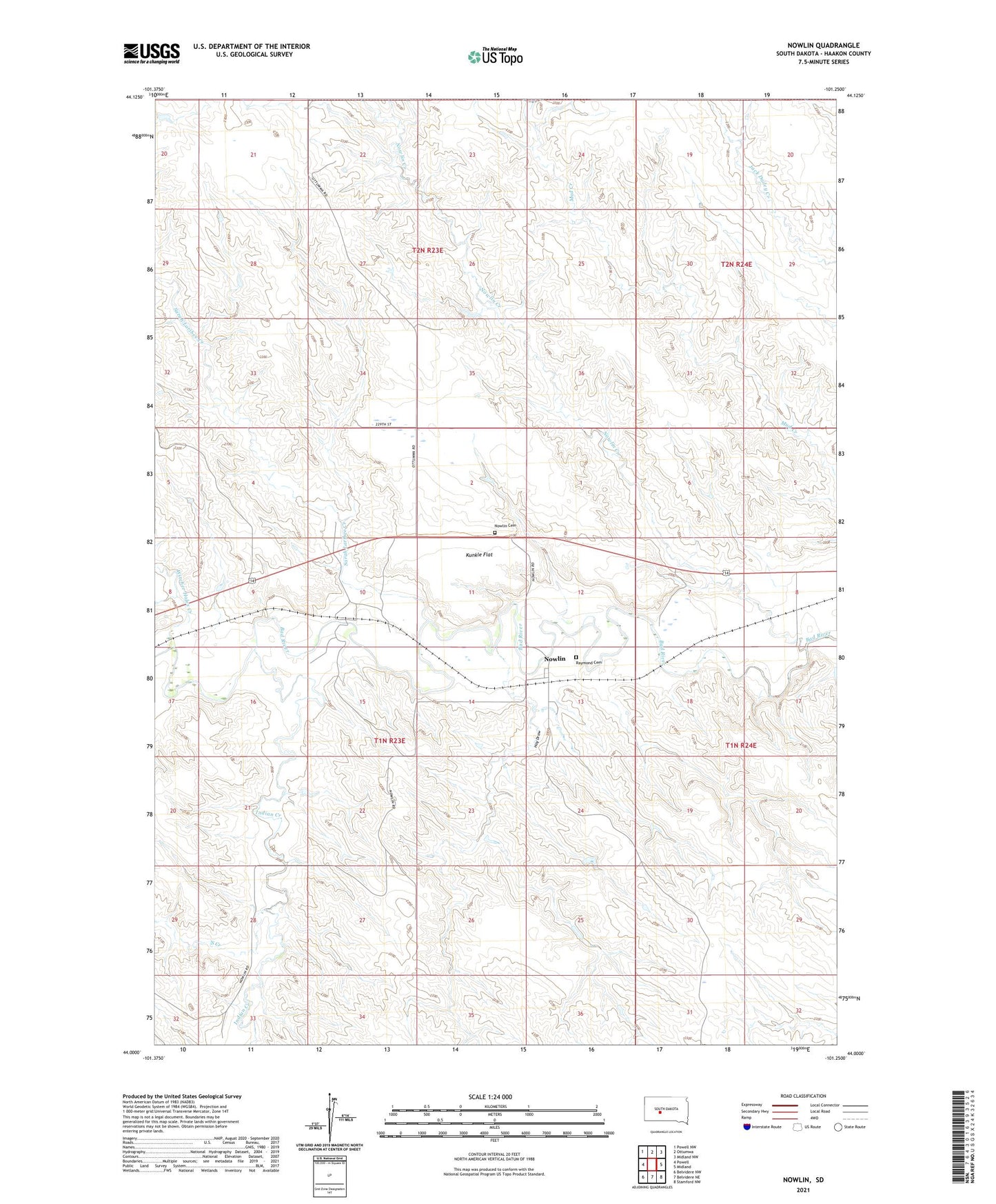
2021 topographic map quadrangle Nowlin in the state of South Dakota. Scale: 1:24000. Based on the newly updated USGS 7.5' US Topo map series, this map is in the following counties: Haakon. The map contains contour data, water features, and other items you are used to seeing on USGS maps, but also has updated roads and other features. This is the next generation of topographic maps. Printed on high-quality waterproof paper with UV fade-resistant inks.
Quads adjacent to this one:
West: Powell
Northwest: Powell NW
North: Ottumwa
Northeast: Midland NW
East: Midland
Southeast: Stamford NW
South: Belvidere NE
Southwest: Belvidere NW
Contains the following named places: Hay Draw, Indian Creek, Kunkle Flat, Nowlin, Nowlin Cemetery, Nowlin Creek, Raymond Cemetery, Sarah Laribee Creek, South Creek, Township of Pleasant View, Witcher Holes Creek