MyTopo
Oacoma South Dakota US Topo Map
Couldn't load pickup availability
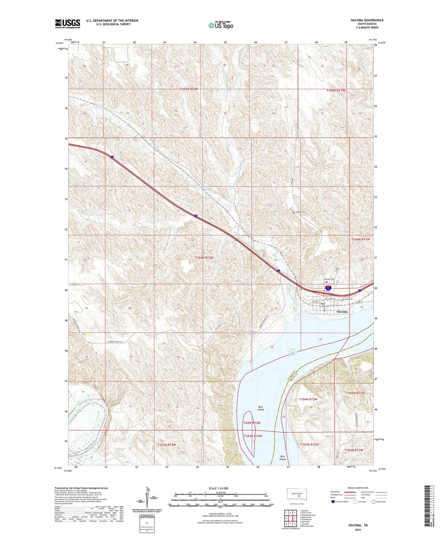
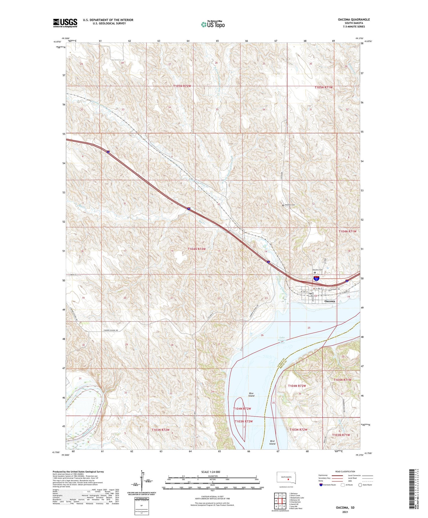
2021 topographic map quadrangle Oacoma in the state of South Dakota. Scale: 1:24000. Based on the newly updated USGS 7.5' US Topo map series, this map is in the following counties: Lyman, Brule. The map contains contour data, water features, and other items you are used to seeing on USGS maps, but also has updated roads and other features. This is the next generation of topographic maps. Printed on high-quality waterproof paper with UV fade-resistant inks.
Quads adjacent to this one:
West: Reliance SE
Northwest: Reliance
North: Short Creek
Northeast: Bedashosha Lake
East: Chamberlain
Southeast: Red Lake West
South: Iona NW
Southwest: Hamill NE
Contains the following named places: American Crow Creek, Badlands, Bice Island, Big Creek, Brule Island, John Bunker Dam, Lindly Ranch, Lower Brule Agency, Moeller Cemetery, North Fork American Crow Creek, Oacoma, Oacoma Cemetery, Oacoma City Hall, Oacoma Community Center, Oacoma Post Office, Reese Ranch, Sharp Ranch, Township of Oacoma, ZIP Code: 57365