MyTopo
Bedashosha Lake South Dakota US Topo Map
Couldn't load pickup availability
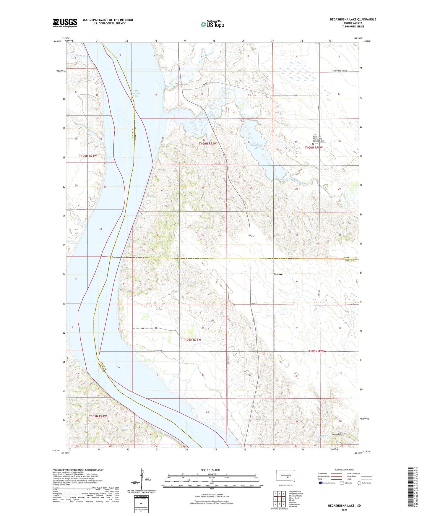
2021 topographic map quadrangle Bedashosha Lake in the state of South Dakota. Scale: 1:24000. Based on the newly updated USGS 7.5' US Topo map series, this map is in the following counties: Buffalo, Brule, Lyman. The map contains contour data, water features, and other items you are used to seeing on USGS maps, but also has updated roads and other features. This is the next generation of topographic maps. Printed on high-quality waterproof paper with UV fade-resistant inks.
Quads adjacent to this one:
West: Short Creek
Northwest: Big Bend Dam
North: Big Bend Dam SE
Northeast: North of Shelby
East: Shelby
Southeast: Pukwana
South: Chamberlain
Southwest: Oacoma
This map covers the same area as the classic USGS quad with code o43099h3.
Contains the following named places: Bailey Dam, Bedashosha Lake, Brule Bottom State Public Hunting Area, Crow Creek, Crow Creek Dam, De Smet Creek, Des Lauriens Island, Fort Hale, Grace Howard Mission, Grosse, Kiowa State Public Hunting Area, Saint John The Baptist Episcopal Cemetery, Saint Johns Church, Short Creek, Tischudy Gulch, Township of West Point, Wolf Creek