MyTopo
Parmelee South Dakota US Topo Map
Couldn't load pickup availability
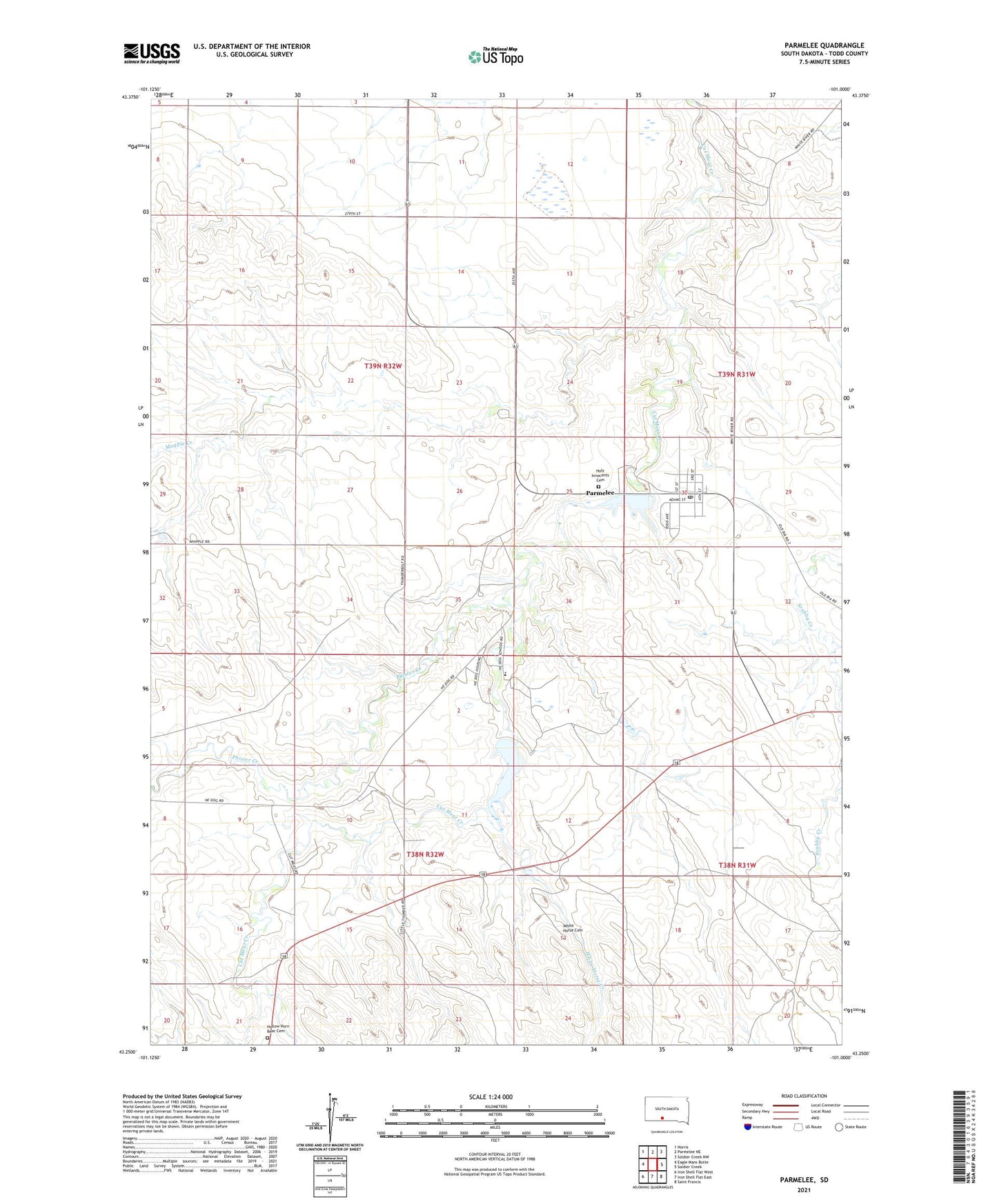
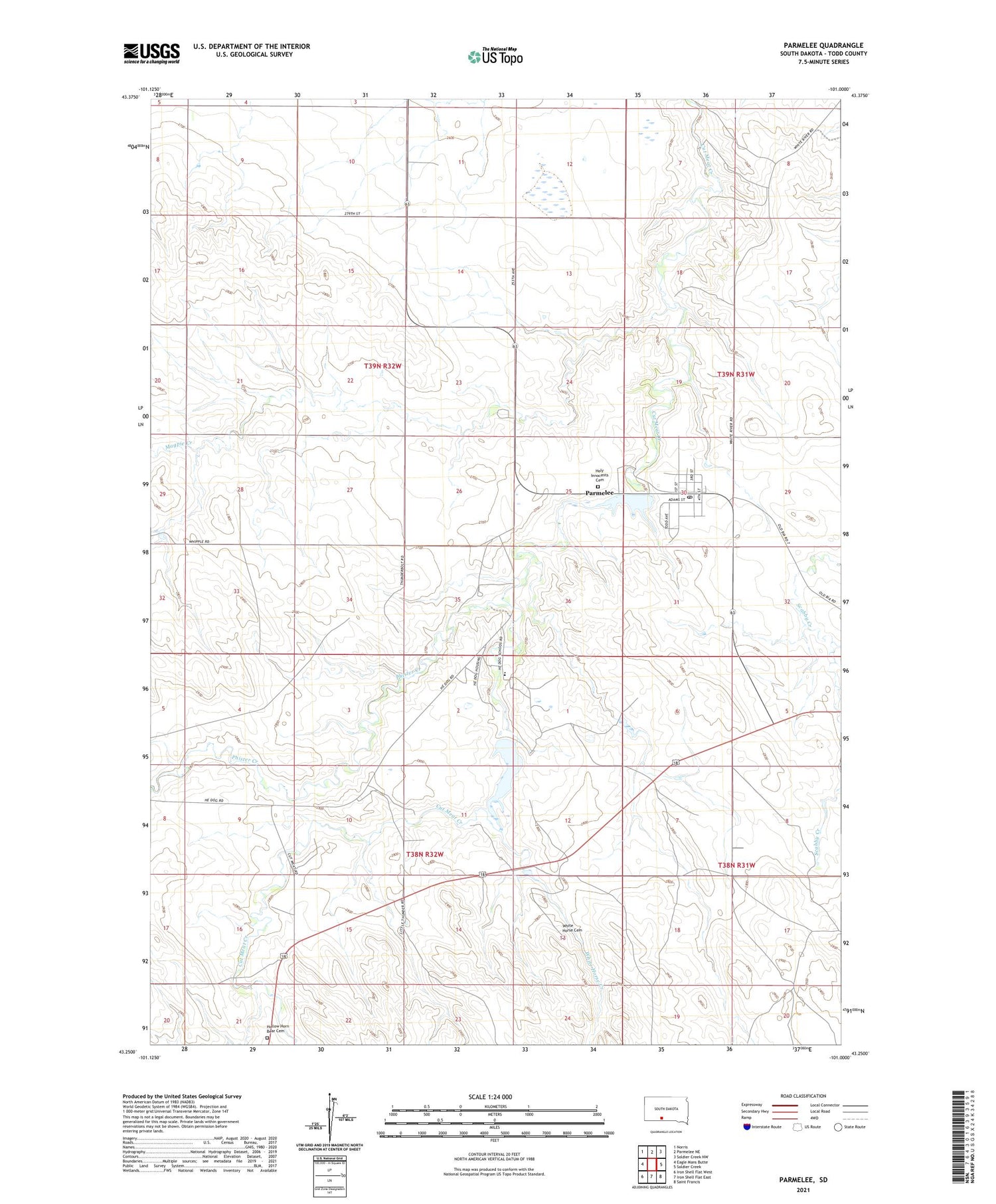
2021 topographic map quadrangle Parmelee in the state of South Dakota. Scale: 1:24000. Based on the newly updated USGS 7.5' US Topo map series, this map is in the following counties: Todd. The map contains contour data, water features, and other items you are used to seeing on USGS maps, but also has updated roads and other features. This is the next generation of topographic maps. Printed on high-quality waterproof paper with UV fade-resistant inks.
Quads adjacent to this one:
West: Eagle Mans Butte
Northwest: Norris
North: Parmelee NE
Northeast: Soldier Creek NW
East: Soldier Creek
Southeast: Saint Francis
South: Iron Shell Flat East
Southwest: Iron Shell Flat West
Contains the following named places: Cut Meat Issue Station, Eagle Feather Lake, He Dog Dam, He Dog Elementary School, He Dog Lake, High Hawks Village Historic Site, Hollow Horn Bear Cemetery, Hollow Horn Bear Village Historic Site, Holy Innocence Church, Holy Innocents Cemetery, Parmelee, Parmelee Census Designated Place, Parmelee Dam, Parmelee Post Office, Parmelee Segment, Phister Creek, Reis School House, White Horse Cemetery, White Horse Creek, ZIP Code: 57566