MyTopo
Saint Francis South Dakota US Topo Map
Couldn't load pickup availability
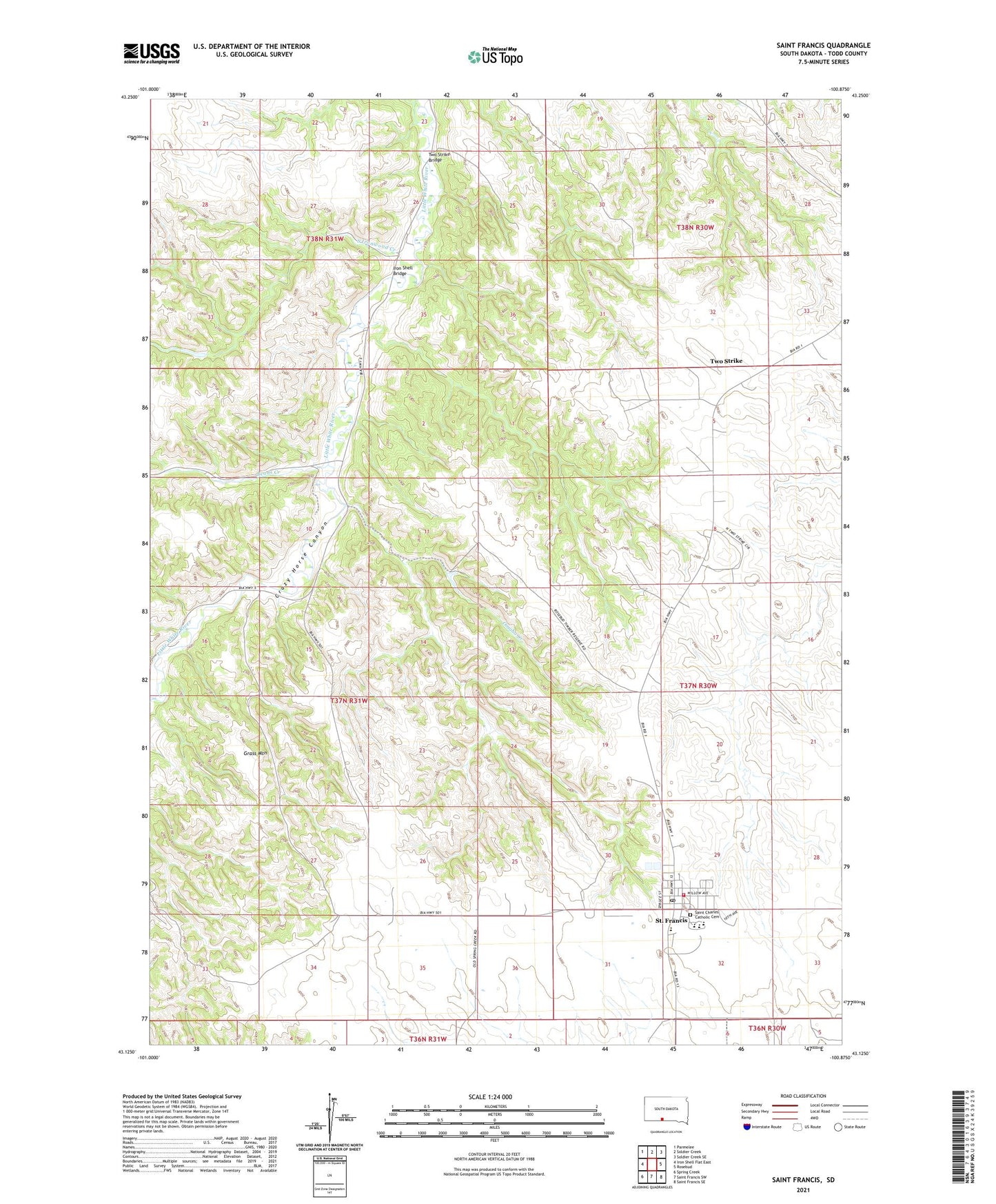
2021 topographic map quadrangle Saint Francis in the state of South Dakota. Scale: 1:24000. Based on the newly updated USGS 7.5' US Topo map series, this map is in the following counties: Todd. The map contains contour data, water features, and other items you are used to seeing on USGS maps, but also has updated roads and other features. This is the next generation of topographic maps. Printed on high-quality waterproof paper with UV fade-resistant inks.
Quads adjacent to this one:
West: Iron Shell Flat East
Northwest: Parmelee
North: Soldier Creek
Northeast: Soldier Creek SE
East: Rosebud
Southeast: Saint Francis SE
South: Saint Francis SW
Southwest: Spring Creek
This map covers the same area as the classic USGS quad with code o43100b8.
Contains the following named places: Beads Creek, Buechel Memorial Lakota Museum, Grass Mountain, Grass Mountain Segment, Immaculate Conception Church, Iron Shell Bridge, Mission School, Omaha Creek, Rosebud Timber Reserve, Saint Charles Catholic Cemetery, Saint Francis, Saint Francis Elementary School, Saint Francis High School, Saint Francis Junior High School, Saint Francis Mission, Saint Francis Post Office, Saint Francis Volunteer Fire Department, South Ironwood Creek, Town of Saint Francis, Two Strike, Two Strike Bridge, Two Strike Census Designated Place, Unorganized Territory of West Todd