MyTopo
Patch Skin Buttes SE South Dakota US Topo Map
Couldn't load pickup availability
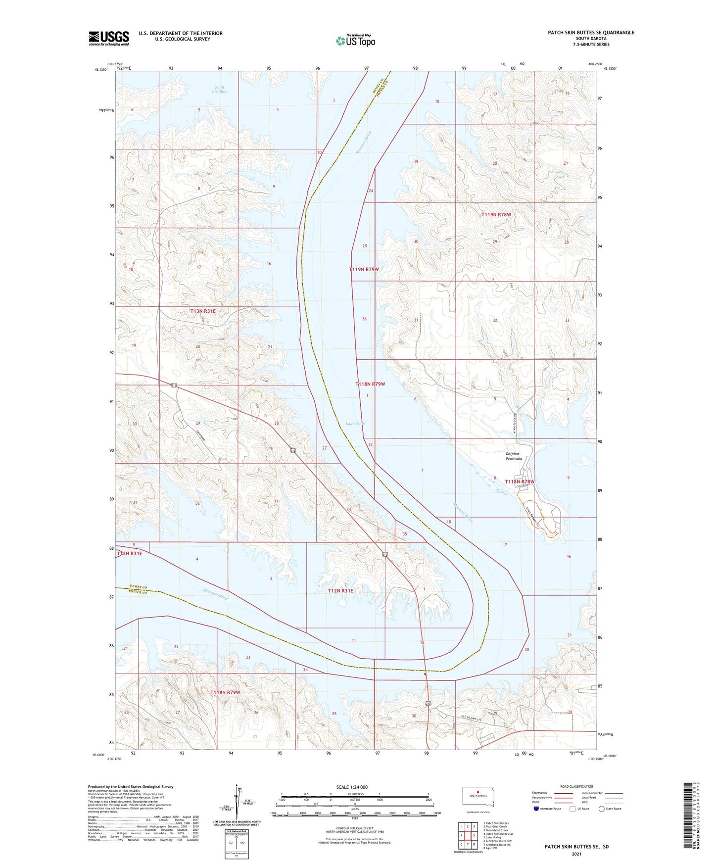
2021 topographic map quadrangle Patch Skin Buttes SE in the state of South Dakota. Scale: 1:24000. Based on the newly updated USGS 7.5' US Topo map series, this map is in the following counties: Potter, Dewey. The map contains contour data, water features, and other items you are used to seeing on USGS maps, but also has updated roads and other features. This is the next generation of topographic maps. Printed on high-quality waterproof paper with UV fade-resistant inks.
Quads adjacent to this one:
West: Patch Skin Buttes SW
Northwest: Patch Skin Buttes
North: Four Bear Creek
Northeast: Steamboat Creek
East: Lake Hurley
Southeast: Agar NW
South: Artichoke Butte NE
Southwest: Artichoke Butte NW
Contains the following named places: Agency Church, Bullberry Island, Carl Cronin Dam, Cheyenne River Indian Agency, Corpus Cristi Church, Dolphus Peninsula, Forest City, Forest City Cemetery, Forest City Recreation Area, Forest City South, Pascals Island, Swedes Draw, Swift Bird Bay, Swift Bird Cemetery, Swift Bird Census Designated Place, Swift Bird Church, Swift Bird Training Center, Township of Forest City, Waneta, Whitlocks Bay Recreation Area, Whitlocks Crossing