MyTopo
Pierre SW South Dakota US Topo Map
Couldn't load pickup availability
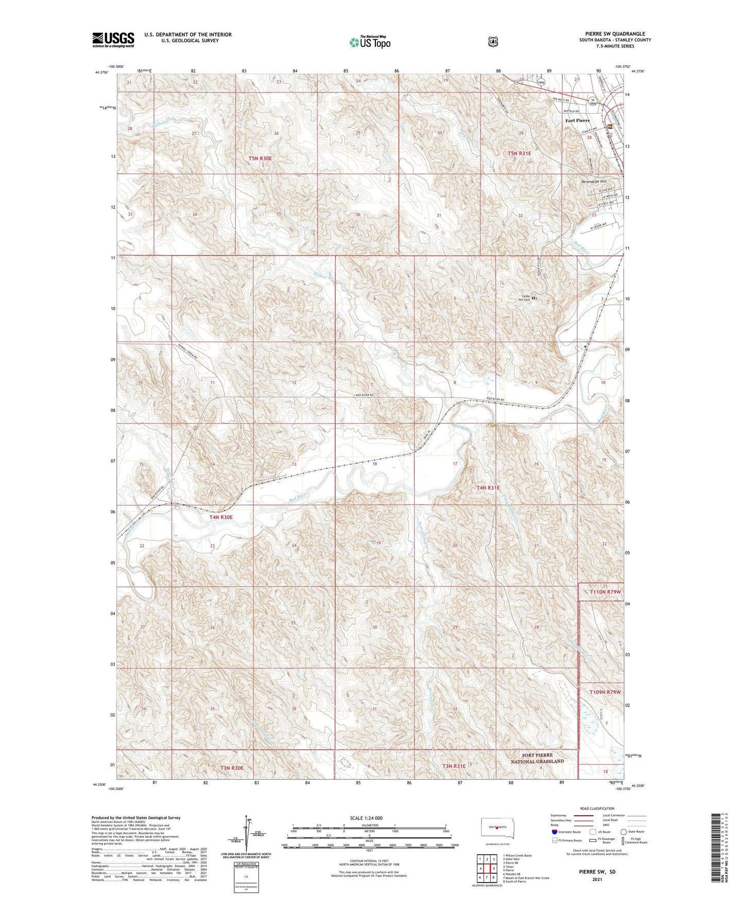
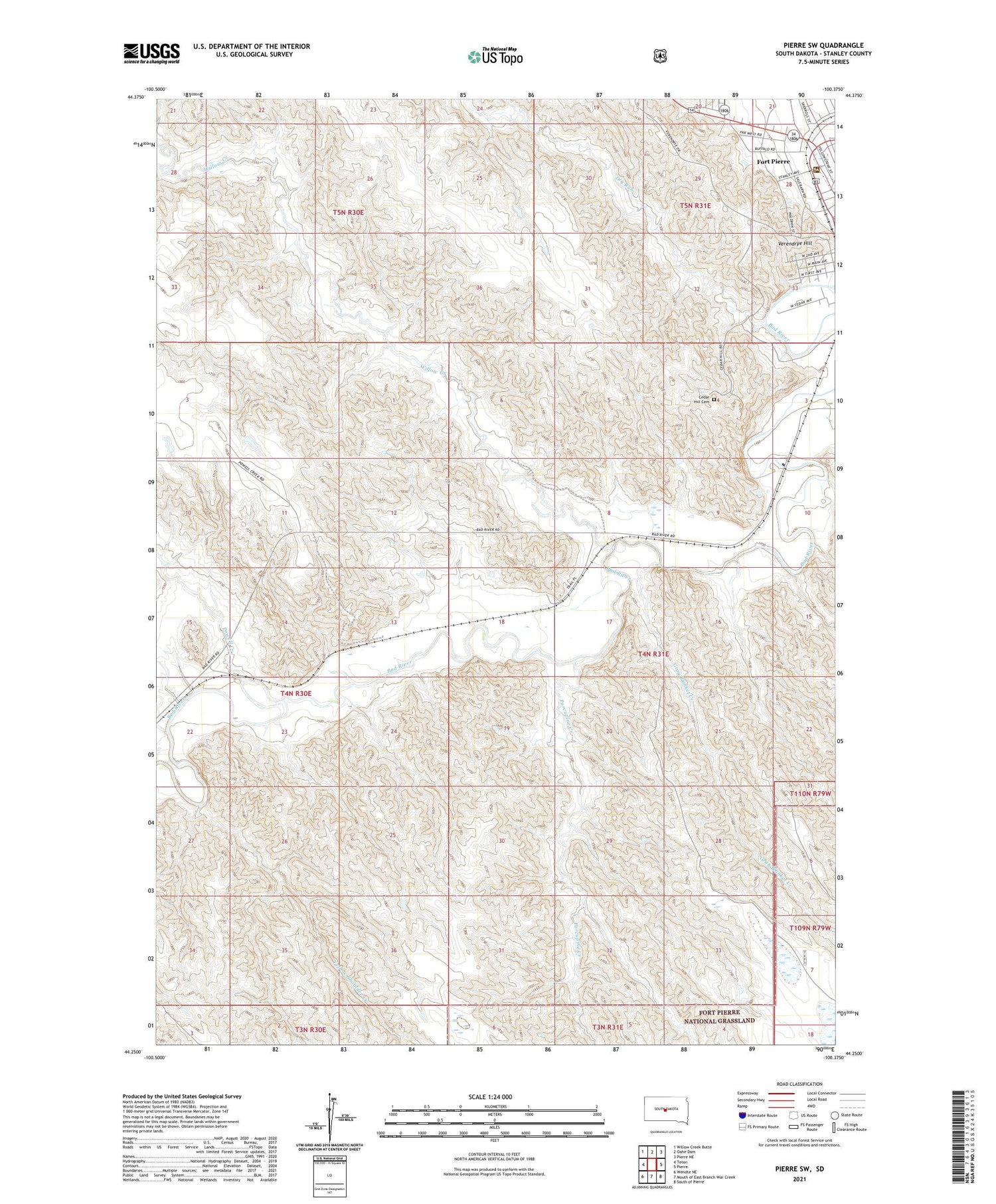
2021 topographic map quadrangle Pierre SW in the state of South Dakota. Scale: 1:24000. Based on the newly updated USGS 7.5' US Topo map series, this map is in the following counties: Stanley. The map contains contour data, water features, and other items you are used to seeing on USGS maps, but also has updated roads and other features. This is the next generation of topographic maps. Printed on high-quality waterproof paper with UV fade-resistant inks.
Quads adjacent to this one:
West: Teton
Northwest: Willow Creek Butte
North: Oahe Dam
Northeast: Pierre NE
East: Pierre
Southeast: South of Pierre
South: Mouth of East Branch War Creek
Southwest: Wendte NE
Contains the following named places: Cedar Hill Cemetery, City of Fort Pierre, Dry Run, Fort Campbell, Gray Blanket Creek, KGFX-FM (Pierre), KNEY-FM (Pierre), Louis Caldwell Dam, Porcupine Creek, Powell Creek, Verendrye Hill, Willow Creek, Yellow Shoulder Creek