MyTopo
Pine Ridge South Dakota US Topo Map
Couldn't load pickup availability
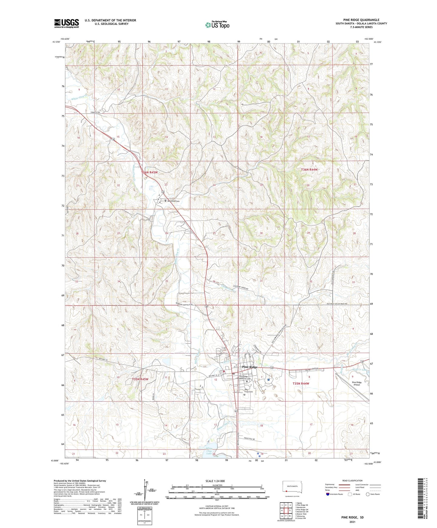
2021 topographic map quadrangle Pine Ridge in the state of South Dakota. Scale: 1:24000. Based on the newly updated USGS 7.5' US Topo map series, this map is in the following counties: Oglala Lakota. The map contains contour data, water features, and other items you are used to seeing on USGS maps, but also has updated roads and other features. This is the next generation of topographic maps. Printed on high-quality waterproof paper with UV fade-resistant inks.
Quads adjacent to this one:
West: Pine Ridge SW
Northwest: Oglala
North: Pine Ridge NE
Northeast: Manderson
East: Manderson SW
Southeast: Clinton NW
South: Whiteclay
Southwest: Beaver Wall
Contains the following named places: Cheyenne Creek, East Prong Wolf Creek, Herd Camp Creek, Holy Cross Cemetery, Holy Rosary School, Oglala School, Oglala Sioux Tribal Ambulance Service, Oglala-Sioux Sundance Arena, Pine Ridge, Pine Ridge Airport, Pine Ridge Census Designated Place, Pine Ridge Elementary School, Pine Ridge Fire Department, Pine Ridge High School, Pine Ridge Indian Health Service Hospital, Pine Ridge Police Department, Pine Ridge Post Office, Pine Ridge Presbyterian Cemetery, Red Cloud Cemetery, Red Cloud Elementary School, Red Cloud High School, South Prong Wolf Creek, Three Moccasin Park, Wakpamni District, White Clay Dam, White Clay Lake, Wolf Creek, Wolf Creek Lake Dam, ZIP Code: 57770