MyTopo
Pollock NW South Dakota US Topo Map
Couldn't load pickup availability
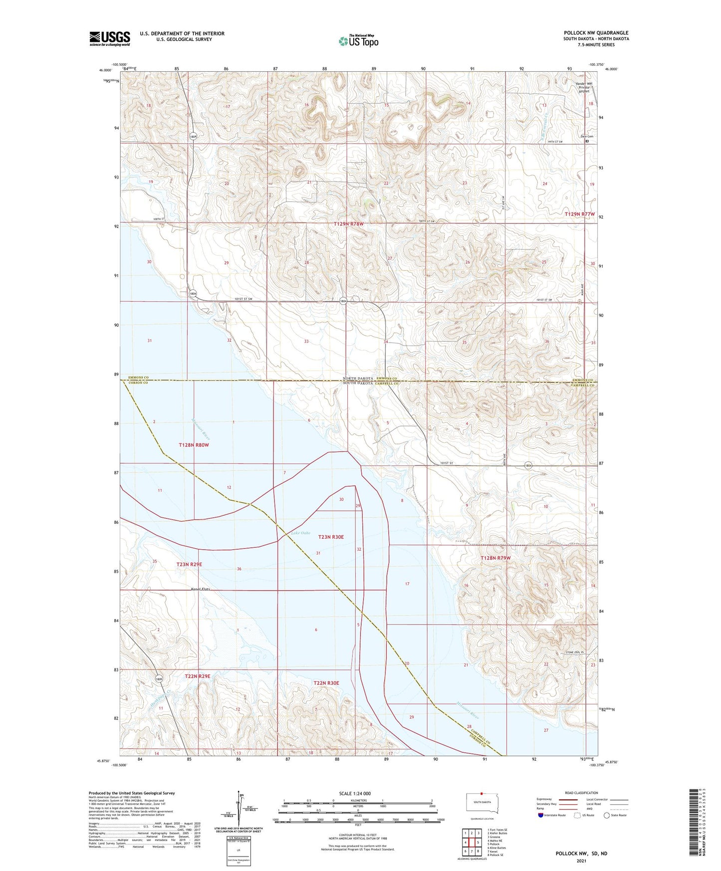
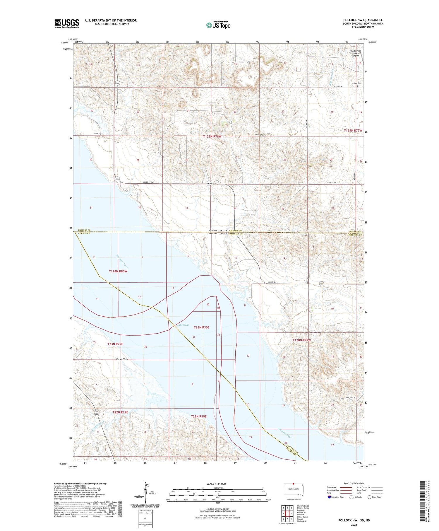
2021 topographic map quadrangle Pollock NW in the states of South Dakota, North Dakota. Scale: 1:24000. Based on the newly updated USGS 7.5' US Topo map series, this map is in the following counties: Campbell, Emmons, Corson. The map contains contour data, water features, and other items you are used to seeing on USGS maps, but also has updated roads and other features. This is the next generation of topographic maps. Printed on high-quality waterproof paper with UV fade-resistant inks.
Quads adjacent to this one:
West: Mahto NE
Northwest: Fort Yates SE
North: Kiefer Buttes
Northeast: Grassna
East: Pollock
Southeast: Pollock SE
South: Kenel
Southwest: Kline Buttes
Contains the following named places: Dale Cemetery, Fort Manuel, Hunkpapa Creek, Kenel, Kenel Flats, Saint Benedict Mission, Township of LaGrace, Vanderbilt, Vanderbilt Post Office, Vanervorsite Bay Recreational Area