MyTopo
Pollock South Dakota US Topo Map
Couldn't load pickup availability
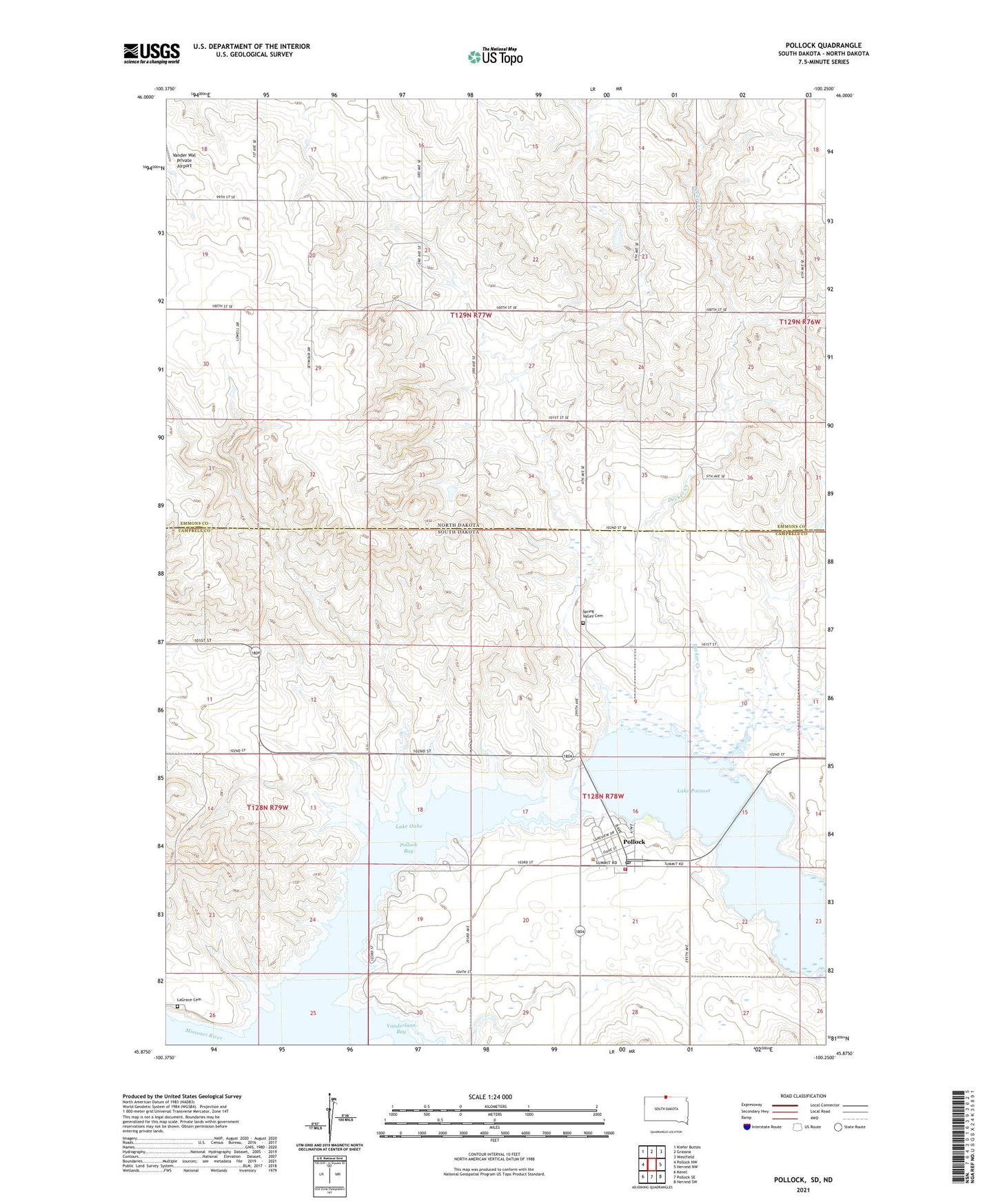
2021 topographic map quadrangle Pollock in the states of South Dakota, North Dakota. Scale: 1:24000. Based on the newly updated USGS 7.5' US Topo map series, this map is in the following counties: Campbell, Emmons. The map contains contour data, water features, and other items you are used to seeing on USGS maps, but also has updated roads and other features. This is the next generation of topographic maps. Printed on high-quality waterproof paper with UV fade-resistant inks.
Quads adjacent to this one:
West: Pollock NW
Northwest: Kiefer Buttes
North: Grassna
Northeast: Westfield
East: Herreid NW
Southeast: Herreid SW
South: Pollock SE
Southwest: Kenel
Contains the following named places: Decker Creek, LaGrace, LaGrace Cemetery, Lake Pocasse, Pocasse National Wildlife Refuge, Pollock, Pollock Bay, Pollock City Hall, Pollock Community Center, Pollock Post Office, Pollock Recreation Area, Pollock Volunteer Fire Department, Searl Creek, Spring Valley Cemetery, Town of Pollock, Township of Pollock, Vander Wal Private Airport, Vanderlaan Bay, West Pollock Recreation Area, ZIP Code: 57648