MyTopo
Westfield North Dakota US Topo Map
Couldn't load pickup availability
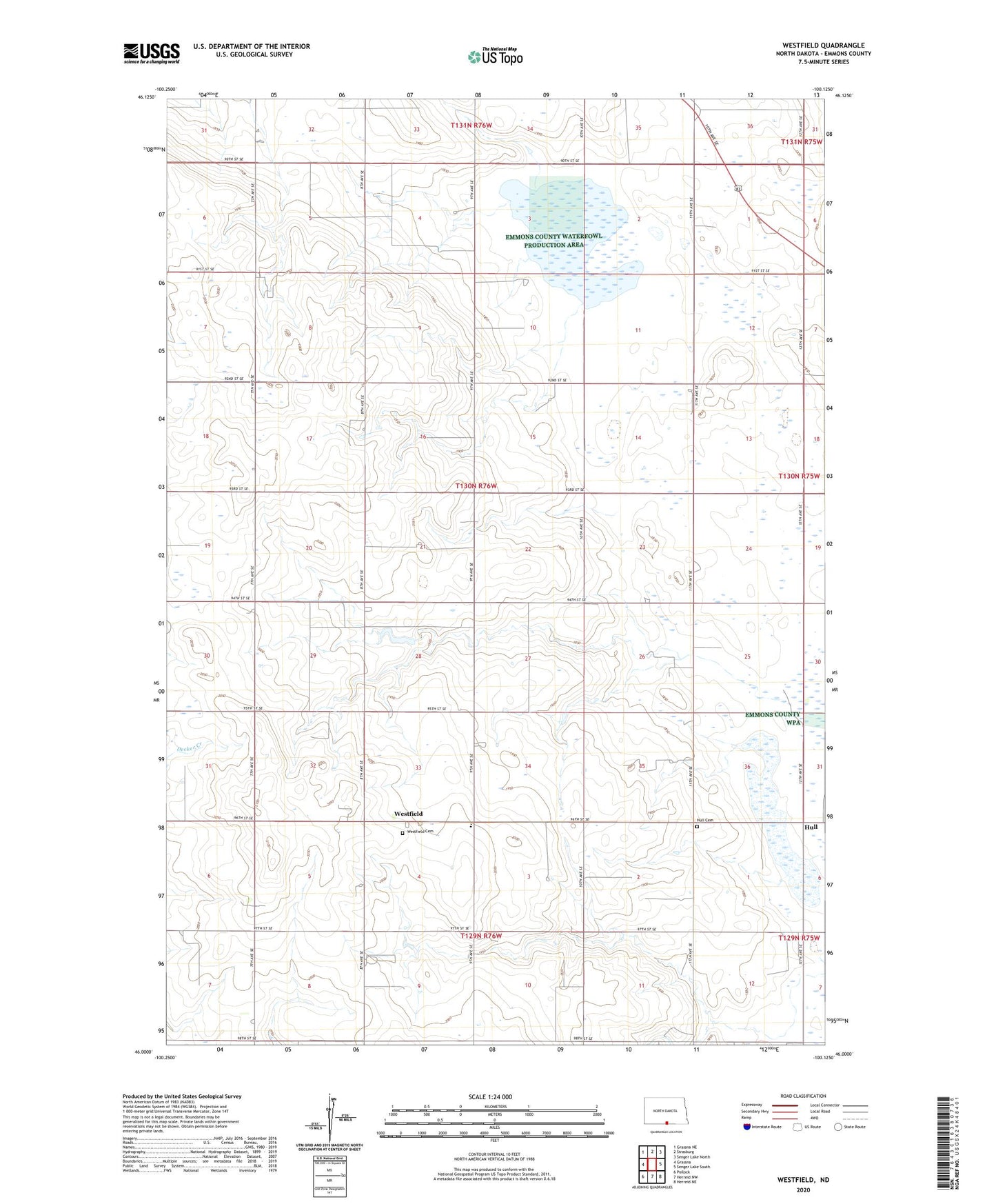
2024 topographic map quadrangle Westfield in the state of North Dakota. Scale: 1:24000. Based on the newly updated USGS 7.5' US Topo map series, this map is in the following counties: Emmons. The map contains contour data, water features, and other items you are used to seeing on USGS maps, but also has updated roads and other features. This is the next generation of topographic maps. Printed on high-quality waterproof paper with UV fade-resistant inks.
Quads adjacent to this one:
West: Grassna
Northwest: Grassna NE
North: Strasburg
Northeast: Senger Lake North
East: Senger Lake South
Southeast: Herreid NE
South: Herreid NW
Southwest: Pollock
This map covers the same area as the classic USGS quad with code o46100a2.
Contains the following named places: Bakker Elementary School, Hull Cemetery, Karl Vanderval Dam, National Waterfowl Production Area, Roth Lake, Unorganized Territory of South Emmons, Westfield, Westfield Cemetery, ZIP Code: 58573