MyTopo
Redfield North South Dakota US Topo Map
Couldn't load pickup availability
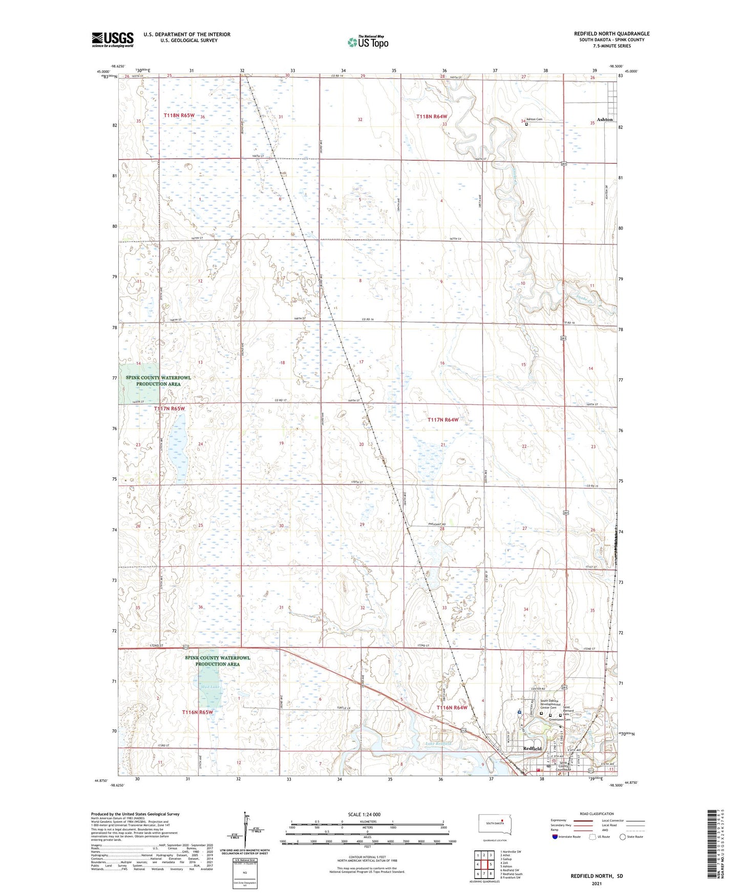
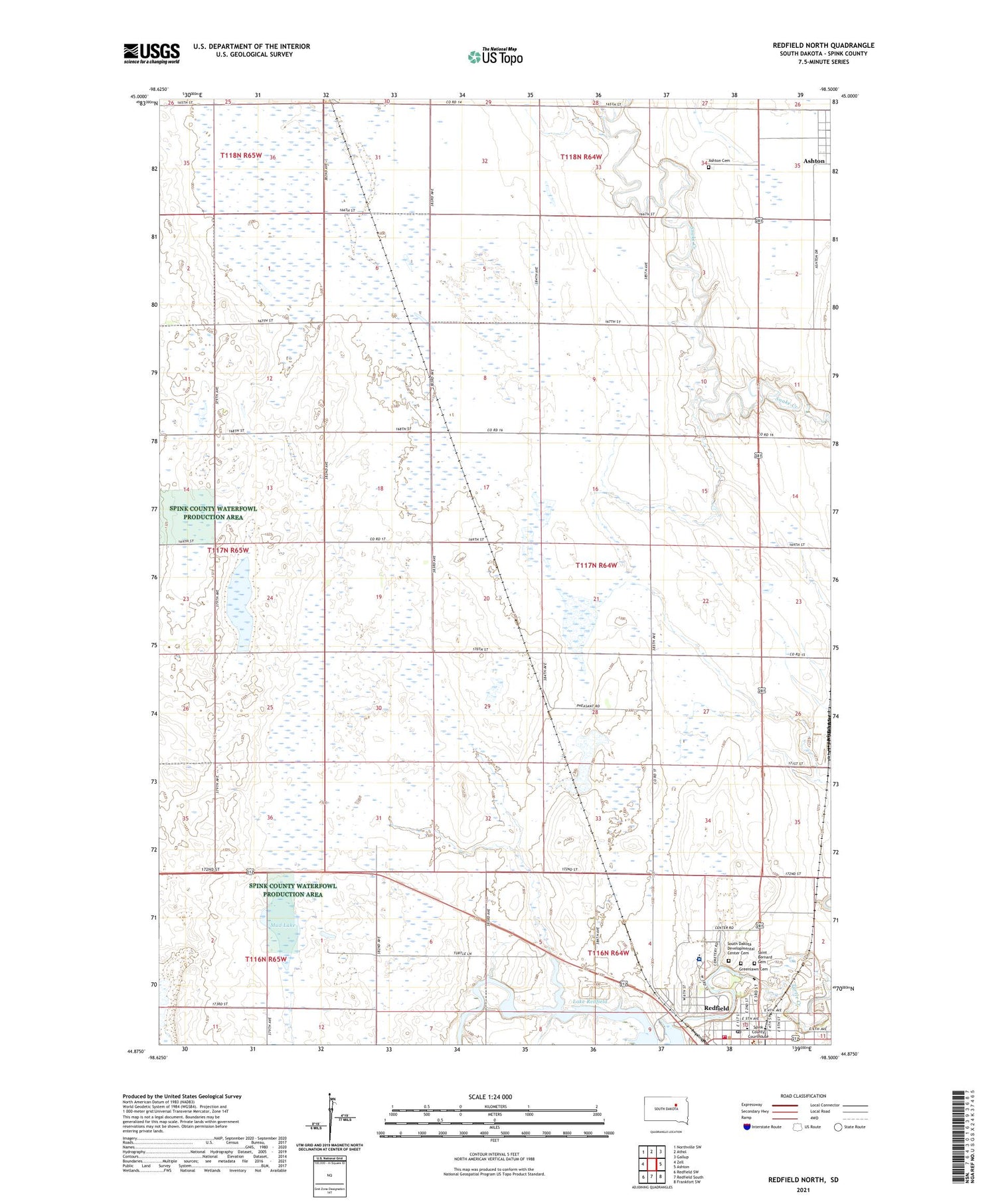
2021 topographic map quadrangle Redfield North in the state of South Dakota. Scale: 1:24000. Based on the newly updated USGS 7.5' US Topo map series, this map is in the following counties: Spink. The map contains contour data, water features, and other items you are used to seeing on USGS maps, but also has updated roads and other features. This is the next generation of topographic maps. Printed on high-quality waterproof paper with UV fade-resistant inks.
Quads adjacent to this one:
West: Zell
Northwest: Northville SW
North: Athol
Northeast: Gallup
East: Ashton
Southeast: Frankfort SW
South: Redfield South
Southwest: Redfield SW
Contains the following named places: Abigail Gardner Rescue Site, Ada Post Office, Ashton Cemetery, Center School Number 5, Doland Police Department, German Methodist Church, Gordon Post Office, Greenlawn Cemetery, Ironsides School, Jenner School, Keller School, KQKD-AM (Redfield), Lake Redfield, Marlette School, Mud Lake, Pheasant City Drive-In, Redfield, Redfield Carnegie Library, Redfield City Fire Department, Redfield City Hall, Redfield Elementary School, Redfield High School, Redfield Junior High School, Redfield Lake Dam, Redfield Post Office, Redfield Rural Fire Department, Saint Bernard Cemetery, School Number 4, South Dakota Developmental Center, South Dakota Developmental Center Cemetery, Spink County Courthouse, Spink County Sheriff Department, Township of Three Rivers