
MyTopo
Rose Hill Cemetery South Dakota US Topo Map
Couldn't load pickup availability
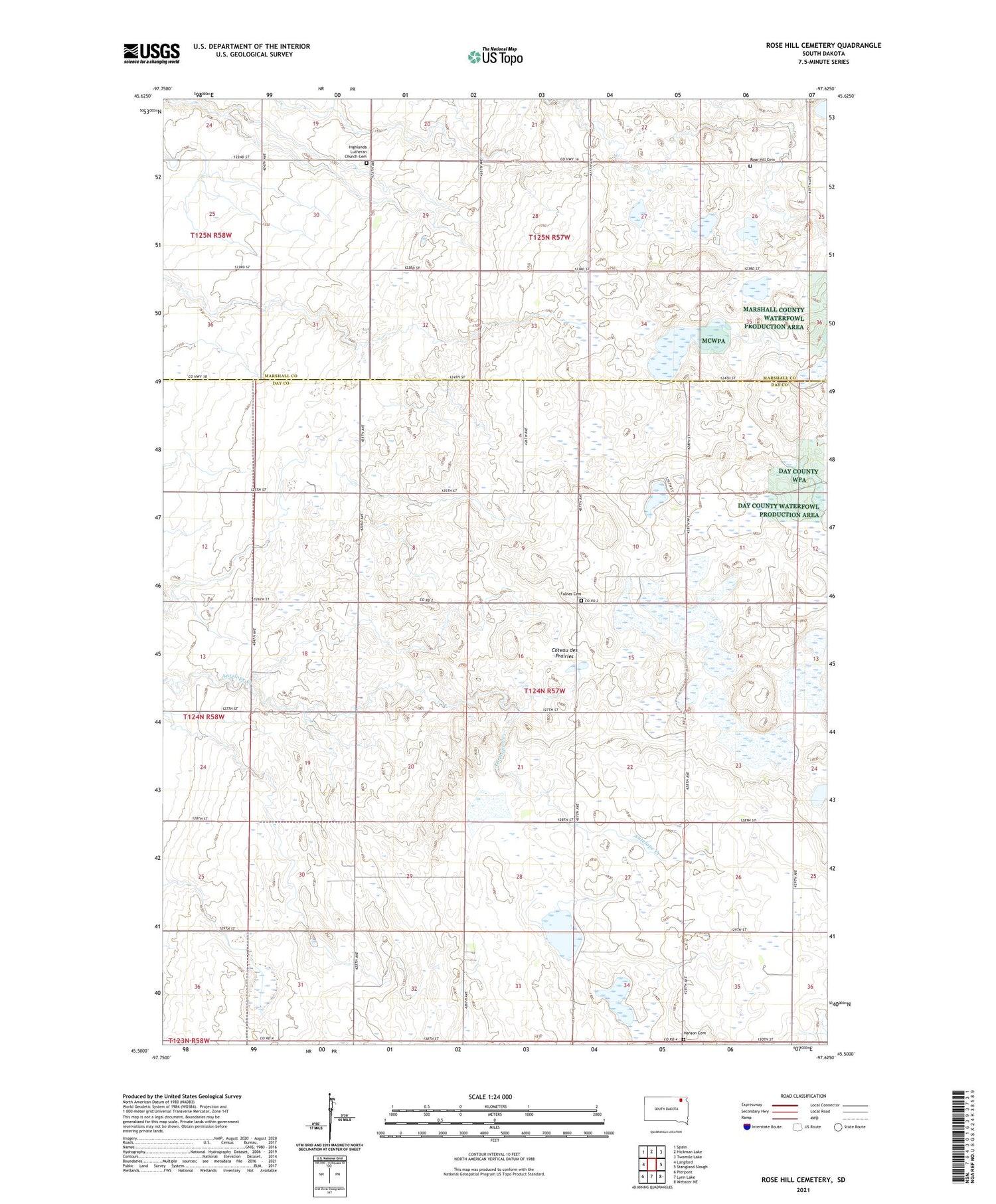
2021 topographic map quadrangle Rose Hill Cemetery in the state of South Dakota. Scale: 1:24000. Based on the newly updated USGS 7.5' US Topo map series, this map is in the following counties: Day, Marshall. The map contains contour data, water features, and other items you are used to seeing on USGS maps, but also has updated roads and other features. This is the next generation of topographic maps. Printed on high-quality waterproof paper with UV fade-resistant inks.
Quads adjacent to this one:
West: Langford
Northwest: Spain
North: Hickman Lake
Northeast: Twomile Lake
East: Stangland Slough
Southeast: Webster NE
South: Lynn Lake
Southwest: Pierpont
Contains the following named places: Falnes Cemetery, Falnes Church, Hanson Cemetery, Highlanda Church, Highlanda Lutheran Church Cemetery, Jandahl School, Rose Hill Cemetery, School Number 204, School Number 205, School Number 226, School Number 3, School Number 4, Sjovall Feed Yard, Township of Independence


