
MyTopo
Tepee Buttes South Dakota US Topo Map
Couldn't load pickup availability
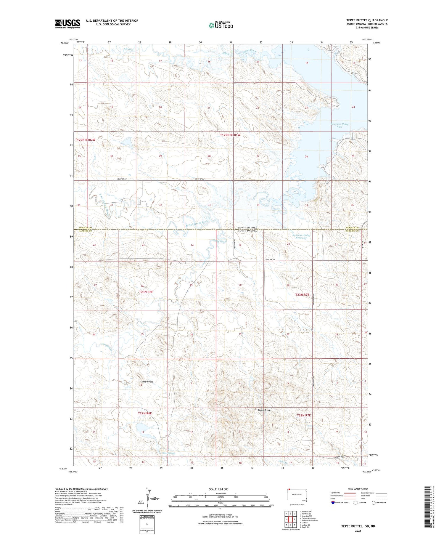
2021 topographic map quadrangle Tepee Buttes in the states of South Dakota, North Dakota. Scale: 1:24000. Based on the newly updated USGS 7.5' US Topo map series, this map is in the following counties: Harding, Bowman. The map contains contour data, water features, and other items you are used to seeing on USGS maps, but also has updated roads and other features. This is the next generation of topographic maps. Printed on high-quality waterproof paper with UV fade-resistant inks.
Quads adjacent to this one:
West: Eagles Nest Butte
Northwest: Bowman SW
North: Bowman SE
Northeast: Scranton SW
Southeast: Ralph SW
South: Ludlow SE
Southwest: Ludlow
Contains the following named places: Alkali Creek, Barn Dam, Beermug Lake, Bowman-Haley Lake, Bowman-Haley Reservoir, Corey Butte, Crooked Creek, Nygaard Leaky Dam, Teepee Dam, Tepee Buttes, Tepee Springs, Township of Calmar, Township of Minnehaha


