MyTopo
Eagles Nest Butte South Dakota US Topo Map
Couldn't load pickup availability
Also explore the Eagles Nest Butte Forest Service Topo of this same quad for updated USFS data
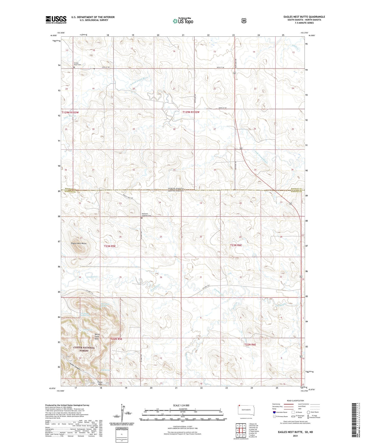
2021 topographic map quadrangle Eagles Nest Butte in the states of South Dakota, North Dakota. Scale: 1:24000. Based on the newly updated USGS 7.5' US Topo map series, this map is in the following counties: Harding, Bowman. The map contains contour data, water features, and other items you are used to seeing on USGS maps, but also has updated roads and other features. This is the next generation of topographic maps. Printed on high-quality waterproof paper with UV fade-resistant inks.
Quads adjacent to this one:
West: Ladner NE
Northwest: Rhame SE
North: Bowman SW
Northeast: Bowman SE
East: Tepee Buttes
Southeast: Ludlow SE
South: Ludlow
Southwest: Ladner SE
This map covers the same area as the classic USGS quad with code o45103h4.
Contains the following named places: Cox School, Cox Spring, Cox Spring Number Two, Eagles Nest Butte, Fuller Pass, Grand River Cemetery, H Feist Ranch, Lone Tree Creek, Lone Tree School, M Feist Ranch, McCumsey Spring, Nathanel Lutheran Cemetery, Paul Spring, Petes Creek, Township of Cox, Township of Ladd