MyTopo
Tornado Ranch South Dakota US Topo Map
Couldn't load pickup availability
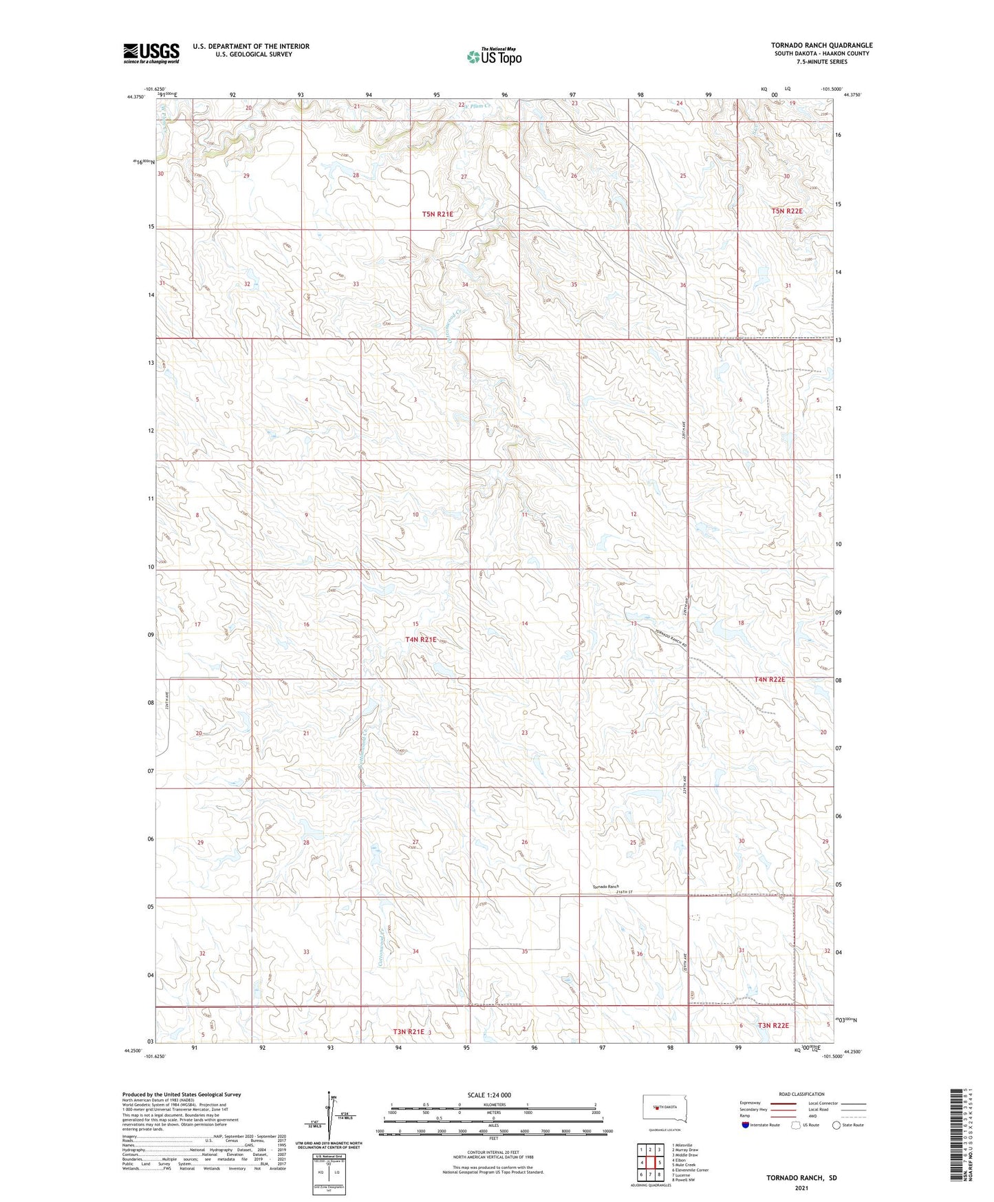
2021 topographic map quadrangle Tornado Ranch in the state of South Dakota. Scale: 1:24000. Based on the newly updated USGS 7.5' US Topo map series, this map is in the following counties: Haakon. The map contains contour data, water features, and other items you are used to seeing on USGS maps, but also has updated roads and other features. This is the next generation of topographic maps. Printed on high-quality waterproof paper with UV fade-resistant inks.
Quads adjacent to this one:
West: Elbon
Northwest: Milesville
North: Murray Draw
Northeast: Middle Draw
East: Mule Creek
Southeast: Powell NW
South: Lucerne
Southwest: Elevenmile Corner
Contains the following named places: Cottonwood Creek, Haakon County, Hansen Ranch, Hilland Dam, Lucerne, Noteboom Ranch, O Neill Ranch, Plum Creek, Tornado Ranch