MyTopo
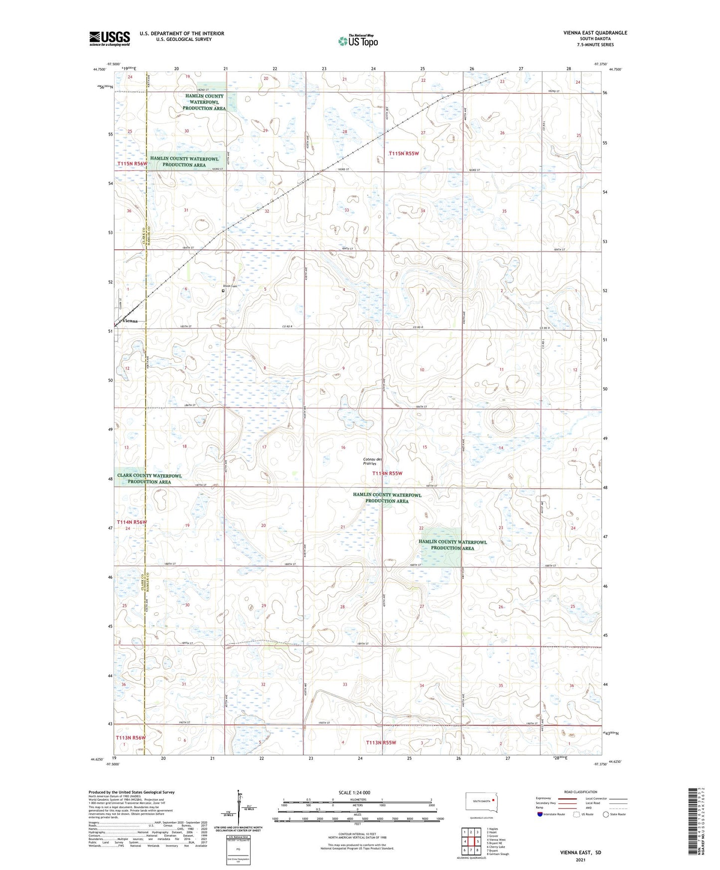
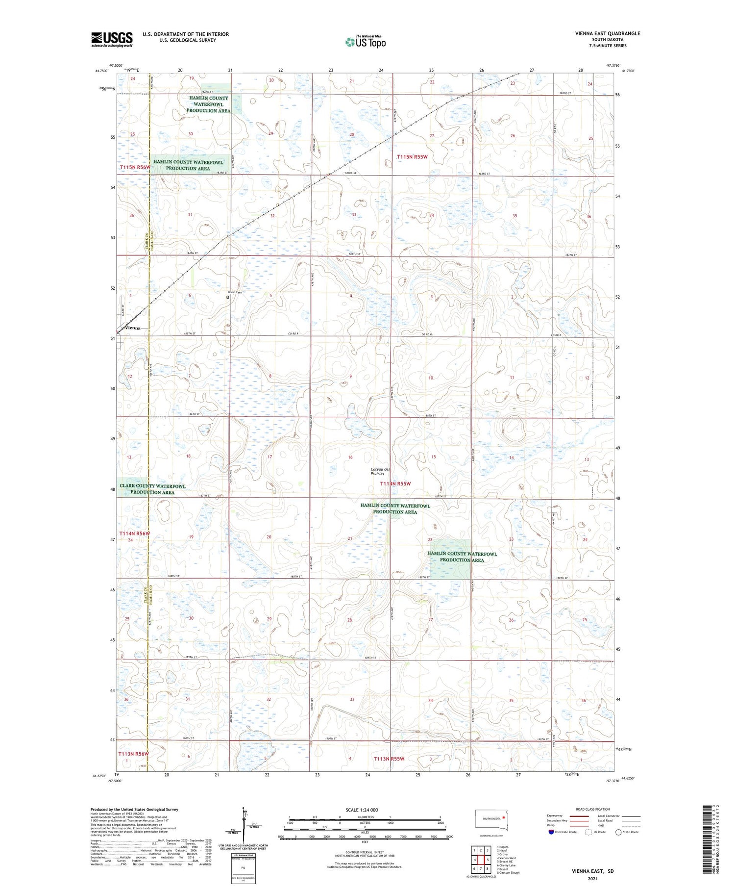
Vienna East South Dakota US Topo Map
Couldn't load pickup availability
2021 topographic map quadrangle Vienna East in the state of South Dakota. Scale: 1:24000. Based on the newly updated USGS 7.5' US Topo map series, this map is in the following counties: Hamlin, Clark. The map contains contour data, water features, and other items you are used to seeing on USGS maps, but also has updated roads and other features. This is the next generation of topographic maps. Printed on high-quality waterproof paper with UV fade-resistant inks.
Quads adjacent to this one:
West: Vienna West
Northwest: Naples
North: Hazel
Northeast: Grover
East: Bryant NE
Southeast: Gertson Slough
South: Bryant
Southwest: Cherry Lake
Contains the following named places: Bochek State Public Shooting Area, Dixon Cemetery, Faiferlick State Public Shooting Area, Flowerfield, Hamlin State Public Shooting Area, Hayes Slough State Public Shooting Area, Kellerton, Rasmussen State Public Shooting Area, Township of Brantford, Township of Dixon