MyTopo
Waubay South Dakota US Topo Map
Couldn't load pickup availability
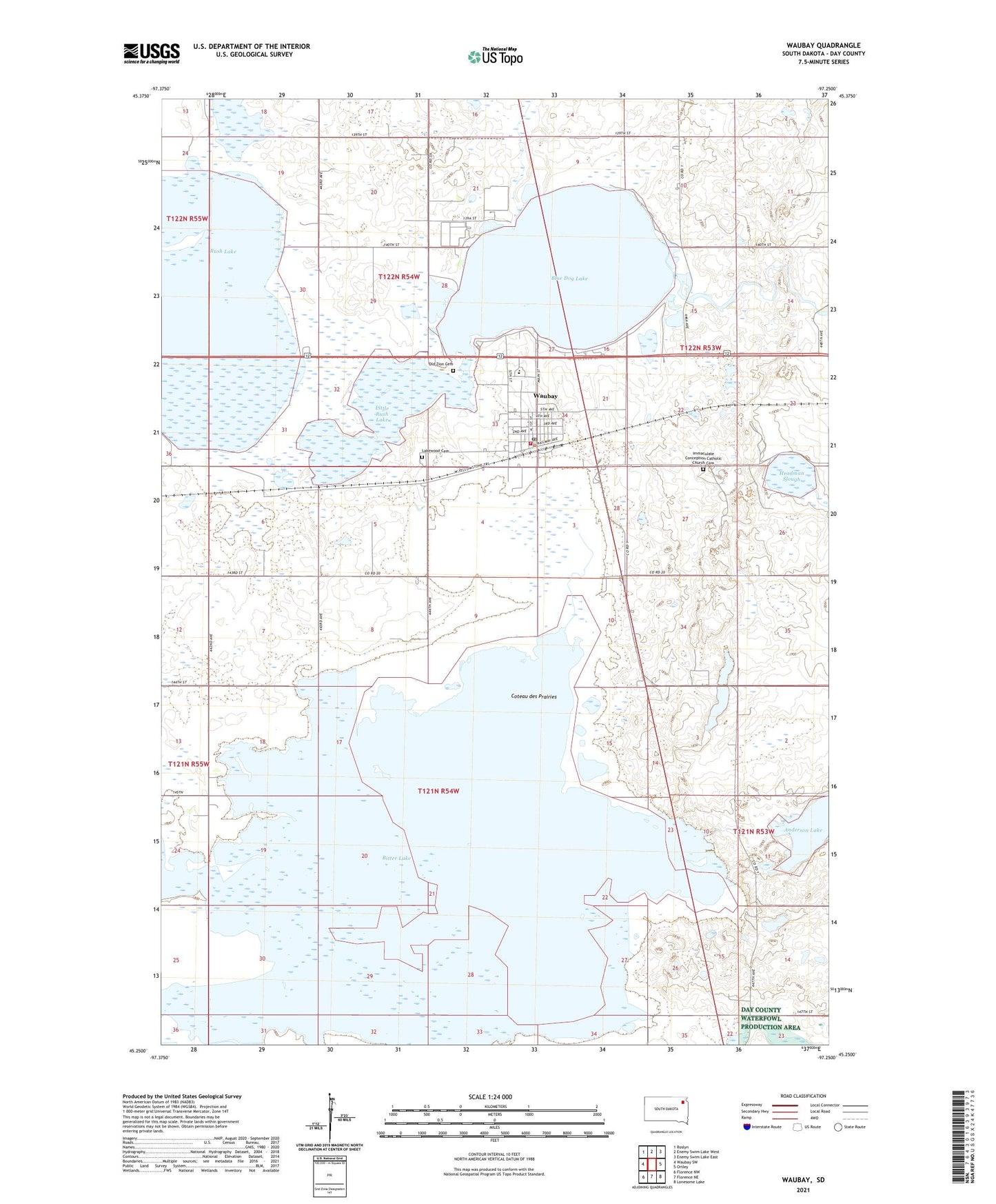
2021 topographic map quadrangle Waubay in the state of South Dakota. Scale: 1:24000. Based on the newly updated USGS 7.5' US Topo map series, this map is in the following counties: Day. The map contains contour data, water features, and other items you are used to seeing on USGS maps, but also has updated roads and other features. This is the next generation of topographic maps. Printed on high-quality waterproof paper with UV fade-resistant inks.
Quads adjacent to this one:
West: Waubay SW
Northwest: Roslyn
North: Enemy Swim Lake West
Northeast: Enemy Swim Lake East
East: Ortley
Southeast: Lonesome Lake
South: Florence NE
Southwest: Florence NW
Contains the following named places: Anderson Lake, Bitter Lake, Blue Dog Lake, City of Waubay, Headman Slough, Immaculate Conception Catholic Church Cemetery, Lakewood Cemetery, Little Rush Lake, Old Zion Cemetery, Rush Lake, Township of Blue Lake, Township of Central Point, Township of Wahbay, Waubay, Waubay City Hall, Waubay Elementary School, Waubay Fire Department, Waubay High School, Waubay Junior High School, Waubay Police Department, Waubay Post Office, Waubay Public Library, ZIP Code: 57273