MyTopo
Enemy Swim Lake West South Dakota US Topo Map
Couldn't load pickup availability
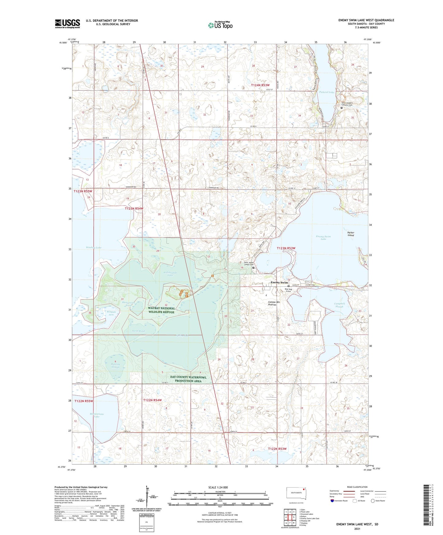
2021 topographic map quadrangle Enemy Swim Lake West in the state of South Dakota. Scale: 1:24000. Based on the newly updated USGS 7.5' US Topo map series, this map is in the following counties: Day. The map contains contour data, water features, and other items you are used to seeing on USGS maps, but also has updated roads and other features. This is the next generation of topographic maps. Printed on high-quality waterproof paper with UV fade-resistant inks.
Quads adjacent to this one:
West: Roslyn
Northwest: Eden
North: Piyas Lake
Northeast: Drywood Lakes
East: Enemy Swim Lake East
Southeast: Ortley
South: Waubay
Southwest: Waubay SW
This map covers the same area as the classic USGS quad with code o45097d3.
Contains the following named places: Blue Dog Grave, Campbell Slough, Dahling Slough, Enemy Swim, Enemy Swim Census Designated Place, Enemy Swim District, Enemy Swim Lake, Hillebrands Lake, Minnewasta Lake, Parker Island, Phragmites Pond, Saint James Church, Saint James Indian Cemetery, Saint Joseph Church, Saint Joseph's Catholic Cemetery, South End, Spring Lake, Swan Pond, Township of Waubay, Wahbay Post Office, Waubay National Wildlife Refuge, Wingate Arm