MyTopo
Weta South Dakota US Topo Map
Couldn't load pickup availability
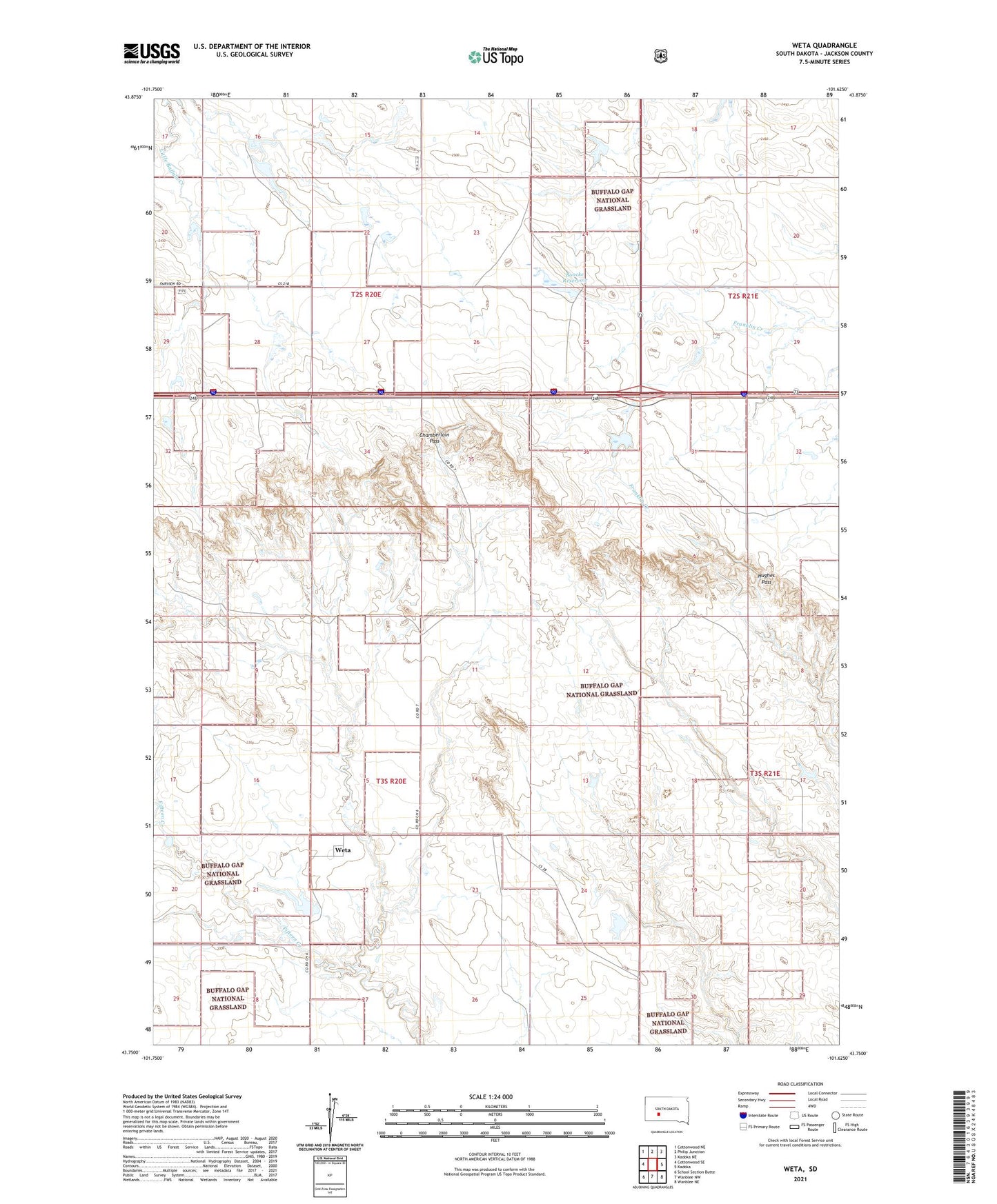
2021 topographic map quadrangle Weta in the state of South Dakota. Scale: 1:24000. Based on the newly updated USGS 7.5' US Topo map series, this map is in the following counties: Jackson. The map contains contour data, water features, and other items you are used to seeing on USGS maps, but also has updated roads and other features. This is the next generation of topographic maps. Printed on high-quality waterproof paper with UV fade-resistant inks.
Quads adjacent to this one:
West: Cottonwood SE
Northwest: Cottonwood NE
North: Philip Junction
Northeast: Kadoka NE
East: Kadoka
Southeast: Wanblee NE
South: Wanblee NW
Southwest: School Section Butte
Contains the following named places: Boock School, Boocke Number 2 Dam, Boocke Reservoir, Chamberlain Pass, Dave Peterson Number 3 Dam, Dave Peterson Number 4 Dam, Hughes Pass, Pat Stout Number 1 Dam, Peterson Ranch, Roy Stout Number 1 Dam, Roy Stout Number 2 Dam, Sevenmile Corner, Township of Little Buffalo, Township of Weta, Weller Number 1 Dam, Weta