MyTopo
Kadoka South Dakota US Topo Map
Couldn't load pickup availability
Also explore the Kadoka Forest Service Topo of this same quad for updated USFS data
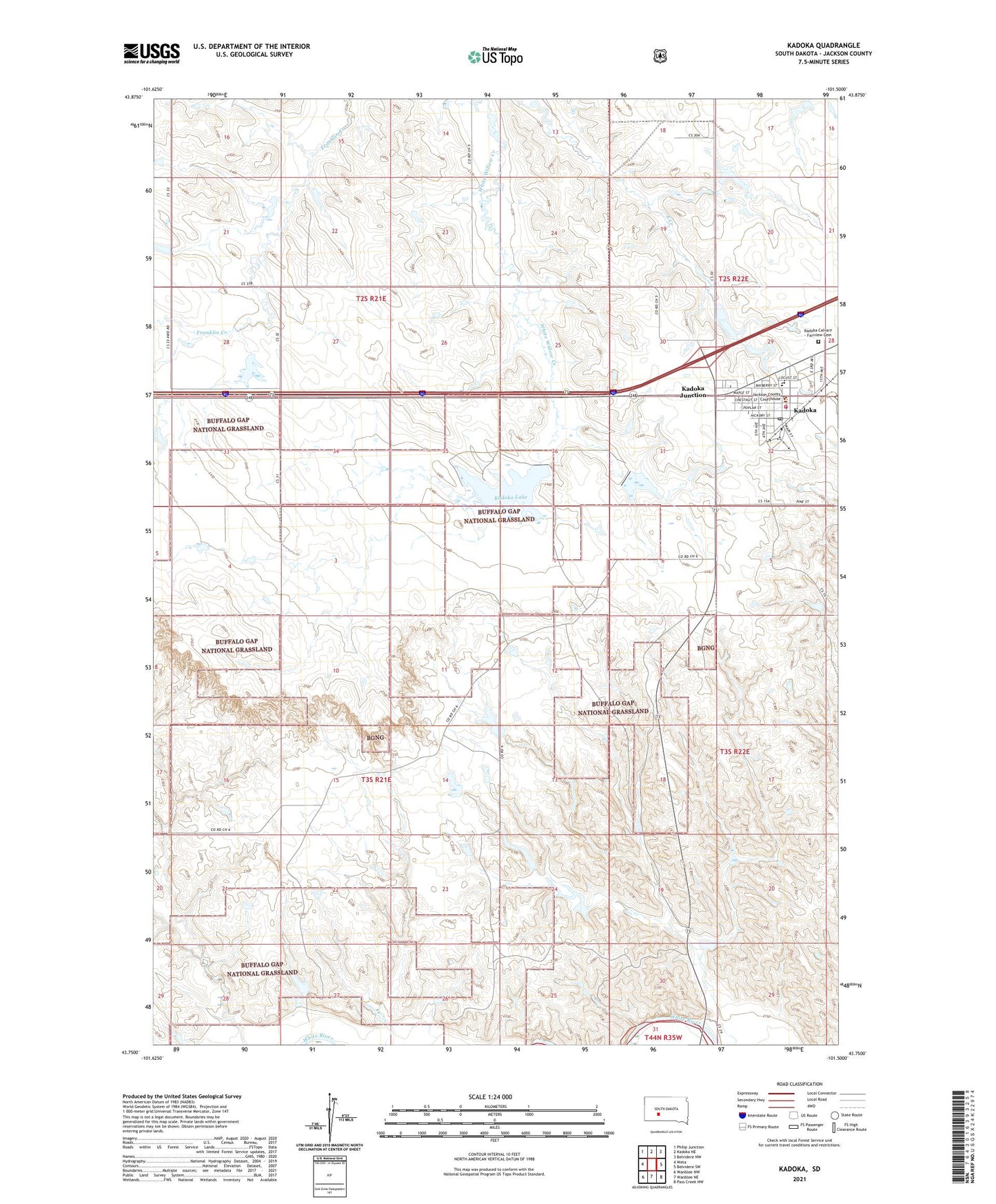
2021 topographic map quadrangle Kadoka in the state of South Dakota. Scale: 1:24000. Based on the newly updated USGS 7.5' US Topo map series, this map is in the following counties: Jackson. The map contains contour data, water features, and other items you are used to seeing on USGS maps, but also has updated roads and other features. This is the next generation of topographic maps. Printed on high-quality waterproof paper with UV fade-resistant inks.
Quads adjacent to this one:
West: Weta
Northwest: Philip Junction
North: Kadoka NE
Northeast: Belvidere NW
East: Belvidere SW
Southeast: Pass Creek NW
South: Wanblee NE
Southwest: Wanblee NW
This map covers the same area as the classic USGS quad with code o43101g5.
Contains the following named places: Andrew Dam, Bradfield Diversion and Detention Dam, City of Kadoka, Jackson County Courthouse, Jackson County Library, Jackson County Sheriff, Kadoka, Kadoka Area High School, Kadoka Calvary - Fairview Cemetery, Kadoka City Police Department, Kadoka Elementary School, Kadoka Junction, Kadoka Lake, Kadoka Lake Dam, Kadoka Post Office, Kadoka Volunteer Ambulance Service, Kadoka Volunteer Fire Department, Township of Kadoka, Township of Wall, Whidby Structure 20 Dam, ZIP Code: 57543