
MyTopo
Bodenham Tennessee US Topo Map
Couldn't load pickup availability
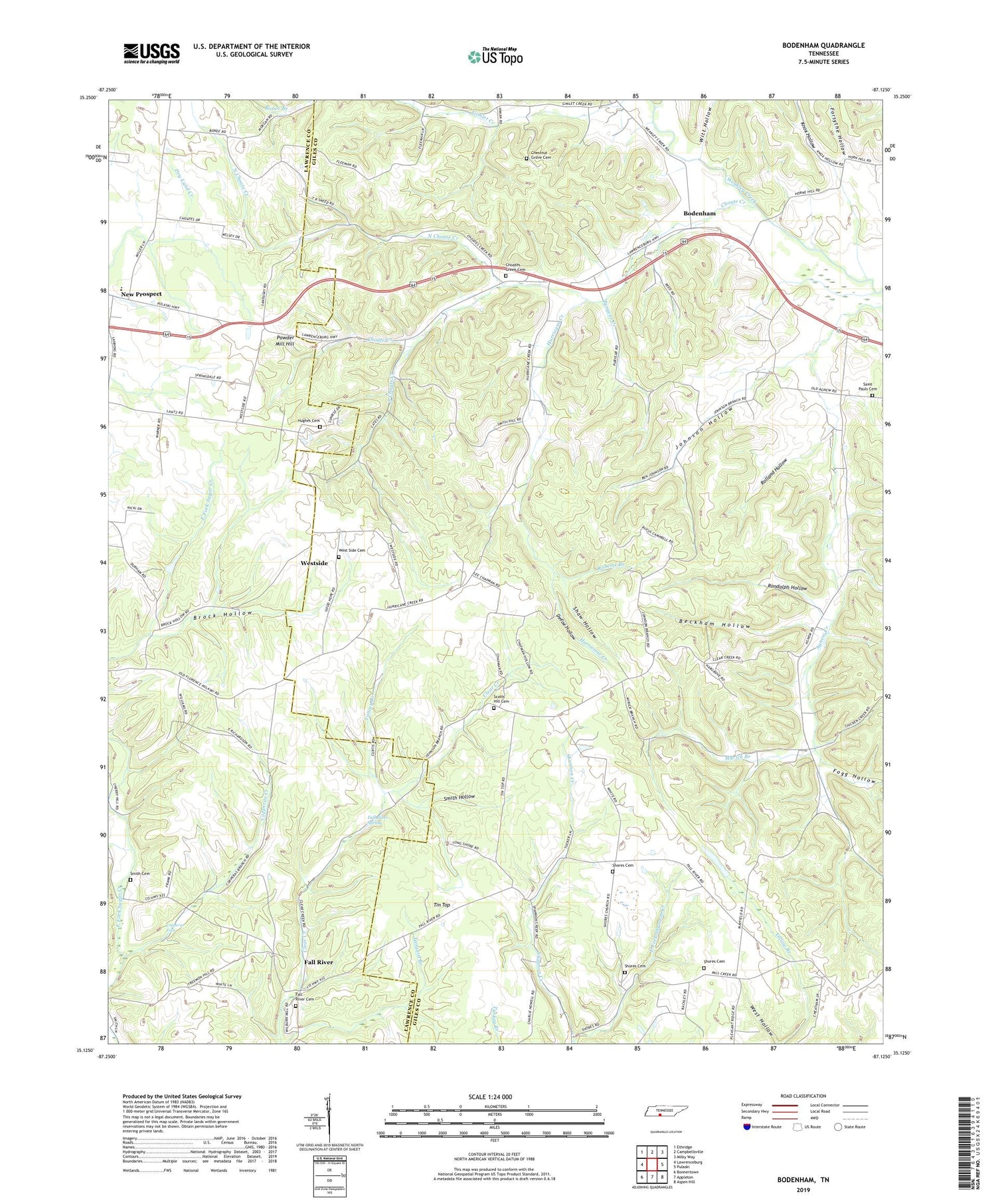
2019 topographic map quadrangle Bodenham in the state of Tennessee. Scale: 1:24000. Based on the newly updated USGS 7.5' US Topo map series, this map is in the following counties: Giles, Lawrence. The map contains contour data, water features, and other items you are used to seeing on USGS maps, but also has updated roads and other features. This is the next generation of topographic maps. Printed on high-quality waterproof paper with UV fade-resistant inks.
Quads adjacent to this one:
West: Lawrenceburg
Northwest: Ethridge
North: Campbellsville
Northeast: Milky Way
East: Pulaski
Southeast: Aspen Hill
South: Appleton
Southwest: Bonnertown
Contains the following named places: Beckham Hollow, Beech Grove Church, Bodenham, Bodenham School, Chestnut Grove Cemetery, Chestnut Grove Church, Chestnut Grove School, Choate Creek, Choate Creek Church, Choates Creek Cemetery, Copperas Creek, Copperas Falls, Copperas School, DeFoe Hollow, East Fork Shannon Creek, Eva Chapel, Fall River, Fall River Cemetery, Fall River School, Fall River Spring, Fogg Hollow, Forsythe Hollow, Good Hope Church, Hams Creek, Hughes Cemetery, Hurricane Creek, Johnson Hollow, Knox Hollow, Myrick Branch, New Prospect Elementary School, North Choate Creek, Powder Mill Hill, Puryear Creek, Randolph Hollow, Reeds Ford, Roberts Branch, Rolland Hollow, Saint Pauls Cemetery, Saint Pauls Church, Scott Hill Church, Scotts Hill Cemetery, Shaw Hollow, Shore, Shore Church, Shores Cemetery, Shores School, Smith Cemetery, Smith Hollow, South Choate Creek, Springdale School, Tin Top, Union Hill School, West Side Cemetery, Westside, Westside School, Wilburn Chapel, Witt Hollow, Yancey Branch


