MyTopo
Gainesboro Tennessee US Topo Map
Couldn't load pickup availability
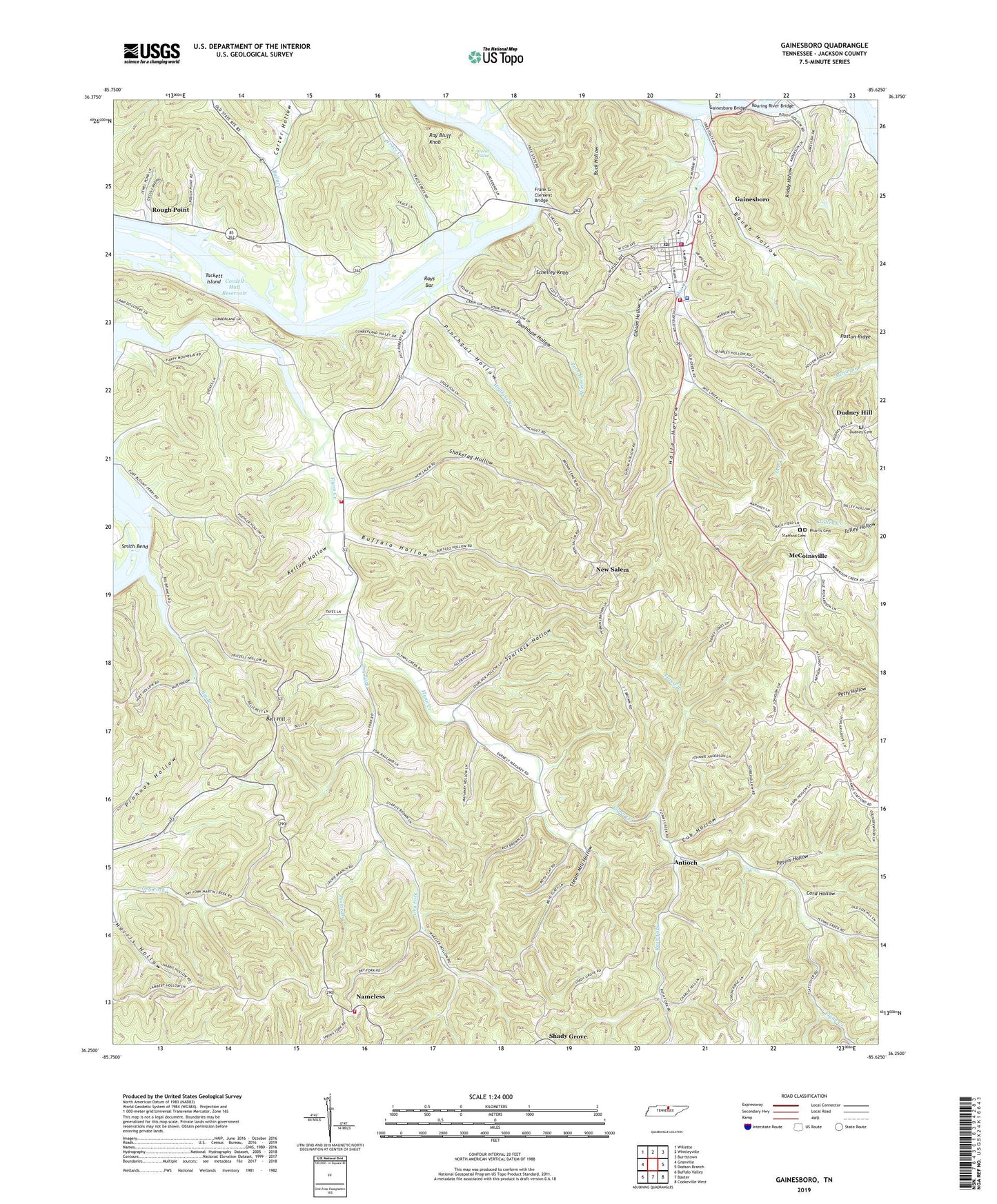
2019 topographic map quadrangle Gainesboro in the state of Tennessee. Scale: 1:24000. Based on the newly updated USGS 7.5' US Topo map series, this map is in the following counties: Jackson. The map contains contour data, water features, and other items you are used to seeing on USGS maps, but also has updated roads and other features. This is the next generation of topographic maps. Printed on high-quality waterproof paper with UV fade-resistant inks.
Quads adjacent to this one:
West: Granville
Northwest: Willette
North: Whitleyville
Northeast: Burristown
East: Dodson Branch
Southeast: Cookeville West
South: Baxter
Southwest: Buffalo Valley
Contains the following named places: Antioch, Antioch School, Baugh Hollow, Bell Hill, Big Branch, Big Branch Church, Big Branch School, Birdwell School, Brooks Ferry, Brooks Island, Brooks Shoal, Buffalo Hollow, Bullard Creek, Carter Hollow, Commissioner District 1, Commissioner District 5, Cord Hollow, Cub Hollow, Current School, Curry Chapel, Doe Creek, Dry Fork, Dudley Hill Church, Dudney Cemetery, Dudney Hill, Dudneys Hill School, Dycus Landing, Flynns Lick, Flynns Lick School, Flynns Lick Volunteer Fire Department, Forks Creek Church, Forks of Creek School, Fort Blount Ferry, Frank G Clement Bridge, Gainesboro, Gainesboro Bridge, Gainesboro City Fire Department, Gainesboro Elementary School, Gainesboro Ferry, Gainesboro First Baptist Church, Gainesboro Landing, Gainesboro Police Department, Gainesboro Post Office, Gibson Avenue Church, Gibson Hollow, Granville Division, Haile Hollow, Heady Branch, Hopkins Branch, Huff Hollow, Jackie Branch, Jackson County, Jackson County Ambulance Service, Jackson County Courthouse, Jackson County High School, Jackson County Hospital, Jackson County Rescue Squad, Jackson County Sheriff's Department, Kellum Hollow, Lacey Branch, Marsh Chapel, McCoinsville, McCoinsville School, Mount Pleasant Church, Nameless, Nameless School, Nameless Volunteer Fire Department, New Bethel School, New Salem, New Salem Church, New Salem School, Peters Hollow, Pharris Cemetery, Pinchgut Hollow, Poor House Branch, Poorhouse Hollow, Poston Ridge, Ray Bluff Knob, Rays Bar, Richmond Chapel, Roaring River, Roaring River Bridge, Roddy Hollow, Rough Point, Rush Fork, Schelley Knob, Shady Grove, Shady Grove School, Shakerag Hollow, Simpsons Ford, Spurlock Hollow, Stafford Cemetery, Steam Mill Hollow, Tackett Island, Town of Gainesboro, Trace Creek, ZIP Codes: 38562, 38564