MyTopo
Hickory Valley Tennessee US Topo Map
Couldn't load pickup availability
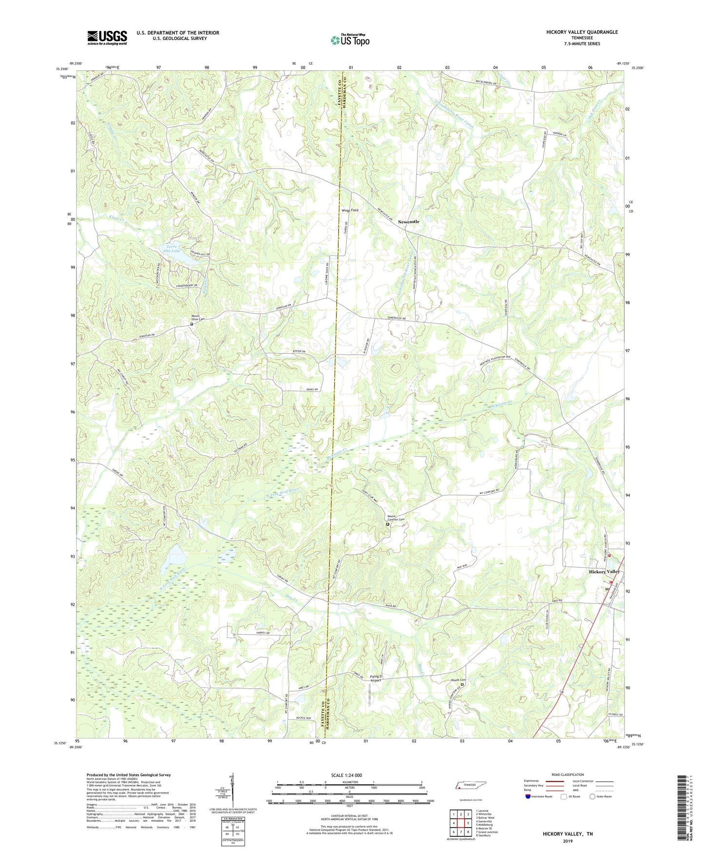
2019 topographic map quadrangle Hickory Valley in the state of Tennessee. Scale: 1:24000. Based on the newly updated USGS 7.5' US Topo map series, this map is in the following counties: Hardeman, Fayette. The map contains contour data, water features, and other items you are used to seeing on USGS maps, but also has updated roads and other features. This is the next generation of topographic maps. Printed on high-quality waterproof paper with UV fade-resistant inks.
Quads adjacent to this one:
West: Somerville
Northwest: Laconia
North: Whiteville
Northeast: Bolivar West
East: Middleburg
Southeast: Saulsbury
South: Grand Junction
Southwest: Moscow SE
Contains the following named places: Antioch Church, Fletcher Church, Flying D Airport, Hardeman County Rescue Squad, Henleys Store, Hickory Valley, Hickory Valley Baptist Church, Hickory Valley Post Office, Hickory Valley School, Hickory Valley Volunteer Fire Department, Jones Grove School, Jopic School, May Creek, May Hill School, McKinnie Creek, Morrow Hill Church, Morrow Hill School, Mount Comfort Cemetery, Mount Hope Church, Mount Olive Cemetery, Mount Olive Church, Newcastle, Oak Dain School, Polk School, Shady Grove Church, Stuart Chapel, Tanyard, Terra Alta Dam, Terra Alta Lake, Town of Hickory Valley, Wings Field, Woods Cemetery, ZIP Code: 38042