MyTopo
Grand Junction Tennessee US Topo Map
Couldn't load pickup availability
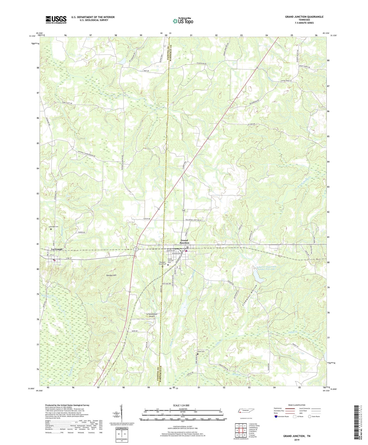
2022 topographic map quadrangle Grand Junction in the state of Tennessee. Scale: 1:24000. Based on the newly updated USGS 7.5' US Topo map series, this map is in the following counties: Hardeman, Fayette. The map contains contour data, water features, and other items you are used to seeing on USGS maps, but also has updated roads and other features. This is the next generation of topographic maps. Printed on high-quality waterproof paper with UV fade-resistant inks.
Quads adjacent to this one:
West: Moscow SE
Northwest: Somerville
North: Hickory Valley
Northeast: Middleburg
East: Saulsbury
Southeast: Camp Hill
South: Canaan
Southwest: Lamar
This map covers the same area as the classic USGS quad with code o35089a2.
Contains the following named places: Ames Plantation, Ames School, Center Point, Center Point Church, City of Grand Junction, Clemmons Bottom, Gordon Hill, Grand Junction, Grand Junction Cemetery, Grand Junction Elementary School, Grand Junction Fire Department and City Hall, Grand Junction Police Department, Grand Junction Post Office, Hopewell Church, Hunts Chapel School, Immanuel Episcopal Church, Indian Creek Watershed Number Four Dam, Indian Creek Watershed Number Four Lake, Indian Creek Watershed Number Seven Dam, Indian Creek Watershed Number Two Dam, Indian Creek Watershed Number Two Lake, Jones Chapel School, La Grange, La Grange Elementary School, La Grange Methodist Church, La Grange Post Office, La Grange Volunteer Fire Department, LaGrange Cemetery, Moody Creek, New Zion Church, New Zion School, Old Jonah Church, Pleasant Grove Cemetery, Prospect Church, Prospect School, Scott Cemetery, Spring Chapel, St Somewhere Airport, Town of La Grange, Woods School, ZIP Codes: 38039, 38046