MyTopo
Hornsby Tennessee US Topo Map
Couldn't load pickup availability
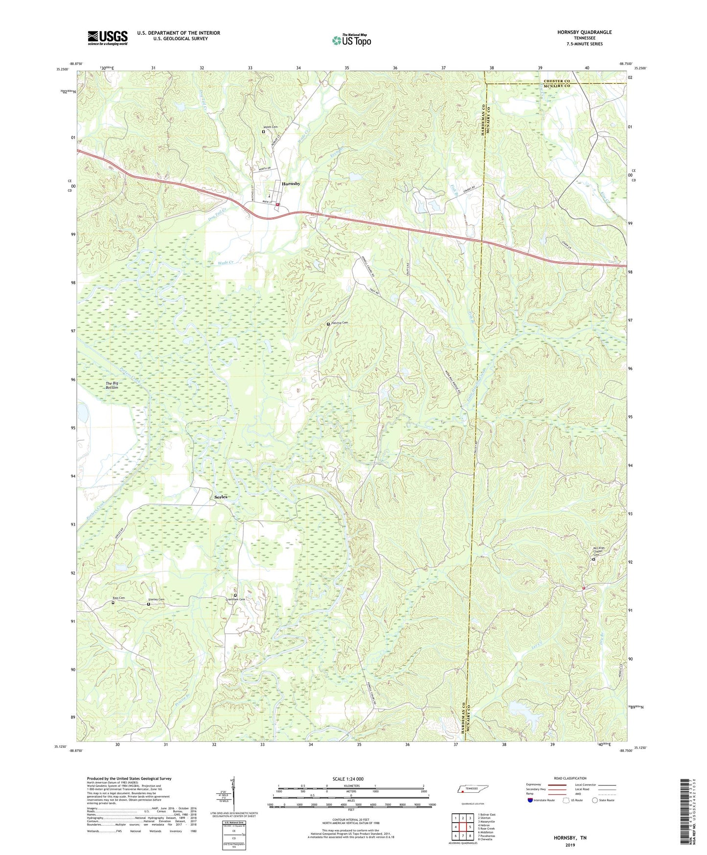
2019 topographic map quadrangle Hornsby in the state of Tennessee. Scale: 1:24000. Based on the newly updated USGS 7.5' US Topo map series, this map is in the following counties: Hardeman, McNairy, Chester. The map contains contour data, water features, and other items you are used to seeing on USGS maps, but also has updated roads and other features. This is the next generation of topographic maps. Printed on high-quality waterproof paper with UV fade-resistant inks.
Quads adjacent to this one:
West: Hebron
Northwest: Bolivar East
North: Silerton
Northeast: Masseyville
East: Rose Creek
Southeast: Chewalla
South: Pocahontas
Southwest: Middleton
Contains the following named places: Bass Cemetery, Brints Chapel, Chapel Hill Church, Cypress Creek, Dog Tail Creek, Ervin Branch, Fish Branch, Grantham Cemetery, Hatchie Cemetery, Hornsby, Hornsby Baptist Church, Hornsby Division, Hornsby Elementary School, Hornsby Post Office, Hornsby Volunteer Fire Department, J J Madison Dam, J J Madison Lake, King Branch, Little Hatchie Church, Little Hatchie Creek, Magbee Branch, McCalip School, McCalips Chapel, McCalips Chapel Cemetery, McNairy County Fire Department Station 42 Byrd Locke Fire Department, Porters Creek, Porters Creek Church, Porters Creek Slough, Powells Chapel, Prairie Branch, Serles, Skipper Creek, Stanley Cemetery, The Big Bottom, Town of Hornsby, Wade Creek, Walnut Grove School, Wyatt Cemetery, ZIP Code: 38044