MyTopo
Pocahontas Tennessee US Topo Map
Couldn't load pickup availability
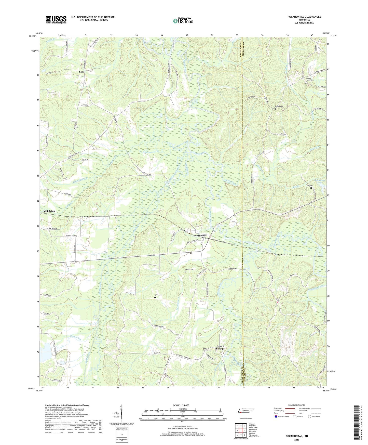
2022 topographic map quadrangle Pocahontas in the state of Tennessee. Scale: 1:24000. Based on the newly updated USGS 7.5' US Topo map series, this map is in the following counties: Hardeman, McNairy. The map contains contour data, water features, and other items you are used to seeing on USGS maps, but also has updated roads and other features. This is the next generation of topographic maps. Printed on high-quality waterproof paper with UV fade-resistant inks.
Quads adjacent to this one:
West: Middleton
Northwest: Hebron
North: Hornsby
Northeast: Rose Creek
East: Chewalla
Southeast: Kossuth North
South: Chalybeate
Southwest: Walnut
This map covers the same area as the classic USGS quad with code o35088a7.
Contains the following named places: Bearman Creek, Bethel Cemetery, Colonel Fork, Commissioner District 6, Cypress Creek, Dry Cypress Creek, Essary Springs, Essary Springs Baptist Church, Essary Springs Cemetery, Essary Springs Census Designated Place, Eureka Cemetery, Eureka Church, Gooch Branch, Gooch School, Hardcastle Creek, Kirk Branch, Kirk Cemetery, Lacy, Lee Creek, Mathis Cemetery, McNairy County Fire Department Station 32 Wolf Pen Fire Department, Moore Cemetery, Morphis Branch, Mosses Creek, Mosses Creek Cemetery, Muddy Creek, Muddy Creek Ditch, Muddy Creek Lake Number Twenty-one, Muddy Creek Number Twenty-one Lake Dam, New Hope Baptist Church, Oak Grove Church, Pleasant Hill School, Pocahontas, Pocahontas Census Designated Place, Pocahontas Dam, Pocahontas Lake, Pocahontas Post Office, Pocahontas School, Reeves Church, Talley Spring Branch, The Mound, Tuscumbia River, ZIP Code: 38061