MyTopo
Laconia Tennessee US Topo Map
Couldn't load pickup availability
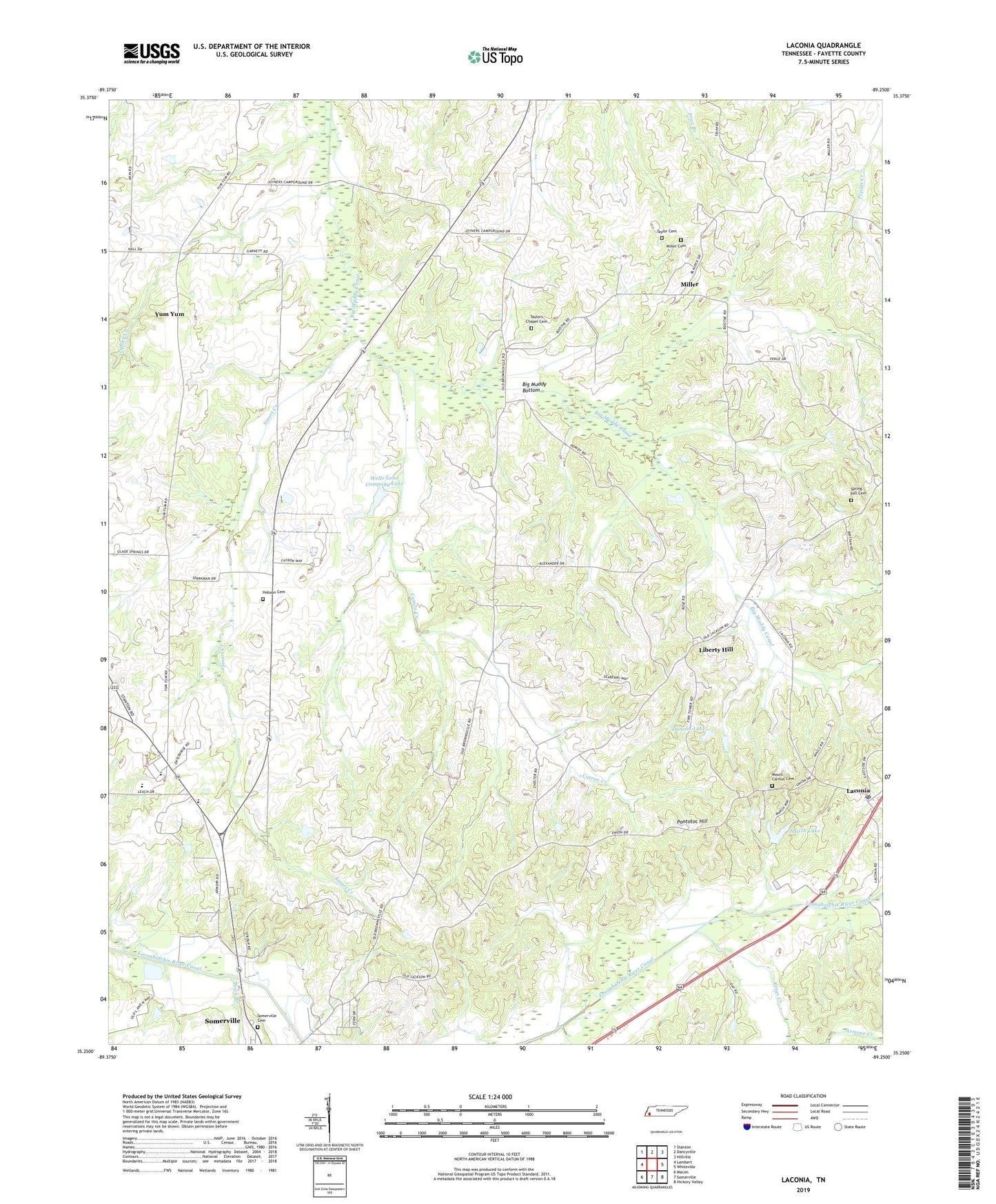
2019 topographic map quadrangle Laconia in the state of Tennessee. Scale: 1:24000. Based on the newly updated USGS 7.5' US Topo map series, this map is in the following counties: Fayette. The map contains contour data, water features, and other items you are used to seeing on USGS maps, but also has updated roads and other features. This is the next generation of topographic maps. Printed on high-quality waterproof paper with UV fade-resistant inks.
Quads adjacent to this one:
West: Lambert
Northwest: Stanton
North: Dancyville
Northeast: Hillville
East: Whiteville
Southeast: Hickory Valley
South: Somerville
Southwest: Macon
Contains the following named places: Alexander Chapel, Alexander School, Armour Creek, Burns Shop, Catron Creek, Commissioner District 2, Duncan Lake, Duncan Lake Dam, Fayette Corners Division, Fayette County Vocational Center, Garnett School, Hilliard School, Hobson Cemetery, Howell Creek, Jefferson Elementary School, Joyners Campground, Kings Creek, Laconia, Laconia Post Office, Liberty Hill, Liberty School, Lipsky Creek, Love School, Marsh Lake, Marsh Lake Dam, Miller, Miller Cemetery, Miller School, Mission Church, Mount Carmel Church, New Mount Zion Missionary Baptist Church Cemetery, Old Union Cemetery, Olive Church, Pepper School, Perry School, Pleasant Grove Church, Pleasant Grove School, Pontotoc Hill, Pontotoc School, Seymour School, Shady Grove Church, Shiloh Church, Smart Creek, Spring Hill Cemetery, Spring Hill Church, Taylor Cemetery, Taylor Chapel, Taylors Chapel Cemetery, Town Branch, Town Creek, Travelers Rest Church, Wells Land Company Lake, Wells Land Company Lake Dam, Yum Yum, ZIP Code: 38068