MyTopo
Macon Tennessee US Topo Map
Couldn't load pickup availability
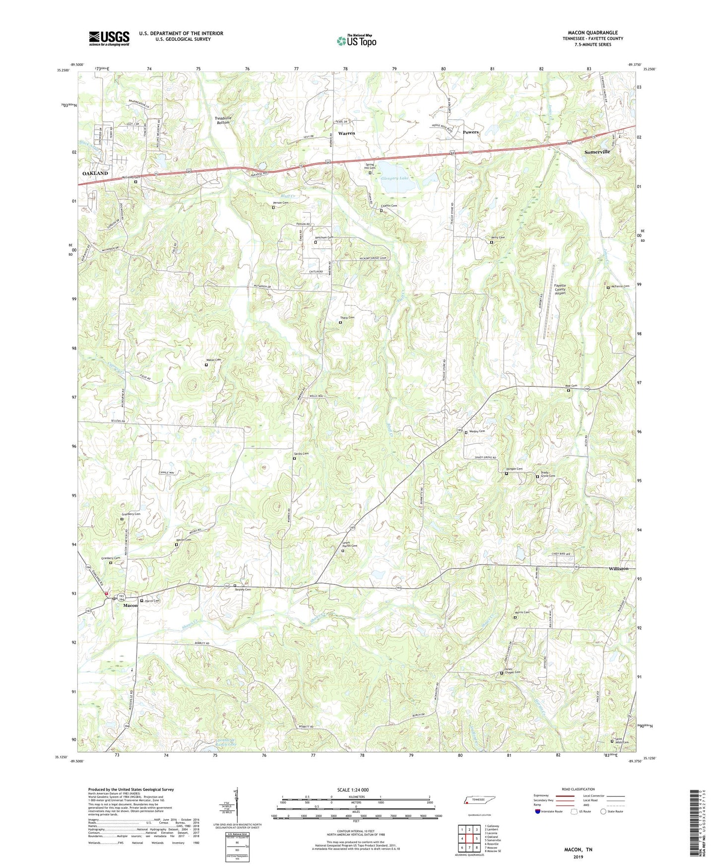
2022 topographic map quadrangle Macon in the state of Tennessee. Scale: 1:24000. Based on the newly updated USGS 7.5' US Topo map series, this map is in the following counties: Fayette. The map contains contour data, water features, and other items you are used to seeing on USGS maps, but also has updated roads and other features. This is the next generation of topographic maps. Printed on high-quality waterproof paper with UV fade-resistant inks.
Quads adjacent to this one:
West: Oakland
Northwest: Gallaway
North: Lambert
Northeast: Laconia
East: Somerville
Southeast: Moscow SE
South: Moscow
Southwest: Rossville
This map covers the same area as the classic USGS quad with code o35089b4.
Contains the following named places: Bluff Creek, Burnett School, Chaffin Cemetery, City of Williston, Commissioner District 1, Commissioner District 6, Corner School, Double W Ranch Lake, Double W Ranch Lake Dam, Dungan Cemetery, East Macon Church, Ebenezer Church, Fayette County, Fayette County Airport, Fayette County Fire Department / Macon District 11, Gaither School, Glengary Lake, Glengary Lake Dam, Granbery Cemetery, Harris Cemetery, Jones Chapel, Jones Chapel Cemetery, Jones School, Ketchum Cemetery, Lewis Parrot Cemetery, Macon, Macon Cemetery, Macon Church, Macon Post Office, Macon School, Mcculley Cemetery, McFerrin Cemetery, Moe Cemetery, Morris Cemetery, Mosby School, Perry Cemetery, Person Cemetery, Powers, Saint Pauls Cemetery, Saint Pauls Church, Sardis Cemetery, Shady Grove Cemetery, Shady Grove Church, Southwest Elementary School, Spring Hill Cemetery, Spring Hill Church, Tarpley Cemetery, Tharp Cemetery, Town of Somerville, Waller Cemetery, Warren, Wesley Cemetery, Wesley Church, Wesley School, ZIP Code: 38076