MyTopo
Laguardo Tennessee US Topo Map
Couldn't load pickup availability
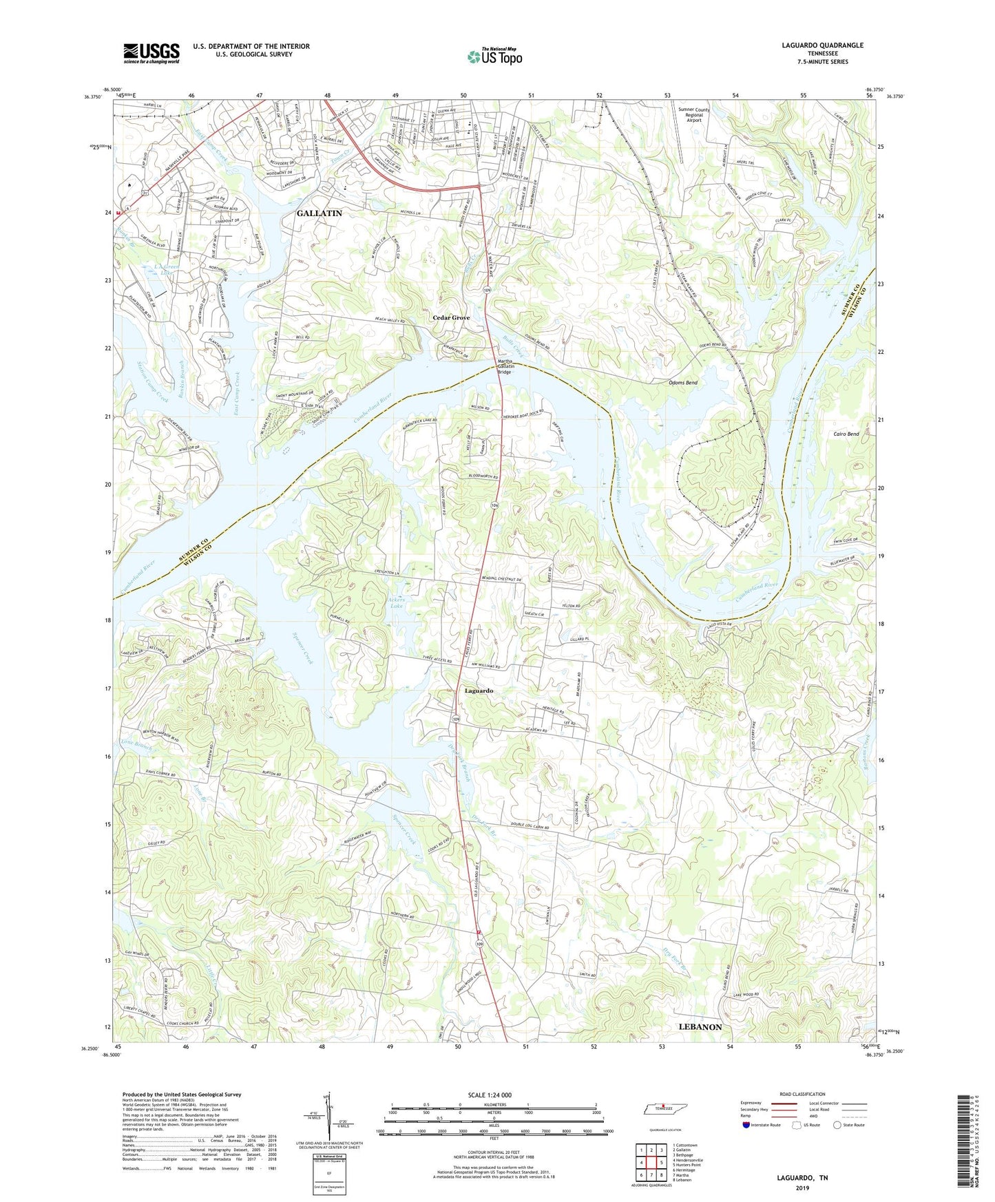
2019 topographic map quadrangle Laguardo in the state of Tennessee. Scale: 1:24000. Based on the newly updated USGS 7.5' US Topo map series, this map is in the following counties: Wilson, Sumner. The map contains contour data, water features, and other items you are used to seeing on USGS maps, but also has updated roads and other features. This is the next generation of topographic maps. Printed on high-quality waterproof paper with UV fade-resistant inks.
Quads adjacent to this one:
West: Hendersonville
Northwest: Cottontown
North: Gallatin
Northeast: Bethpage
East: Hunters Point
Southeast: Lebanon
South: Martha
Southwest: Hermitage
Contains the following named places: Ackers Lake, Benders Ford, Boxwell Reservation, Bulls Creek, Bulls Creek Access Area, Cages Ferry, Cedar Grove, Cedar Grove Access Area, Cedar Grove Missionary Baptist Church, Coles Ferry, Coles Ferry Access Area, Commissioner District 4, Commissioner District 5, Cooks Branch, Corum Post Office, Dry Fork Branch, East Camp Creek, Franklin Chapel, Gallatin Fire Department Station 2, Gallatin Landing, Gallatin Marina, Gallatin Steam Plant Access Area, Gallatin Steam Plant Reservation, Guild Elementary School, Kirkpatrick Lake, L A Green Dam, L A Green Lake, Laguardo, Laguardo High School, Laguardo Recreation Area, Liberty Branch, Martha Gallatin Access Area, Martha Gallatin Bridge, New Hope Church, Odoms Bend, Odoms Bend Access Area, Odoms Bend School, Old Lock and Dam Number Four, Peach Valley Church, Rankin Branch, Rucker Stewart Middle School, Sandy Chapel Access Area, Spencer Creek, Station Camp Creek, Sullivans Store, Sumner County Park, Sumnere Academy, Town Creek, Trammel Creek, Volunteer State Community College, Wilson County EMA Station 6 - Laguardo, Woods Ferry