MyTopo
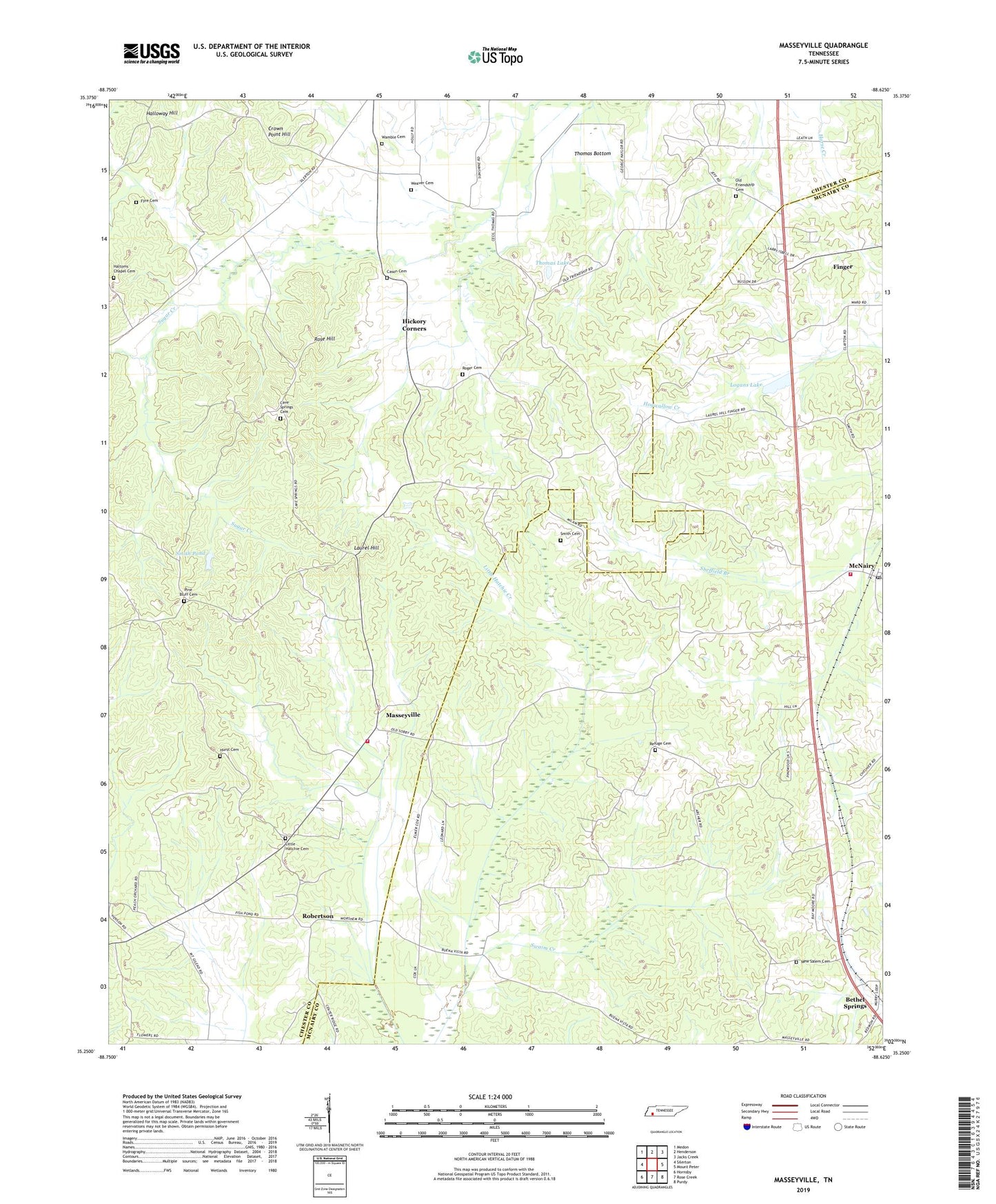
Masseyville Tennessee US Topo Map
Couldn't load pickup availability
2019 topographic map quadrangle Masseyville in the state of Tennessee. Scale: 1:24000. Based on the newly updated USGS 7.5' US Topo map series, this map is in the following counties: Chester, McNairy. The map contains contour data, water features, and other items you are used to seeing on USGS maps, but also has updated roads and other features. This is the next generation of topographic maps. Printed on high-quality waterproof paper with UV fade-resistant inks.
Quads adjacent to this one:
West: Silerton
Northwest: Medon
North: Henderson
Northeast: Jacks Creek
East: Mount Peter
Southeast: Purdy
South: Rose Creek
Southwest: Hornsby
Contains the following named places: Cason Cemetery, Cave Spring Church, Cave Springs Cemetery, Chester County Fire Department / Masseyville Volunteer Fire Department Station 550, Commissioner District 3, Crown Point Hill, Fyre Cemetery, Gail, Halloway Hill, Haltoms Chapel Cemetery, Halton Chapel, Hickory Corner School, Hickory Corners, Hurst Cemetery, Ivys Store, Laurel Hill, Little Hatchie Cemetery, Little Hatchie Church, Little Sugar Creek, Logans Lake, Logans Lake Dam, Masseyville, Masseyville School, McNairy, McNairy County Fire Department Station 11 McNairy Fire Department, McNairy Post Office, Mitchell Chapel, New Home Church, New Salem Cemetery, New Salem Church, Old Friendship Baptist Church, Old Friendship Cemetery, Old Friendship School, Phillip School, Pine Bluff Cemetery, Pleasant Hill Church, Refuge Cemetery, Refuge Church, Robertson, Roger Cemetery, Rose Hill, Sheffield Branch, Smith Cemetery, Smith Pond, Swaim Creek, Thomas Bottom, Thomas Lake, Wamble Cemetery, Weaver Cemetery