MyTopo
Mercer Tennessee US Topo Map
Couldn't load pickup availability
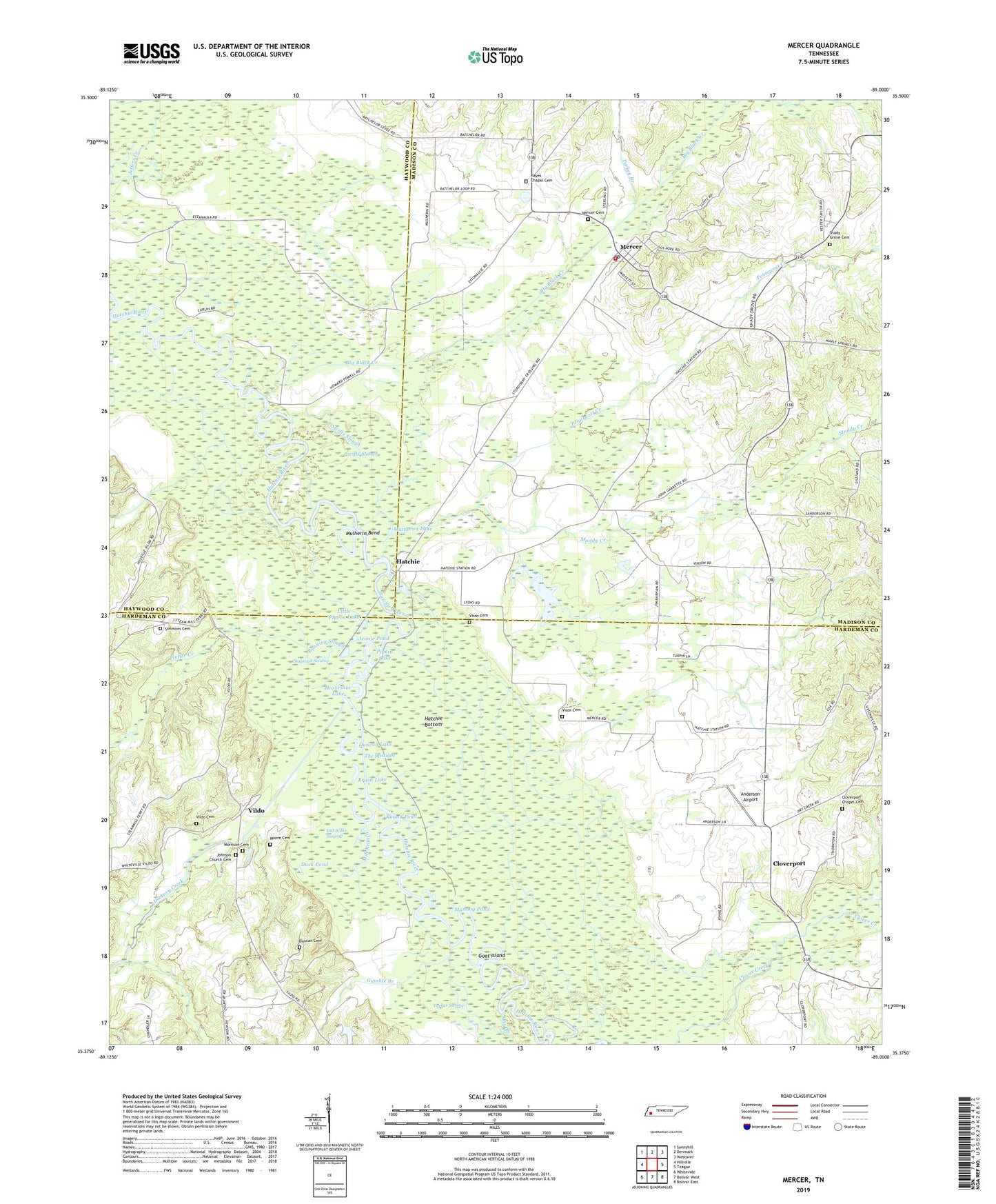
2019 topographic map quadrangle Mercer in the state of Tennessee. Scale: 1:24000. Based on the newly updated USGS 7.5' US Topo map series, this map is in the following counties: Hardeman, Madison, Haywood. The map contains contour data, water features, and other items you are used to seeing on USGS maps, but also has updated roads and other features. This is the next generation of topographic maps. Printed on high-quality waterproof paper with UV fade-resistant inks.
Quads adjacent to this one:
West: Hillville
Northwest: Sunnyhill
North: Denmark
Northeast: Westover
East: Teague
Southeast: Bolivar East
South: Bolivar West
Southwest: Whiteville
Contains the following named places: Anderson Airport, Beech Grove Church, Big Black Creek, Bill Wilks Swamp, Brown School, Brush Lake, Chapman Swamp, Chisholm Creek, Cloverport, Cloverport Baptist Church, Cloverport Chapel, Cloverport Chapel Cemetery, Dry Branch, Duck Pond, Duncan Cemetery, Duncan Lake, Estanaula, Gamble Branch, Goat Island, Hatchie, Hayes Chapel Cemetery, Hays Chapel, Hickory Creek, Horseshoe Lake, Jennie Pond, Johnson Church Cemetery, Little Pigeon Lake, Madison County Fire Department Station 8, Mammy Pond, Matthews Lake, May Branch, McCartys Ferry, McCartys Landing, Mercer, Mercer Cemetery, Mercer Census Designated Place, Mercer Post Office, Mill Branch, Moore Cemetery, Morrison Cemetery, Muddy Creek, Mulherin Bend, Old Ferry Landing, Parker Swamp, Pennycost Creek, Pinner Creek, Pipkin Lake, Round Pond, Running Slough, Shady Grove Cemetery, Silver Moon Lake, Simmons Cemetery, Sturdivant Crossing, Swifts Slough, The Straight, Turkey Branch, Vildo, Vildo Cemetery, Vison Cemetery, ZIP Code: 38392