MyTopo
Sunnyhill Tennessee US Topo Map
Couldn't load pickup availability
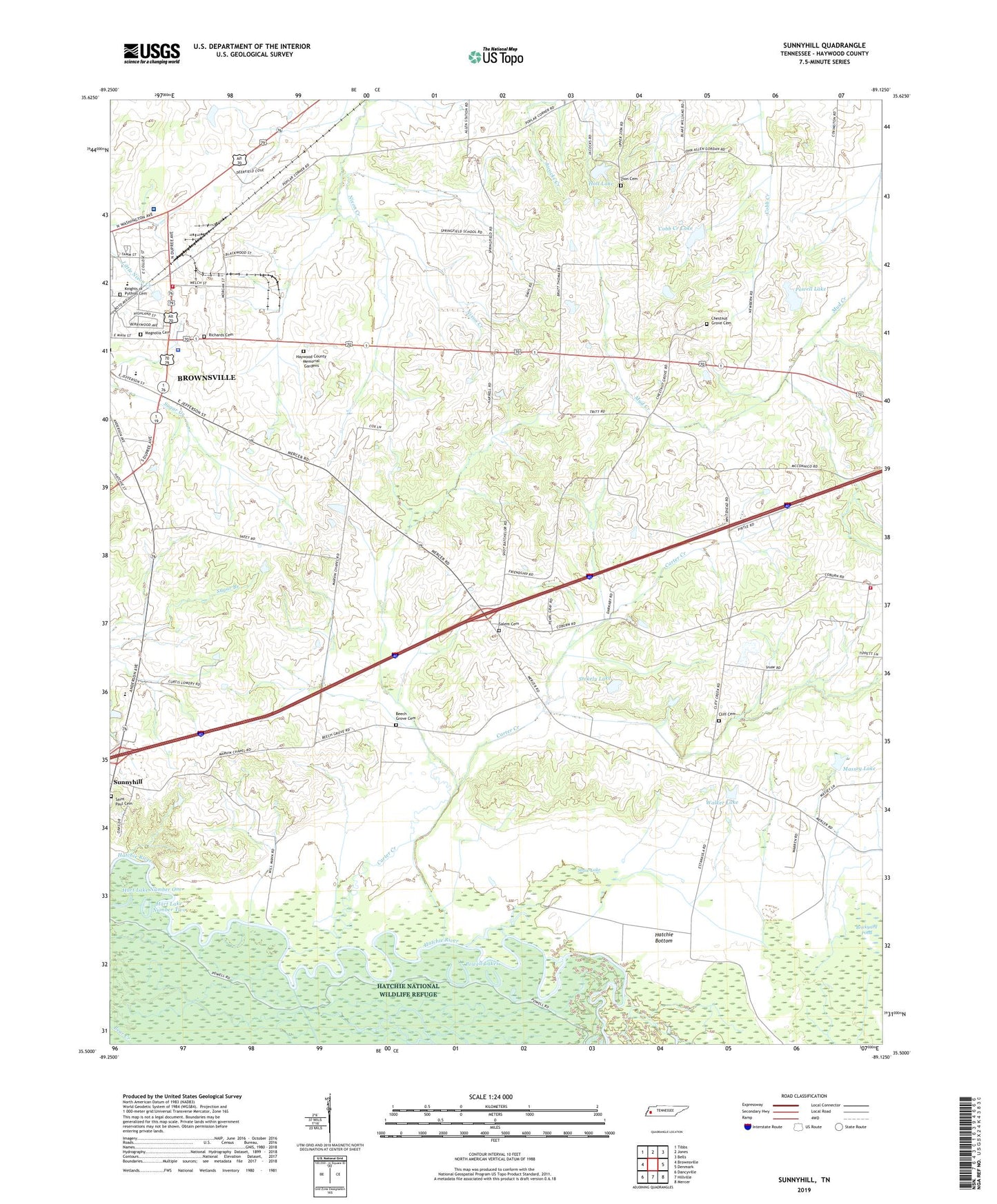
2022 topographic map quadrangle Sunnyhill in the state of Tennessee. Scale: 1:24000. Based on the newly updated USGS 7.5' US Topo map series, this map is in the following counties: Haywood. The map contains contour data, water features, and other items you are used to seeing on USGS maps, but also has updated roads and other features. This is the next generation of topographic maps. Printed on high-quality waterproof paper with UV fade-resistant inks.
Quads adjacent to this one:
West: Brownsville
Northwest: Tibbs
North: Jones
Northeast: Bells
East: Denmark
Southeast: Mercer
South: Hillville
Southwest: Dancyville
This map covers the same area as the classic USGS quad with code o35089e2.
Contains the following named places: Beech Grove Cemetery, Beech Grove Church, Browns Creek Church, Brownsville - Haywood County Ambulance Authority, Brownsville - Haywood County Fire Department District 2, Brownsville Fire Department Station 2, Cane Creek, Carter Creek, Chestnut Grove Cemetery, Cliff Cemetery, Cliff Creek Church, Cliff School, Cobb Creek Lake, Cobb Creek Tributary Dam Number 15m-28-2, Commissioner District 3, Commissioner District 7, Dezern School, East Side Elementary School, Friendship Church, Hart Lake Number Two, Haywood County Farm, Haywood County Memorial Gardens, Haywood County Sheriff's Office, Haywood High School, Haywood Park Community Hospital, Holt Dam, Holt Lake, Knights of Pythias Cemetery, Lester School, Magnolia Cemetery, Marvin Chapel, Massey Lake, Mount Zion Church, Powell Camp, Powell Dam, Powell Lake, Powell Lakes, Richards Cemetery, Saint Paul Cemetery, Saint Pauls Church, Salem Cemetery, Salem Church, Shaw Lake, Springfield School, Stokely Dam, Stokely Lake, Sunny Hill Middle School, Sunnyhill, Upper Zion Church, Walker Dam, Walker Lake, WBHT-AM (Brownsville), Willow Grove, Willow Grove School, Woodland Division, WTBG-FM (Brownsville), Zion Cemetery