MyTopo
Middleburg Tennessee US Topo Map
Couldn't load pickup availability
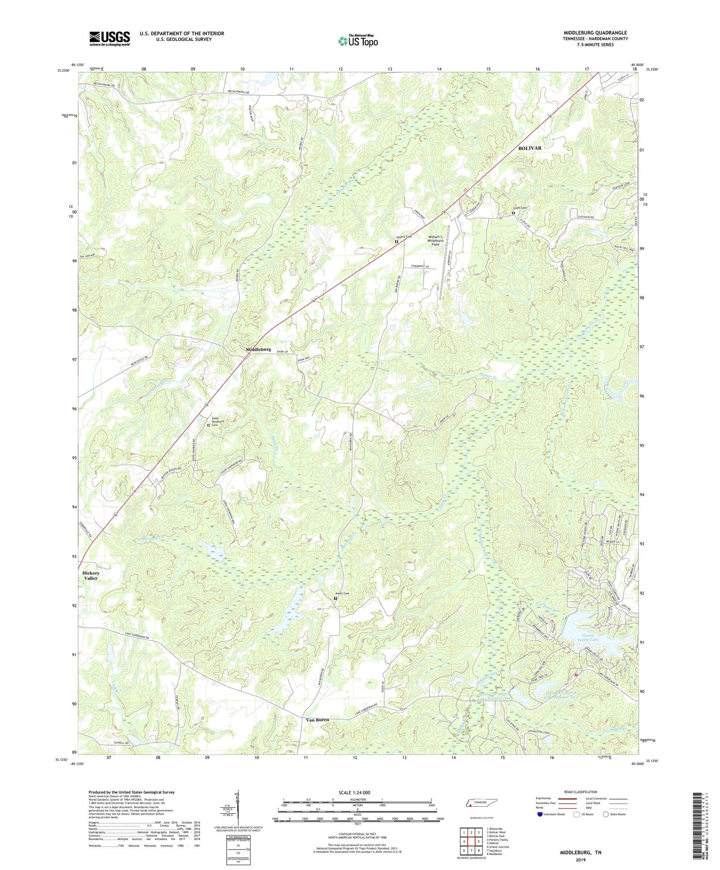
2019 topographic map quadrangle Middleburg in the state of Tennessee. Scale: 1:24000. Based on the newly updated USGS 7.5' US Topo map series, this map is in the following counties: Hardeman. The map contains contour data, water features, and other items you are used to seeing on USGS maps, but also has updated roads and other features. This is the next generation of topographic maps. Printed on high-quality waterproof paper with UV fade-resistant inks.
Quads adjacent to this one:
West: Hickory Valley
Northwest: Whiteville
North: Bolivar West
Northeast: Bolivar East
East: Hebron
Southeast: Middleton
South: Saulsbury
Southwest: Grand Junction
Contains the following named places: Avent Cemetery, Bolivar Division, Clifft Cemetery, Commissioner District 2, Commissioner District 4, Covington Branch, Daily Creek, Enon Church, Gin Pond Branch, Good Shepherd Cemetery, Grand Valley Dam Number Two, Grand Valley Fire Department, Grand Valley Lake, Grand Valley Lake Number One Dam, Hamer Creek, Marshall Creek, Mathews School, Messiah's Spiritual Body Church, Middleburg, Middleburg Baptist Church, Middleburg School, New Bethel Baptist Church, Snow Creek, Spring Creek Ranch Lake Number One, Spring Creek Ranch Lake Number One Dam, Spring Creek Ranch Lake Number Two, Spring Creek Ranch Lake Number Two Dam, Sugar Hill, Sugar Hill School, Ussery Cemetery, Van Buren, Van Buren School, Welcome Ussery Creek, William L Whitehurst Field