MyTopo
Milton Tennessee US Topo Map
Couldn't load pickup availability
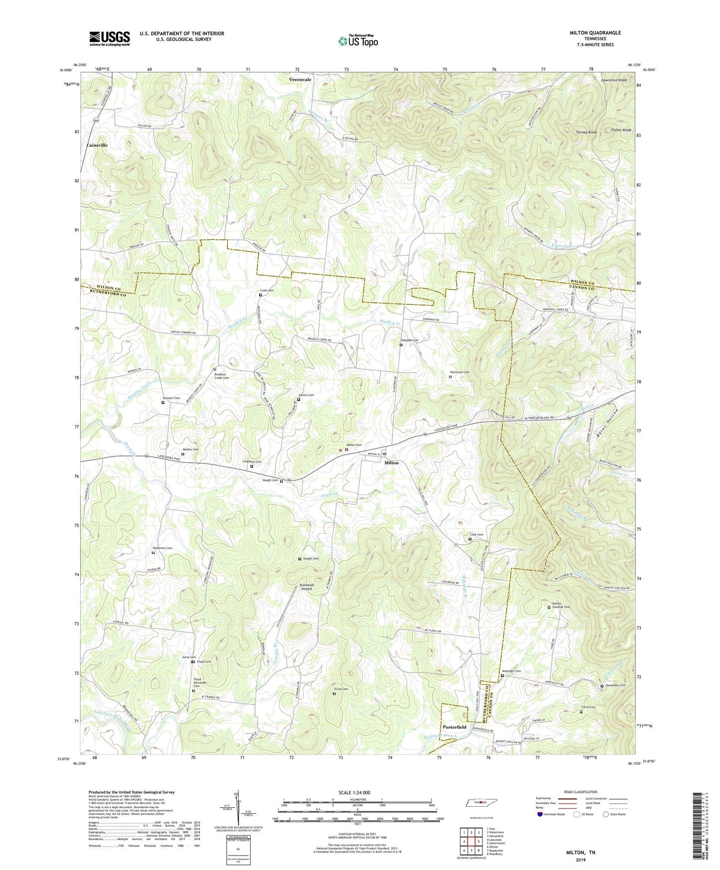
2019 topographic map quadrangle Milton in the state of Tennessee. Scale: 1:24000. Based on the newly updated USGS 7.5' US Topo map series, this map is in the following counties: Rutherford, Wilson, Cannon. The map contains contour data, water features, and other items you are used to seeing on USGS maps, but also has updated roads and other features. This is the next generation of topographic maps. Printed on high-quality waterproof paper with UV fade-resistant inks.
Quads adjacent to this one:
West: Lascassas
Northwest: Vine
North: Watertown
Northeast: Alexandria
East: Auburntown
Southeast: Woodbury
South: Readyville
Southwest: Dillton
Contains the following named places: Alexander Cemetery, Bains Hollow, Bradley Creek Church, Bradley Creek Missionary Church, Bradley Mill, Bradleys Creek Cemetery, Cainsville, Cainsville Methodist Church, Center Point Church, Cook Cemetery, Craddock Cemetery, Dement Cemetery, Dry Fork, Elrod Cemetery, Ewingsville, Fisher Knob, Floyd Cemetery, Floyd-Alexander Cemetery, Gaines Cemetery, Gloriana, Gloriana Church, Green Valley Dairy Farms, Greenvale, Halls Mill, Jones Cemetery, Knight School, Lascassas Volunteer Fire Department Station 2, Lawrence Knob, Mathes Cemetery, McKnight Cemetery, McPeaks Mill, Milton, Milton Cemetery, Milton Post Office, Northcutt Branch, Oregon, Oregon Church, Overall Church, Overalls Camp Ground, Patterson Cemetery, Porterfield, Rucker Goodloe Cemetery, Simpson Cemetery, Stonewall Airpark, Travis Cemetery, Trimble Branch, Trimble Church, Turney Knob, Vaught Cemetery, ZIP Code: 37118