MyTopo
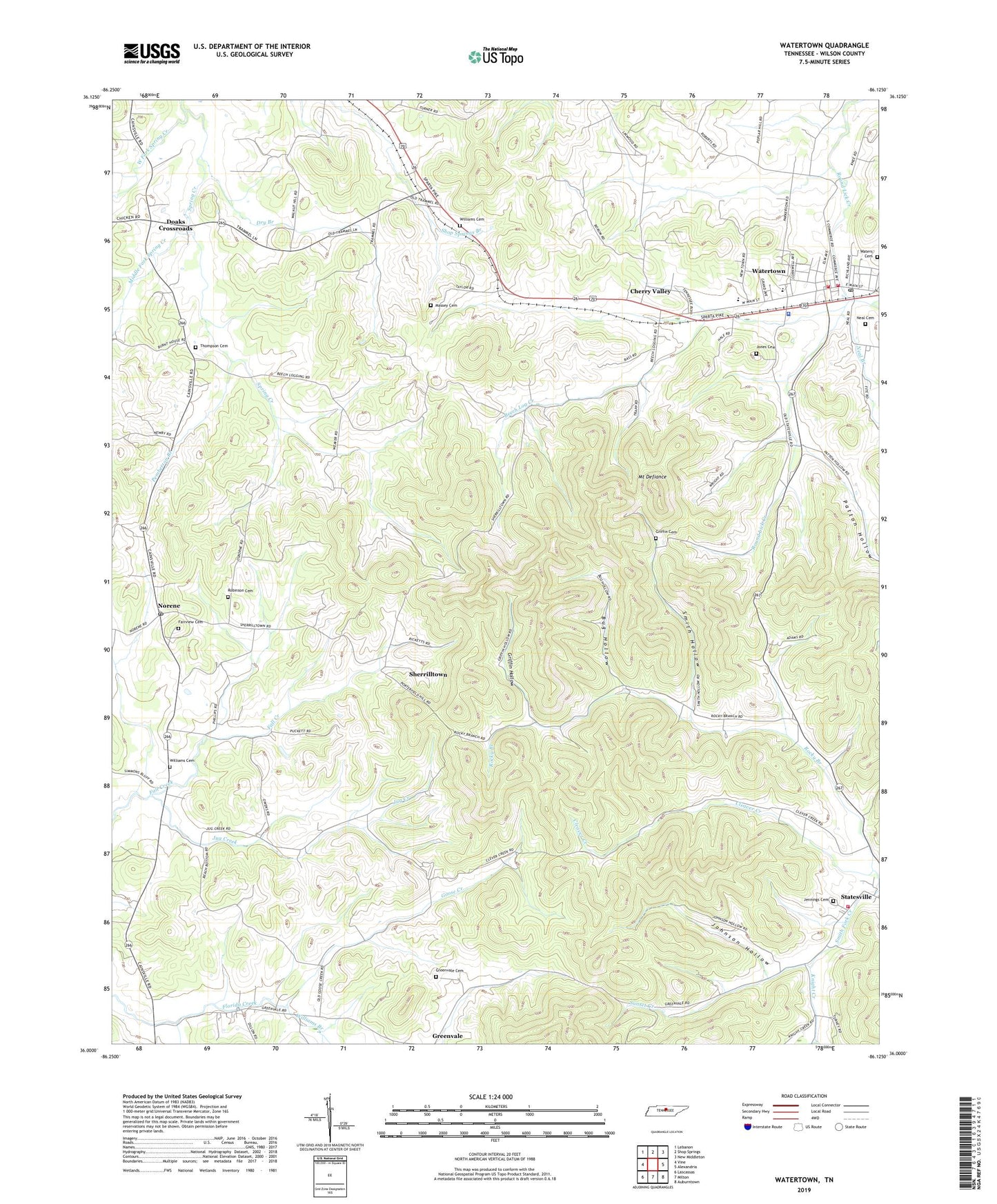
Watertown Tennessee US Topo Map
Couldn't load pickup availability
2022 topographic map quadrangle Watertown in the state of Tennessee. Scale: 1:24000. Based on the newly updated USGS 7.5' US Topo map series, this map is in the following counties: Wilson. The map contains contour data, water features, and other items you are used to seeing on USGS maps, but also has updated roads and other features. This is the next generation of topographic maps. Printed on high-quality waterproof paper with UV fade-resistant inks.
Quads adjacent to this one:
West: Vine
Northwest: Lebanon
North: Shop Springs
Northeast: New Middleton
East: Alexandria
Southeast: Auburntown
South: Milton
Southwest: Lascassas
This map covers the same area as the classic USGS quad with code o36086a2.
Contains the following named places: Beech Log Creek, Bug Hollow, Center Hill, Cherry Valley, City of Watertown, Doaks Crossroads, Dry Branch, Fairview Cemetery, Fall Creek Church, Goose Creek, Greenvale Baptist Church, Greenvale Cemetery, Greenvale Census Designated Place, Griffin Cemetery, Griffin Hollow, Jennings Cemetery, Johnson Hollow, Jones Cemetery, Jug Creek, Knight Creek, Massey Cemetery, Middle Fork Spring Creek, Mount Defiance, Mount Olive Church, Mount Vernon, Mount Vernon Church, Neal Branch, Neal Cemetery, Norene, Norene Census Designated Place, Norene Post Office, Norene School, Patton Hollow, Pemberton Branch, Ramah Church, Robinson Cemetery, Rocky Branch, Sherrilltown, Smith Fork Church, Smith Hollow, Spring Creek Church, Sunset Creek, Thompson Cemetery, Waters Cemetery, Watertown, Watertown Church of Christ, Watertown Division, Watertown Elementary School, Watertown High School, Watertown Junior High School, Watertown Police Department, Watertown Post Office, Watertown Volunteer Fire Department, West Fork Spring Creek, Williams Branch, Williams Cemetery, Wilson Emergency Management Agency Fire Station 2 Watertown, Wilson Emergency Management Agency Fire Station 7 Statesville, ZIP Code: 37184


