
MyTopo
Mosheim Tennessee US Topo Map
Couldn't load pickup availability
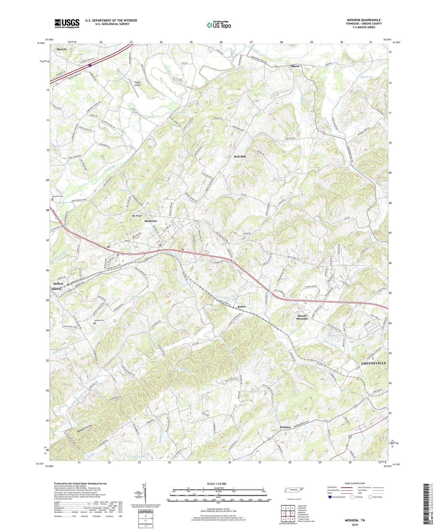
2019 topographic map quadrangle Mosheim in the state of Tennessee. Scale: 1:24000. Based on the newly updated USGS 7.5' US Topo map series, this map is in the following counties: Greene. The map contains contour data, water features, and other items you are used to seeing on USGS maps, but also has updated roads and other features. This is the next generation of topographic maps. Printed on high-quality waterproof paper with UV fade-resistant inks.
Quads adjacent to this one:
West: Mohawk
Northwest: Bulls Gap
North: McCloud
Northeast: Baileyton
East: Greeneville
Southeast: Davy Crockett Lake
South: Cedar Creek
Southwest: Parrottsville
Contains the following named places: Albany, Big Ridge, Big Spring, Big Spring Church, Brookside School, Brown Prospect, Brown Springs Church, Burkey Pond, Carpenters Chapel, Carter Chapel, Cedar Hill, Cedar Hill Church, Cherokee Estates, Cold Spring, Colvard Prospect, Combs Pond, Commissioner District 7, Crazy Creek, Cuerton Dial Branch, Dulaney, Dulaney Branch, Fairview School, Flaglor Airport, Gap Creek, Gass Creek, Gethsemane School, Gilbreath, Gilbreath School, Glenwood Elementary School, Grassy Creek, Greene County Industrial Park, Greene Vocational Center, Hartman Branch, Hartman Church, Hartman Mine Number One, Hartman Mine Number Two, Hartmans School, Hawkins Cemetery, Hoover Creek, Huff Branch, Hull Mill, Lick Branch, Marvin, Marvin United Methodist Church, McNew Branch, Memento, Midway, Midway Post Office, Midway United Methodist Church, Mosheim, Mosheim Branch, Mosheim Division, Mosheim Elementary School, Mosheim Fire Department, Mosheim Post Office, Mosheim Volunteer Fire Department, Mount Pleasant, Mount Pleasant School, New Bethel Cumberland Presbyterian Church, New Bethel School, Possum Creek, Puncheon Camp Creek, Rader, Rader and Rader Dairy Farm, Ramsey Chapel, Ramsey Hollow, Sinai Church, Snow Camp Branch, Solomon Branch, Susong Cemetery, Tipton Prospect, Tipton Spring, Town of Mosheim, Trail of the Lonesome Pine, West Greene High School, ZIP Code: 37818


