MyTopo
Baileyton Tennessee US Topo Map
Couldn't load pickup availability
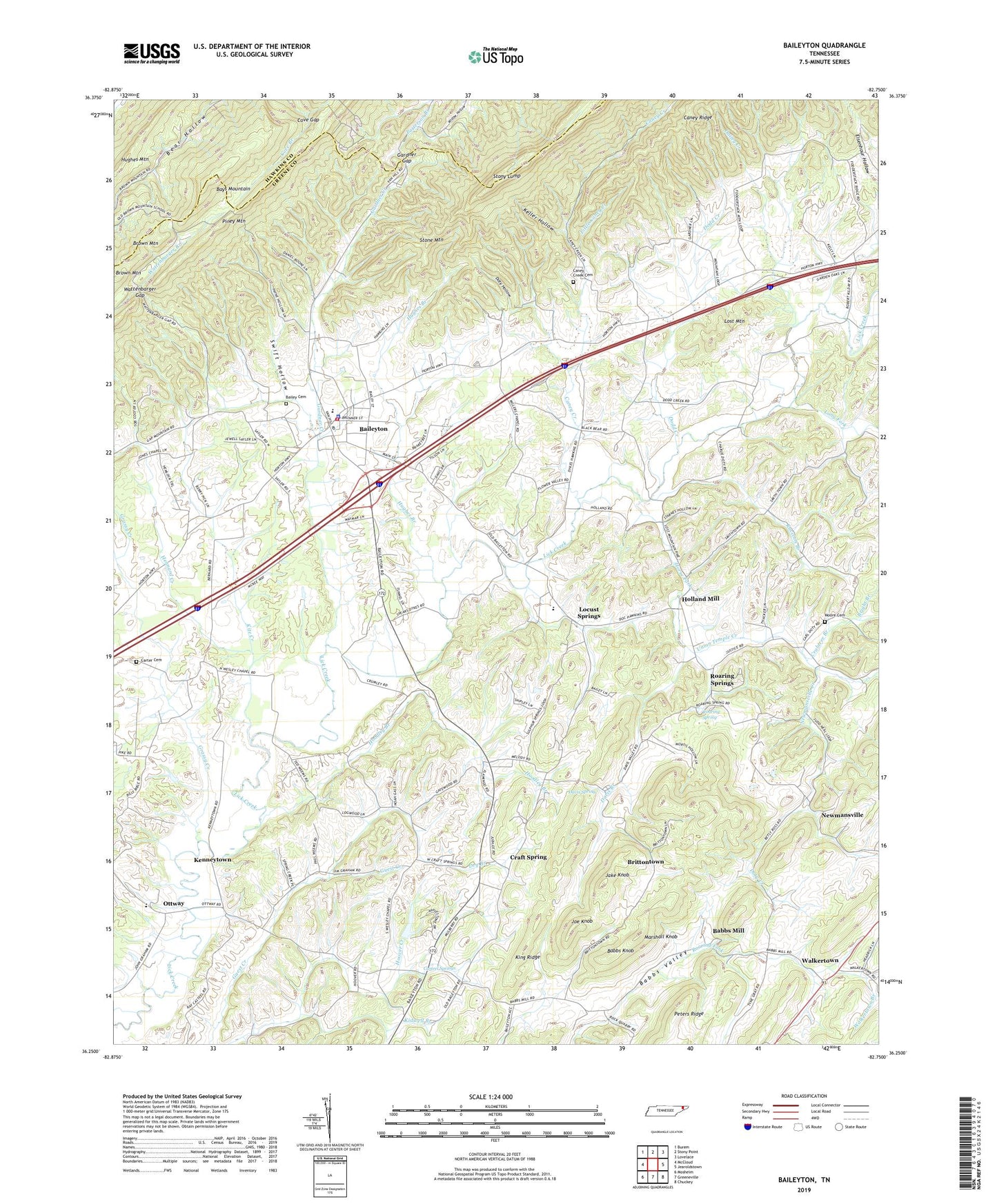
2022 topographic map quadrangle Baileyton in the state of Tennessee. Scale: 1:24000. Based on the newly updated USGS 7.5' US Topo map series, this map is in the following counties: Greene, Hawkins. The map contains contour data, water features, and other items you are used to seeing on USGS maps, but also has updated roads and other features. This is the next generation of topographic maps. Printed on high-quality waterproof paper with UV fade-resistant inks.
Quads adjacent to this one:
West: McCloud
Northwest: Burem
North: Stony Point
Northeast: Lovelace
East: Jearoldstown
Southeast: Chuckey
South: Greeneville
Southwest: Mosheim
This map covers the same area as the classic USGS quad with code o36082c7.
Contains the following named places: Babbs Knob, Babbs Mill, Babbs Valley, Bailey Cemetery, Baileyton, Baileyton Division, Baileyton Elementary School, Baileyton First Baptist Church, Baileyton Police Department, Baileyton United Methodist Church, Bright Branch, Brittontown, Brittontown School, Brown Mountain, Brown Mountain School, Caney Creek, Caney Creek Cemetery, Caney Creek Church, Caney Ridge, Carter Cemetery, Casteel Springs, Castell Springs, Commissioner District 1, Cove Gap, Crabtree Branch, Craft Spring, Cross Anchor, Cross Anchor School, Dailey Creek, Davis Branch, Davis Spring, Dodd Creek, Doty Chapel, Doty Creek, Doty Hollow, Dry Branch, Gardner Creek, Gardner Gap, Grassy Creek, Greene County / Greeneville EMS, Hennard Creek, Holland Mill, Hoodley Branch, Horse Fork, Hughes Branch, Jake Knob, Joe Knob, Justis Dam, Justis Lake, Keller Hollow, Kenneytown, Kidwell Branch, King Ridge, Kite Creek, Lakeview Estates Dam, Lakeview Estates Lake, Lick Creek Mill, Little Caney Creek, Locust Springs, Long Fork, Lost Mountain, Lost Mountain School, Marshall Knob, Moore Cemetery, Mount Hope, Mount Pleasant Church, New Lebanon Church, Newmansville, Newmansville Creek, North Greene High School, Ottway, Ottway Elementary School, Ottway United Methodist Church, Pensinger Airport, Peters Ridge, Piney Grove School, Piney Mountain, Raccoon Branch, Roaring Spring, Roaring Springs, Roaring Springs School, Salem Church, Stony Lump, Sulphur Springs School, Swift Hollow, Town of Baileyton, Union Temple Creek, United Volunteer Fire Station 14, Walkertown, Walkertown Branch, Walkertown School, Wattenbarger Branch, Wattenbarger Gap, Wesley Chapel School, Wesley Chapel United Methodist Church, Zion Church, ZIP Code: 37745