MyTopo
Pattie Gap Tennessee US Topo Map
Couldn't load pickup availability
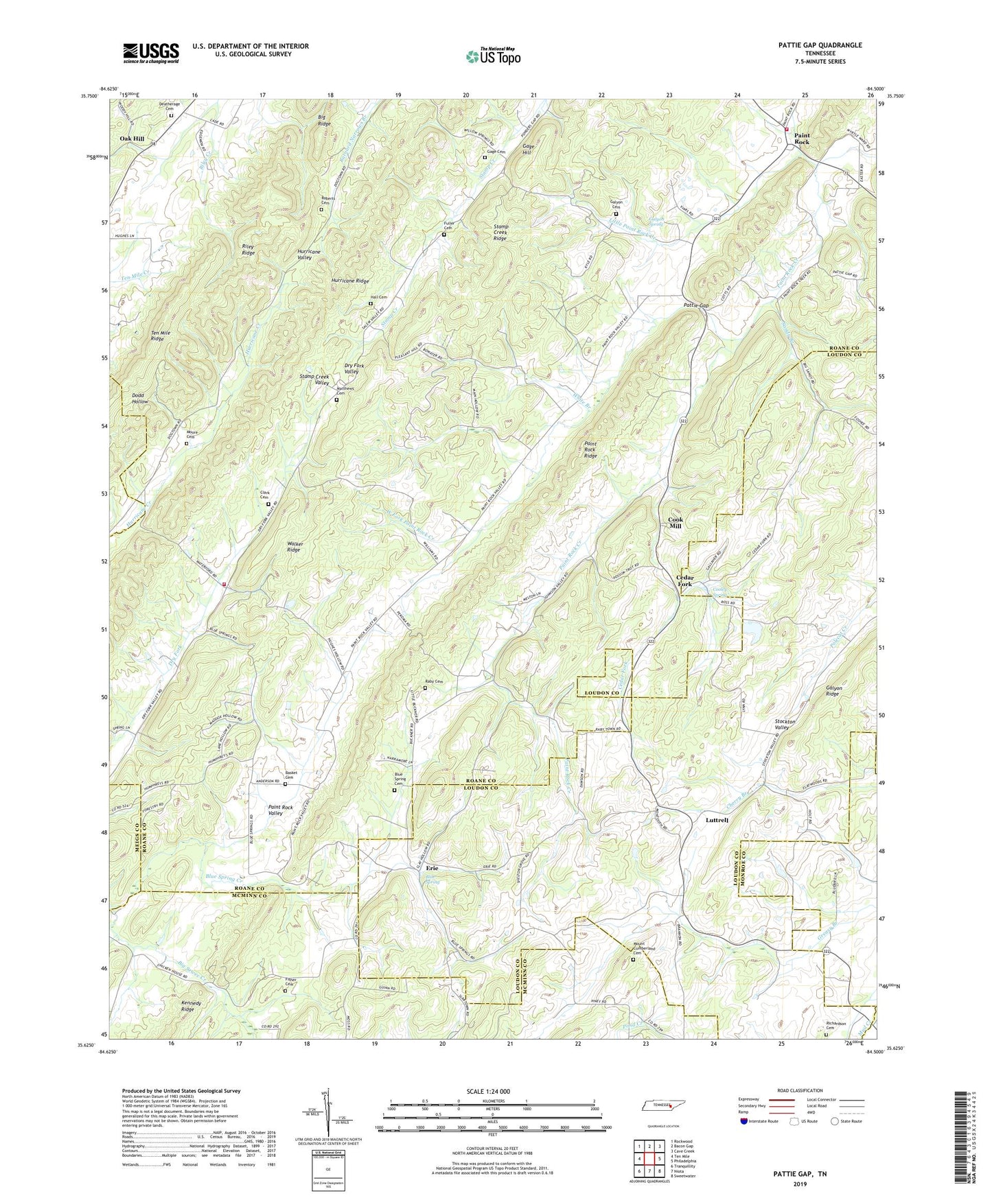
2019 topographic map quadrangle Pattie Gap in the state of Tennessee. Scale: 1:24000. Based on the newly updated USGS 7.5' US Topo map series, this map is in the following counties: Roane, Loudon, McMinn, Monroe, Meigs. The map contains contour data, water features, and other items you are used to seeing on USGS maps, but also has updated roads and other features. This is the next generation of topographic maps. Printed on high-quality waterproof paper with UV fade-resistant inks.
Quads adjacent to this one:
West: Ten Mile
Northwest: Rockwood
North: Bacon Gap
Northeast: Cave Creek
East: Philadelphia
Southeast: Sweetwater
South: Niota
Southwest: Tranquillity
Contains the following named places: Basket Cemetery, Big Ridge, Blue Spring, Blue Spring Cemetery, Blue Spring Church, Blue Spring Creek, Cedar Fork, Cedar Fork Church, Clarks Dry Fork Cemetery, Compromise Church, Compromise School, Cook Mill, Cooley Spring, Deatherage Cemetery, Dry Fork School, Erie, Erie Church, Fenders Church, Fisher Cemetery, Gage Cemetery, Gage Hill, Galyon Cemetery, Galyon Ridge, Galyon Spring, Hall Cemetery, Hurricane Ridge, Johnson, Johnson Chapel, Little Paint Rock Creek, Luttrell, Luttrell School, Matthews Cemetery, Moore Cemetery, Morrisgap, Morrison Store, Mount Cumberland Cemetery, Mount Cumberland Church, Mud Creek, Oak Hill, Oak Hill School, Paint Rock, Paint Rock Ridge, Paint Rock School, Paint Rock Valley, Pattie Gap, Pleasant Hill Church, Raby Cemetery, Regret, Richardson Cemetery, Riley Ridge, Roberts Cemetery, Rose and Fuller Cemetery, Salem Church, Sandy Branch, Sandy School, Shelton Grove Church, South Roane County Volunteer Fire Department Station 2, South Roane County Volunteer Fire Department Station 4, Walker Ridge, West Fork Paint Rock Creek, White Branch