
MyTopo
Unicoi Tennessee US Topo Map
Couldn't load pickup availability
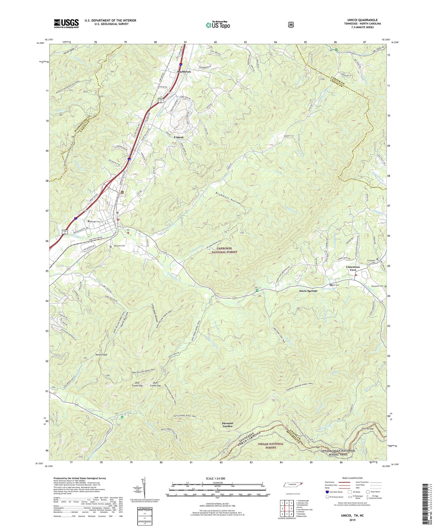
2019 topographic map quadrangle Unicoi in the states of Tennessee, North Carolina. Scale: 1:24000. Based on the newly updated USGS 7.5' US Topo map series, this map is in the following counties: Unicoi, Carter, Washington, Mitchell. The map contains contour data, water features, and other items you are used to seeing on USGS maps, but also has updated roads and other features. This is the next generation of topographic maps. Printed on high-quality waterproof paper with UV fade-resistant inks.
Quads adjacent to this one:
West: Erwin
Northwest: Jonesborough
North: Johnson City
Northeast: Elizabethton
East: Iron Mountain Gap
Southeast: Bakersville
South: Huntdale
Southwest: Chestoa
Contains the following named places: Appalachian Flying Service Number One Airport, Bear Trail Ridge, Bell Cemetery, Big Ball, Britt Mine, Brummett Hollow, Buchanan Cemetery, Buffalo High Point, Buffalo Mountain, Carroll Chapel, CCC Camp Cordell Hull, Cherokee National Forest Fire Service, Cherry Gap, Cherry Gap Shelter, Clear Fork, Commissioner District 3, Cordwood Branch, Cove Branch, Dark Hollow, Davis Springs, Dick Creek, Dick Creek Gap, Dry Creek Camp Ground, Dry Creek School, Fall Branch, Gaddy Prospect, Grindstaff Cemetery, Head Prospect, Hemlock Forest Trail, Honeycomb Creek, Honeycomb Mountain, Horseback Ridge, Indian Creek, Irishman Branch, Ivy Hill Church, Jeffrey Creek, John Brummett Mine, Jones Chapel, Jones Mine, Laughren Chapel, Limestone Cove, Limestone Cove Campground, Limestone Cove Recreation Area, Limestone Cove School, Limestone Cove Trail, Limestone Cove Volunteer Fire Department, Little Dark Hollow, Little Dark Hollow Trail, Little Mountain, Little Rocky Branch, Long Branch, Low Gap, Marbleton, Marbleton School, Nelson Gap, Nelson High Point, Oldfield Branch, Paint Branch, Peterson Cemetery, Piney Ball, Pinnacle Mountain, Pinnacle Mountain Lookout, Pinnacle Tower Trail, Pleasant Garden, Rattlesnake Ridge, Rattlesnake Ridge Trail, Rattlesnake Trail, Ravens Lore Trail, Red Fork, Red Fork Falls Trail, Red Fork School, Right Prong Rock Creek, Rock Creek Bicycle Trail, Rock Creek Camp Ground, Rock Creek Falls Trail, Rocky Branch, Sam Brummett Mine, Scioto Creek, Scoito Shooting Range, Shadtown, Stamping Ground Ridge, Stamping Ground Trail, Stone Mountain, Straight Creek, Street Mine, Sugar Hollow, Swingle Cemetery, Three Mountains, Three Mountains School, Three Mountains Schools, Tipton Prospect, Town of Unicoi, Turkey Trail Branch, Unaka Mountain, Unaka Mountain Campground, Unaka Mountain Recreation Area, Unaka Mountain Scenic Area, Unaka Mountain Scenic Trail, Unaka Mountain Wilderness, Unicoi, Unicoi Baptist Church, Unicoi Division, Unicoi Elementary School, Unicoi Mine, Unicoi Post Office, Unicoi Prospect, Unicoi Volunteer Fire Department, Whispering Pines, ZIP Code: 37692


