MyTopo
Bacliff Texas US Topo Map
Couldn't load pickup availability
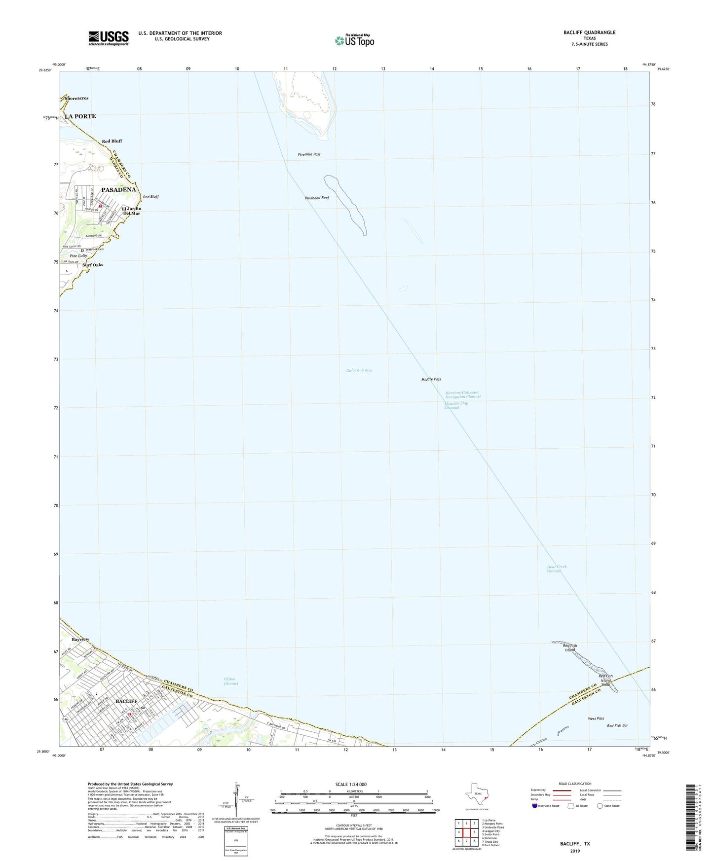
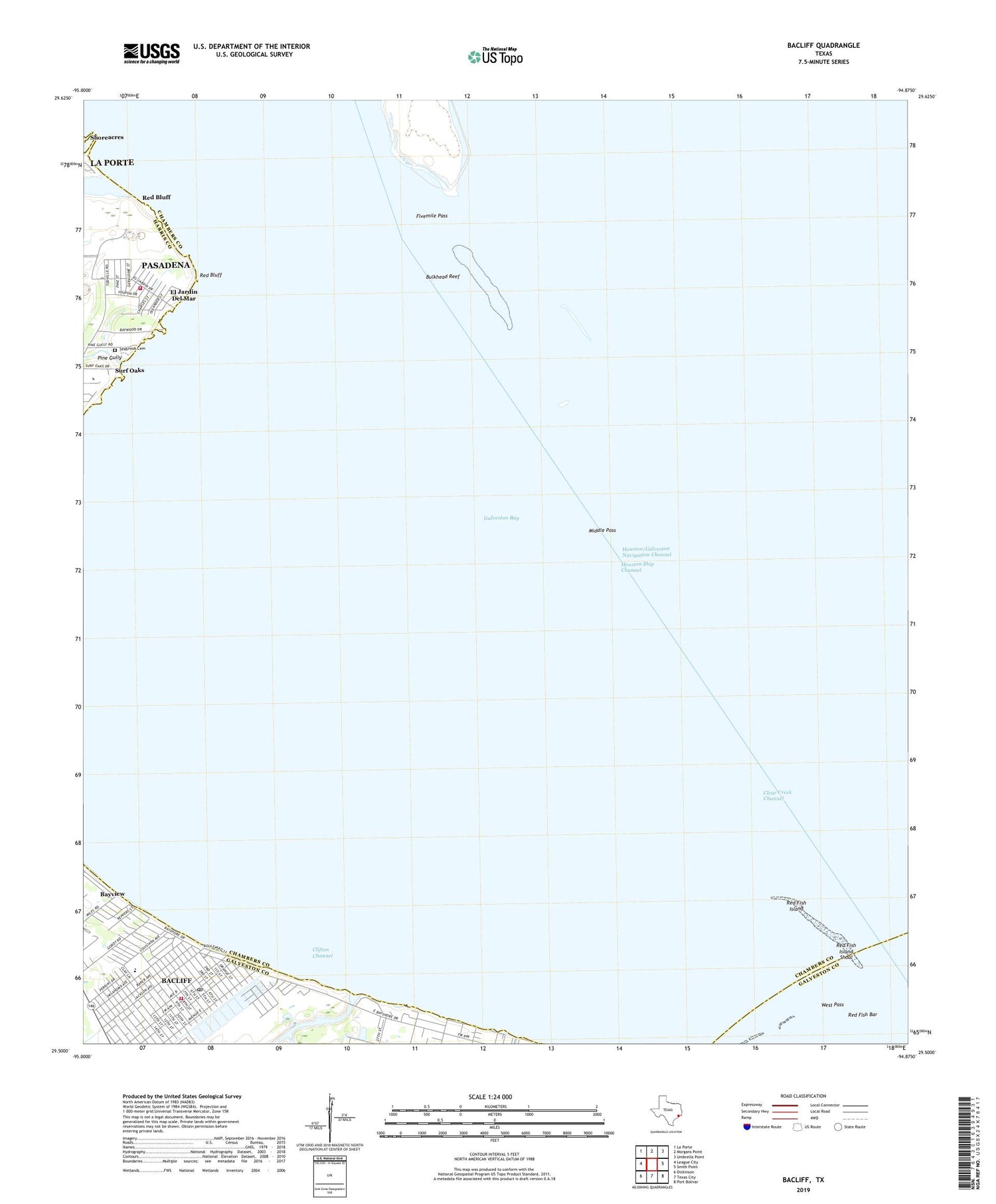
2019 topographic map quadrangle Bacliff in the state of Texas. Scale: 1:24000. Based on the newly updated USGS 7.5' US Topo map series, this map is in the following counties: Chambers, Galveston, Harris. The map contains contour data, water features, and other items you are used to seeing on USGS maps, but also has updated roads and other features. This is the next generation of topographic maps. Printed on high-quality waterproof paper with UV fade-resistant inks.
Quads adjacent to this one:
West: League City
Northwest: La Porte
North: Morgans Point
Northeast: Umbrella Point
East: Smith Point
Southeast: Port Bolivar
South: Texas City
Southwest: Dickinson
Contains the following named places: Bacliff, Bacliff Census Designated Place, Bacliff Post Office, Bacliff Volunteer Fire Department, Bayshore Church, Bayshore Park, Bulkhead Reef, Camp County Public Library, Chase Park, City of Seabrook, Clear Creek Channel, Clifton Beach, Clifton Channel, El Jardin Del Mar, Ellis Airport, First Baptist Church of Bacliff, Fivemile Pass, Galveston Bay, Galveston County Constable's Office Precinct 1, Galveston County Constable's Office Precinct 7, Kenneth E Little Elementary School, Middle Pass, Pasadena Volunteer Fire Department Station 9, Pine Gully, Red Bluff, Red Fish Island, Red Fish Island Shoal, Seabrook Cemetery, Surf Oaks, Texas Corinthian Yacht Club Marina, West Pass, ZIP Code: 77518