MyTopo
Smith Point Texas US Topo Map
Couldn't load pickup availability
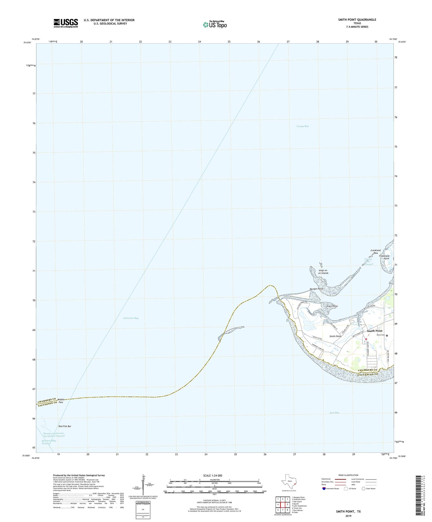
2022 topographic map quadrangle Smith Point in the state of Texas. Scale: 1:24000. Based on the newly updated USGS 7.5' US Topo map series, this map is in the following counties: Chambers, Galveston. The map contains contour data, water features, and other items you are used to seeing on USGS maps, but also has updated roads and other features. This is the next generation of topographic maps. Printed on high-quality waterproof paper with UV fade-resistant inks.
Quads adjacent to this one:
West: Bacliff
Northwest: Morgans Point
North: Umbrella Point
Northeast: Oak Island
East: Lake Stephenson
Southeast: Flake
South: Port Bolivar
Southwest: Texas City
This map covers the same area as the classic USGS quad with code o29094e7.
Contains the following named places: Candy Abshier Wildlife Management Area, Davis Cemetery, Frankland Pass, Frankland Point, Houston Oil and Minerals Smith Point Heliport, Middle Pass, Morgan Point, Red Fish Bar, Redfish Reef Oil Field, Smith Point, Smith Point Oil Field, Smith Point Volunteer Fire Department and Emergency Services, Trinity River Channel, Trout Point, Vingt-et-un Islands