MyTopo
Bat Cave Texas US Topo Map
Couldn't load pickup availability
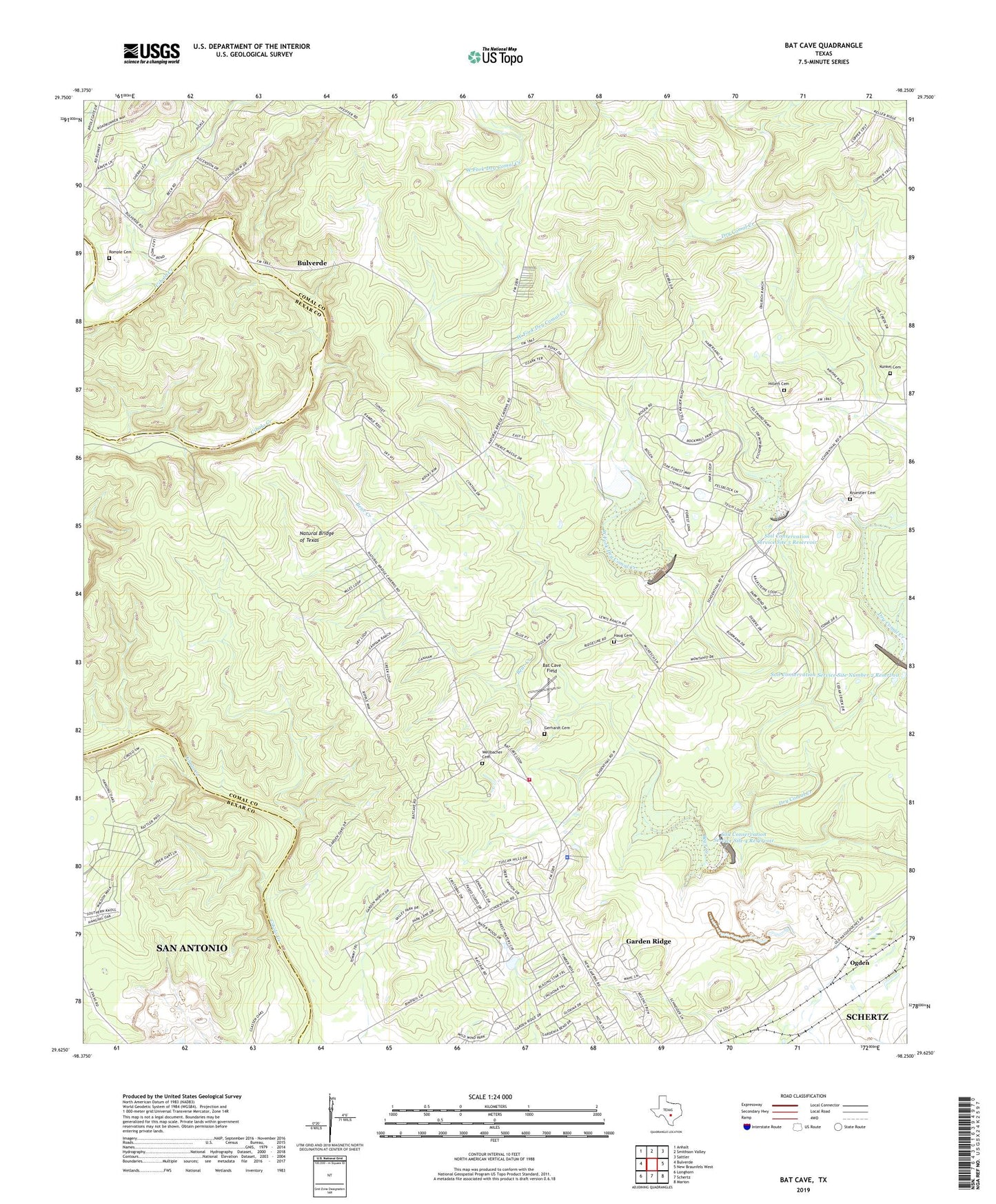
2019 topographic map quadrangle Bat Cave in the state of Texas. Scale: 1:24000. Based on the newly updated USGS 7.5' US Topo map series, this map is in the following counties: Comal, Bexar. The map contains contour data, water features, and other items you are used to seeing on USGS maps, but also has updated roads and other features. This is the next generation of topographic maps. Printed on high-quality waterproof paper with UV fade-resistant inks.
Quads adjacent to this one:
West: Bulverde
Northwest: Anhalt
North: Smithson Valley
Northeast: Sattler
East: New Braunfels West
Southeast: Marion
South: Schertz
Southwest: Longhorn
Contains the following named places: Bat Cave Field, Bear Creek, Bracken Church, Bracken United Methodist Church, Bracken Volunteer Fire Department Central Station, City of Garden Ridge, Garden Ridge, Garden Ridge Police Department, Gerhardt Cemetery, Haug Cemetery, Hillert Cemetery, Kitty Hawk Flying Field, Kruestler Cemetery, Kunkel Cemetery, Natural Bridge of Texas, Ogden, Romple Cemetery, Servtex Quarry, Soil Conservation Service Site 1 Dam, Soil Conservation Service Site 1 Reservoir, Soil Conservation Service Site 4 Dam, Soil Conservation Service Site 4 Reservoir, Soil Conservation Service Site 5 Dam, Soil Conservation Service Site 5 Reservoir, Soil Conservation Service Site Number 2 Dam, Soil Conservation Service Site Number 2 Reservoir, Wellbacher Cemetery, West Fork Dry Comal Creek, ZIP Code: 78266