MyTopo
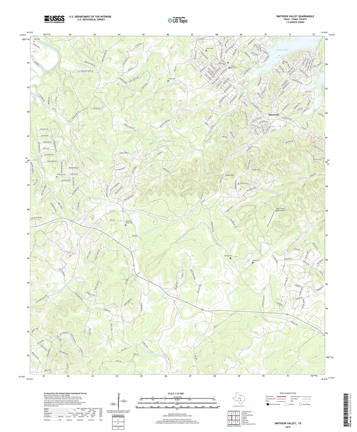
Smithson Valley Texas US Topo Map
Couldn't load pickup availability
2022 topographic map quadrangle Smithson Valley in the state of Texas. Scale: 1:24000. Based on the newly updated USGS 7.5' US Topo map series, this map is in the following counties: Comal. The map contains contour data, water features, and other items you are used to seeing on USGS maps, but also has updated roads and other features. This is the next generation of topographic maps. Printed on high-quality waterproof paper with UV fade-resistant inks.
Quads adjacent to this one:
West: Anhalt
Northwest: Spring Branch
North: Fischer
Northeast: Devils Backbone
East: Sattler
Southeast: New Braunfels West
South: Bat Cave
Southwest: Bulverde
This map covers the same area as the classic USGS quad with code o29098g3.
Contains the following named places: Allen Park, Bear Creek Ranch Airport, Canyon Lake Division, Canyon Lake Fire and EMS Station 52, Canyon Lake Forest, Canyon Springs, Comal County, Cranes Mill Cemetery, Grace Bible Fellowship Church, Gus Rust Family Cemetery, Heimer Cemetery, Jonas Cemetery, Kraft Cemetery, Krause Lake, Krause Lake Dam, Miller Creek, Sherwood School, Simon Cemetery, Smithson Valley, Smithson Valley Cemetery, Smithson Valley High School, Startz Hill, Startzville, Tom Creek, Valley View, Weidner Cemetery, Westhaven