MyTopo
Beeville West Texas US Topo Map
Couldn't load pickup availability
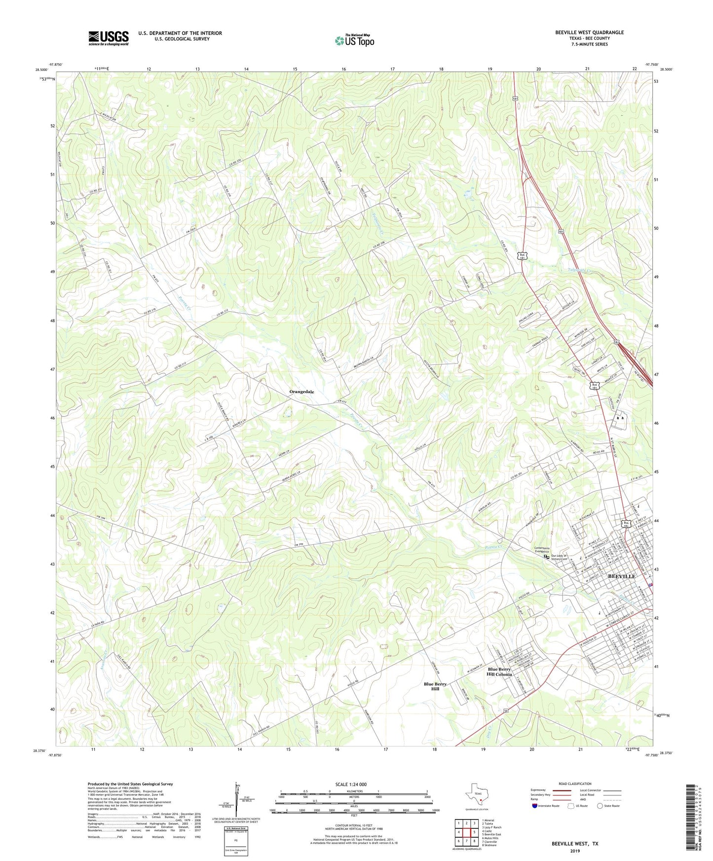
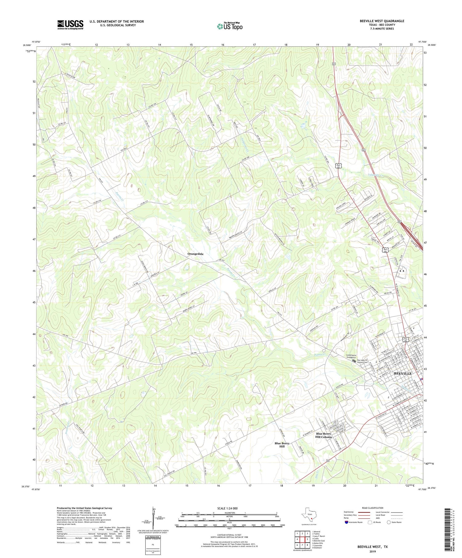
2019 topographic map quadrangle Beeville West in the state of Texas. Scale: 1:24000. Based on the newly updated USGS 7.5' US Topo map series, this map is in the following counties: Bee. The map contains contour data, water features, and other items you are used to seeing on USGS maps, but also has updated roads and other features. This is the next generation of topographic maps. Printed on high-quality waterproof paper with UV fade-resistant inks.
Quads adjacent to this one:
West: Cadiz
Northwest: Mineral
North: Tuleta
Northeast: Lazy F Ranch
East: Beeville East
Southeast: Skidmore
South: Clareville
Southwest: Mulos Hills
Contains the following named places: A C Jones High School, Adams Saint Church of Christ, Alta Vista Park, Angel Care Ambulance Service, Beeville Art Museum, Beeville City Hall, Beeville Country Club, Beeville Police Community Training Center, Beeville Police Department, Beeville Volunteer Fire Department, Bethel Pentecostal Church, Blue Berry Hill, Blue Berry Hill Census Designated Place, Blue Berry Hill Colonia, Brown Ranch Airport, Cementerio Evangelico, Coastal Bend College - Beeville, First Baptist Church School, First Presbyterian Church, Flournoy Park, Friendship Church, Hall School, Jackson School, Jones Chapel Methodist Church, Kobler Park, KYTX-FM (Beeville), Moreno Junior High School, Northwest Area Park, Old Airport Road Colonia, Orangedale, Our Lady of Victory Cemetery, Our Lady of Victory School, Primera Iglesia Bautista Church, R A Hall Elementary School, Reyes Park, Salazar Heights Colonia, Ten Acre Park, Veterans Memorial Park