MyTopo
Skidmore Texas US Topo Map
Couldn't load pickup availability
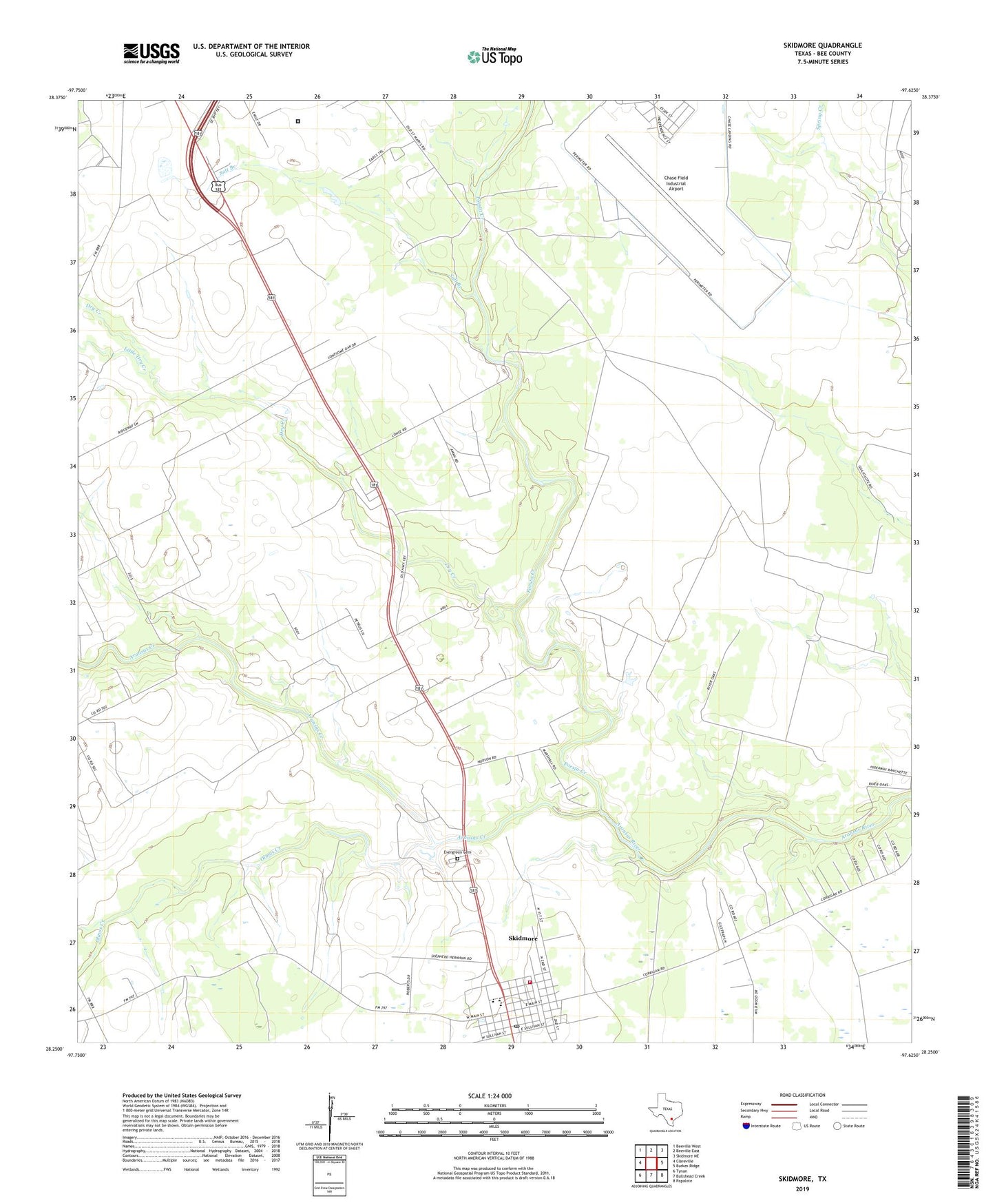
2022 topographic map quadrangle Skidmore in the state of Texas. Scale: 1:24000. Based on the newly updated USGS 7.5' US Topo map series, this map is in the following counties: Bee. The map contains contour data, water features, and other items you are used to seeing on USGS maps, but also has updated roads and other features. This is the next generation of topographic maps. Printed on high-quality waterproof paper with UV fade-resistant inks.
Quads adjacent to this one:
West: Clareville
Northwest: Beeville West
North: Beeville East
Northeast: Skidmore NE
East: Burkes Ridge
Southeast: Papalote
South: Bullshead Creek
Southwest: Tynan
This map covers the same area as the classic USGS quad with code o28097c6.
Contains the following named places: Aransas Creek, Chase Field Industrial Airport, Dry Creek, Evergreen Cemetery, Little Dry Creek, Olmos Creek, Poesta Creek, Salt Branch, Skidmore, Skidmore - Tynan Elementary School, Skidmore - Tynan High School, Skidmore - Tynan Junior High School, Skidmore Census Designated Place, Skidmore Post Office, Skidmore Volunteer Fire Department, Texas Department of Criminal Justice William G McConnell Unit, Yougeen