MyTopo
Ben Arnold Texas US Topo Map
Couldn't load pickup availability
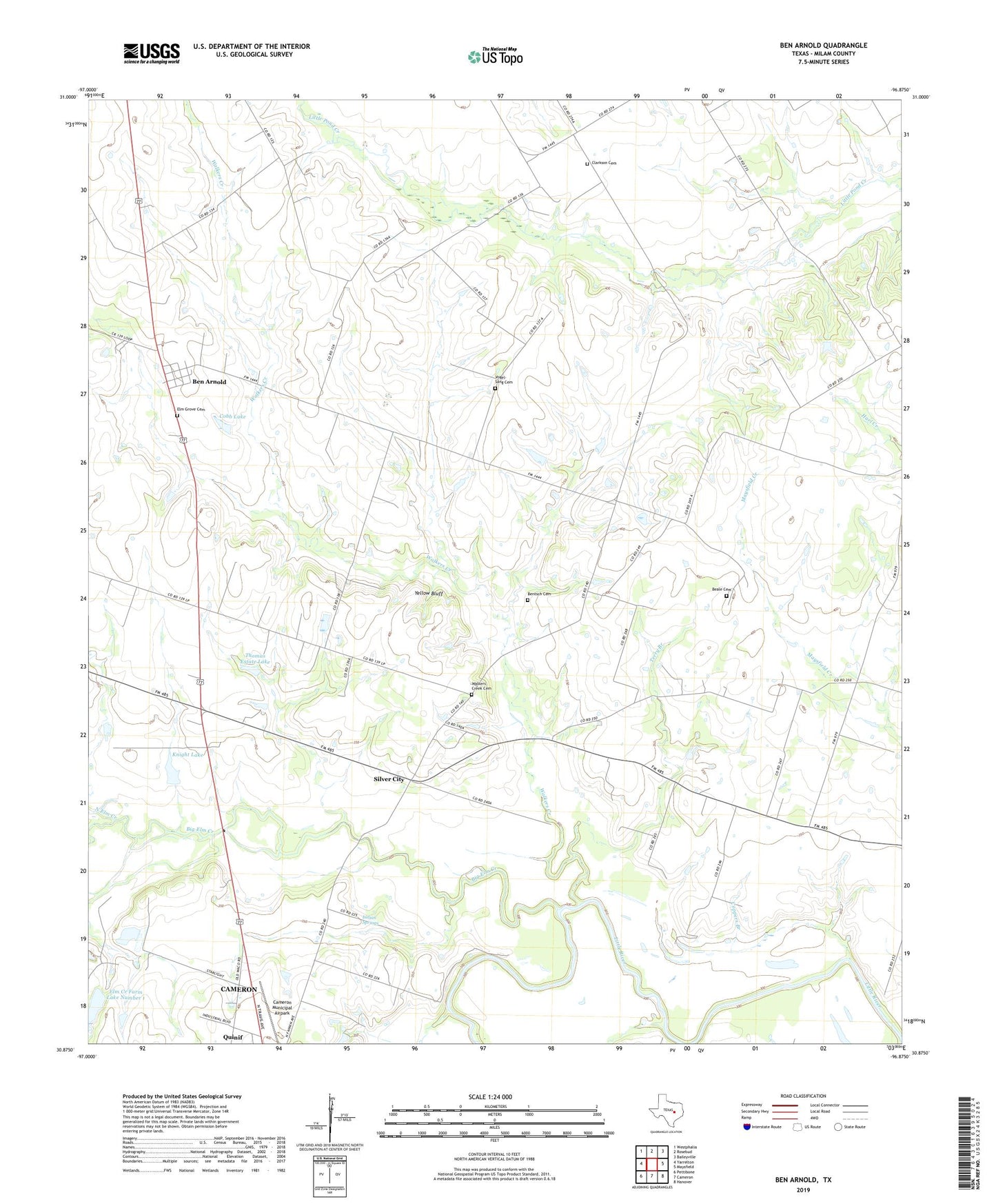
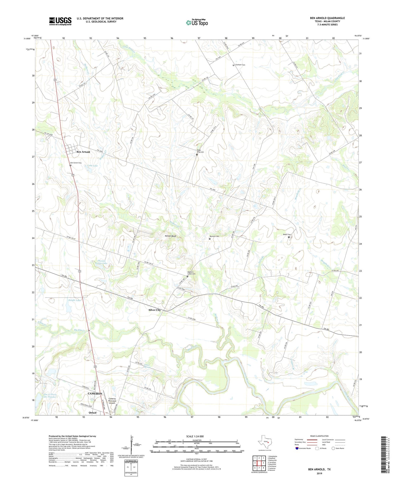
2019 topographic map quadrangle Ben Arnold in the state of Texas. Scale: 1:24000. Based on the newly updated USGS 7.5' US Topo map series, this map is in the following counties: Milam. The map contains contour data, water features, and other items you are used to seeing on USGS maps, but also has updated roads and other features. This is the next generation of topographic maps. Printed on high-quality waterproof paper with UV fade-resistant inks.
Quads adjacent to this one:
West: Yarrelton
Northwest: Westphalia
North: Rosebud
Northeast: Baileyville
East: Maysfield
Southeast: Hanover
South: Cameron
Southwest: Pettibone
Contains the following named places: Beale Cemetery, Belmena, Ben Arnold, Ben Arnold Census Designated Place, Big Elm Creek, Black, Cameron Municipal Airpark, Clarkson, Clarkson Cemetery, Clarkson Church, Cobb Lake, Cobb Lake Dam, Coppers Branch, Elm Creek Farm Dam Number 1, Elm Creek Farm Lake Number 1, Elm Grove Cemetery, Hudson Lake, Hudson Lake Dam, Indian Springs, KJKS-FM (Cameron), Knight Lake, Knight Lake Dam, New Providence Church, North Elm Creek, Quinif, Rentsch Cemetery, Schulenburg Public Library, Silver City, Splawn, Terry Branch, Thomas Estate Lake, Thomas Estate Lake Dam, Vogel-Sang Cemetery, Walkers Creek, Walkers Creek Cemetery, Walkers Creek School, Yellow Bluff, ZIP Code: 76520