MyTopo
Baileyville Texas US Topo Map
Couldn't load pickup availability
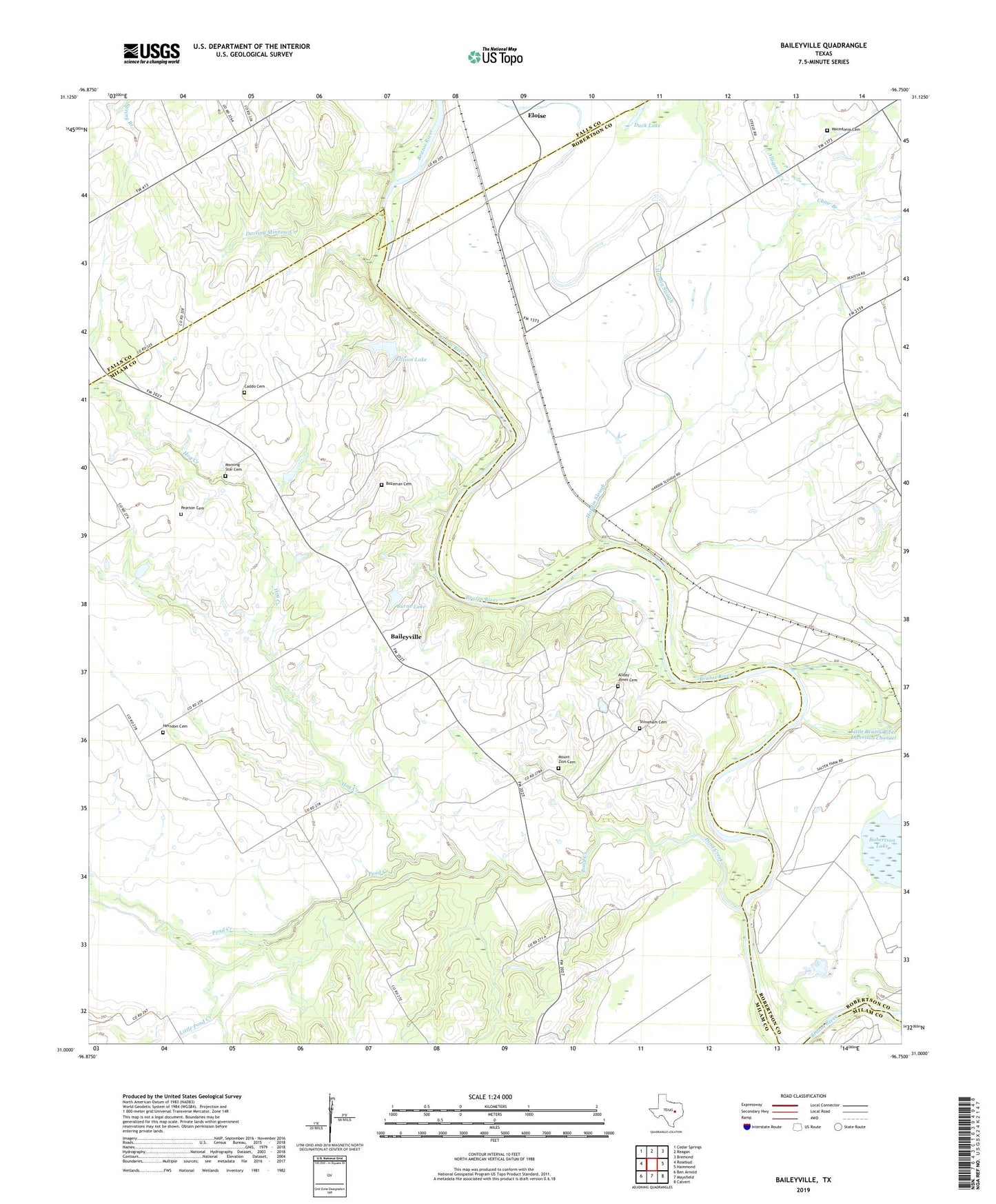
2022 topographic map quadrangle Baileyville in the state of Texas. Scale: 1:24000. Based on the newly updated USGS 7.5' US Topo map series, this map is in the following counties: Milam, Robertson, Falls. The map contains contour data, water features, and other items you are used to seeing on USGS maps, but also has updated roads and other features. This is the next generation of topographic maps. Printed on high-quality waterproof paper with UV fade-resistant inks.
Quads adjacent to this one:
West: Rosebud
Northwest: Cedar Springs
North: Reagan
Northeast: Bremond
East: Hammond
Southeast: Calvert
South: Maysfield
Southwest: Ben Arnold
This map covers the same area as the classic USGS quad with code o31096a7.
Contains the following named places: Allday - Jones Cemetery, Alligator Creek, Baileyville, Bozeman Cemetery, Burns Lake, Burns Lake Dam, Caddo Cemetery, Chair Branch, Cottonmouth Creek, Darting Minnow Creek, Duck Lake, Ellison Lake, Ellison Lake Dam, Eloise, Hardin Slough, Herndon Cemetery, Hog Creek, Hopper Ranch, Little Brazos River Diversion Channel, Little Pond Creek, Macedonia Cemetery, Macedonia Church, Morning Star Cemetery, Morning Star Church, Mount Zion Cemetery, Mount Zion Church, Pearson Cemetery, Pond Creek, Salter Farm, Stoneham Cemetery, True-Vine Church