MyTopo
Big Lake Texas US Topo Map
Couldn't load pickup availability
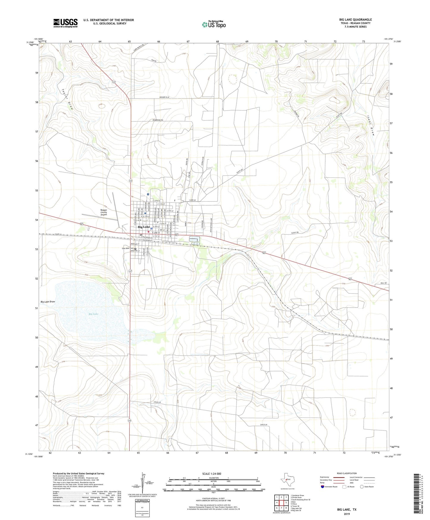
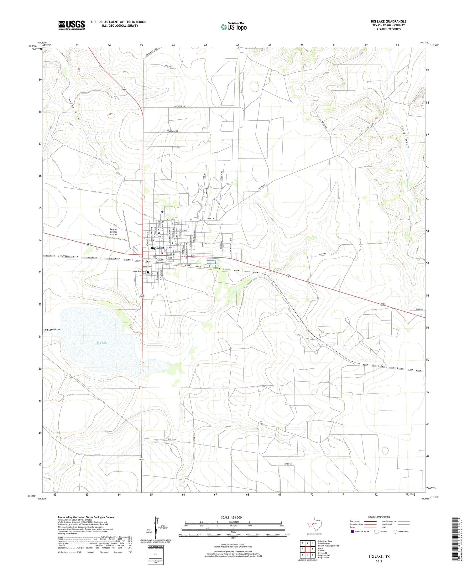
2019 topographic map quadrangle Big Lake in the state of Texas. Scale: 1:24000. Based on the newly updated USGS 7.5' US Topo map series, this map is in the following counties: Reagan. The map contains contour data, water features, and other items you are used to seeing on USGS maps, but also has updated roads and other features. This is the next generation of topographic maps. Printed on high-quality waterproof paper with UV fade-resistant inks.
Quads adjacent to this one:
West: Best
Northwest: Gardener Draw
North: Divide Draw
Northeast: South Mustang Draw SE
East: Witco
Southeast: Big Lake SE
South: Big Lake SW
Southwest: Texon SE
Contains the following named places: Apostolic Church, Big Lake, Big Lake City Hall, Big Lake Draw, Big Lake Post Office, Big Lake Volunteer Fire Department, Church of Christ Big Lake, City of Big Lake, Faith Temple United Pentecostal Church, First Baptist Church, Glen Rest Cemetery, John Scott Oil Field, KWGH-AM (Big Lake), Price Northwest Oil Field, Price Oil Field, Reagan County Airport, Reagan County Elementary School, Reagan County High School, Reagan County Middle School, Reagan County Sheriff's Office, Reagan Memorial Hospital