MyTopo
Burleson Texas US Topo Map
Couldn't load pickup availability
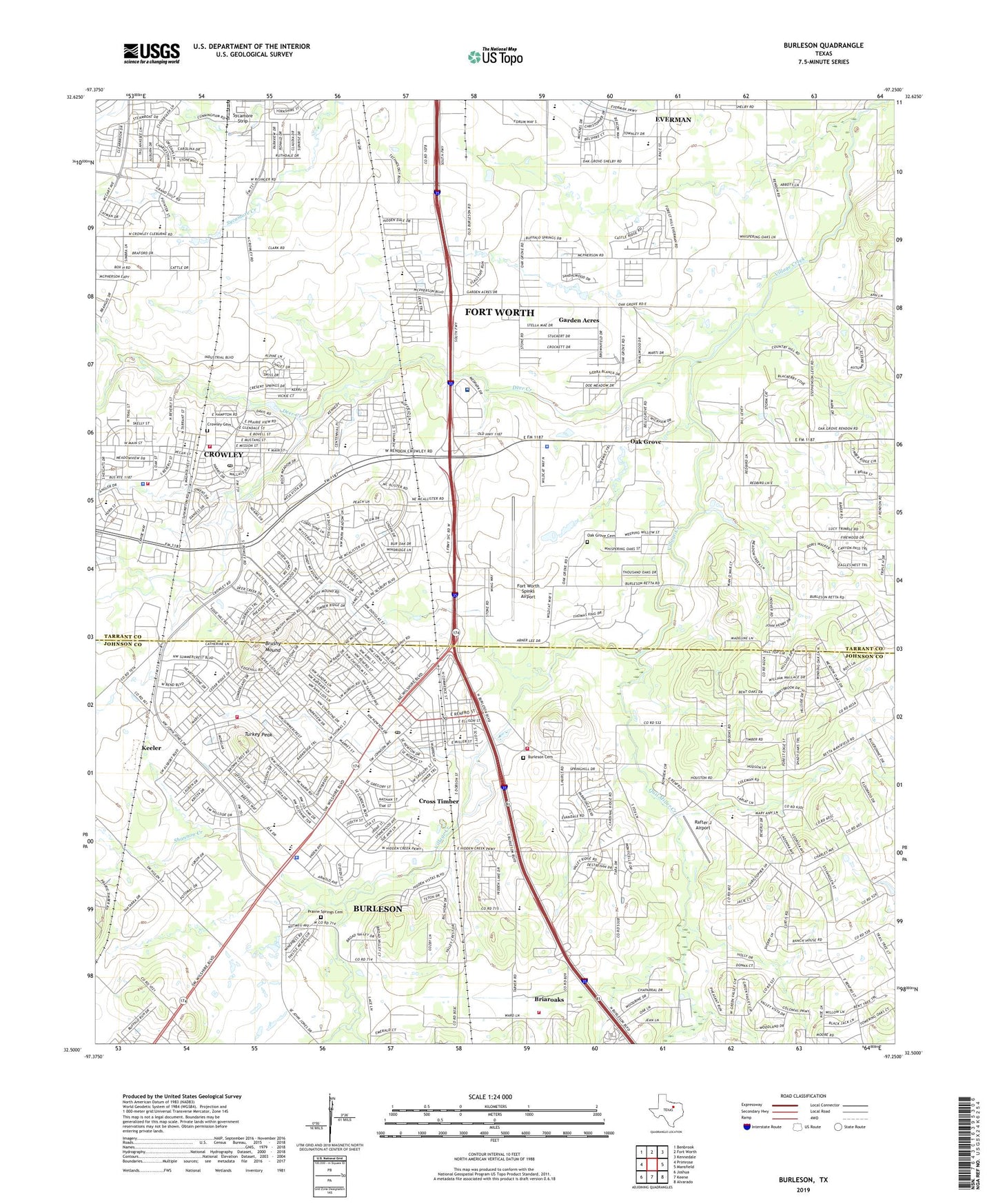
2019 topographic map quadrangle Burleson in the state of Texas. Scale: 1:24000. Based on the newly updated USGS 7.5' US Topo map series, this map is in the following counties: Tarrant, Johnson. The map contains contour data, water features, and other items you are used to seeing on USGS maps, but also has updated roads and other features. This is the next generation of topographic maps. Printed on high-quality waterproof paper with UV fade-resistant inks.
Quads adjacent to this one:
West: Primrose
Northwest: Benbrook
North: Fort Worth
Northeast: Kennedale
East: Mansfield
Southeast: Alvarado
South: Keene
Southwest: Joshua
Contains the following named places: Abiding Faith Lutheran Church, Alsbury Baptist Church, Bartlett Park, Bess Race Elementary School, Bethany Fellowship Church, Bicentennial Park, Boulevard Baptist Church, Bransom Farm Airport, Briaroaks, Briaroaks Volunteer Fire Station, Brushy Mound, Burleson, Burleson Alternative School, Burleson City Hall, Burleson Fire Department Station 1, Burleson Fire Department Station 2, Burleson High School, Burleson Intermediate School, Burleson Memorial Cemetery, Burleson Middle School, Burleson Police Department, Burleson Post Office, Burleson Seventh Day Adventist Church, Burleson Stadium, Calvary Pentecostal Church, Cana Baptist Church, Candleridge Community Baptist Church, Chisenhall Park, Christian Faith Baptist Church, Church of Christ, City of Burleson, City of Crowley, Covenant Place of Burleson Church, Cross Timber, Crowley, Crowley Cemetery, Crowley City Hall, Crowley Fire Department, Crowley Fire Department Station 2, Crowley High School, Crowley Police Department, Crowley Post Office, Deer Creek, Elk Stadium, Everman Church of Christ, Everman High School, Everman Junior High School, First Presbyterian Church in Crowley, Fort Worth Spinks Airport, Frazier Elementary School, Garden Acres, Garden Acres Baptist Church, H F Stevens Middle School, Hallmark Baptist Church, Holy Faith Cathedral of Praise, J E Marr Stadium, Jack Taylor Elementary School, Johnson County Constable's Office Precinct 2, Johnson Park, Keeler, Kingswood United Methodist Church of Burleson, Luck Field, McPherson Road Baptist Church, Meadowridge Community Baptist Church, Mound Elementary School, Norwood Elementary School, Oak Grove, Oak Grove Church, Pleasantview Baptist Church, Prairie Springs Cemetery, Quil Miller Creek, Rafter J Airport, Redchain Research Farm, Royal Oaks Baptist Church, Shannon Creek, Shannon Creek Baptist Church, South Seminary, Southeast Post Office, Southwest Baptist Church, Sycamore Strip, T Park, Texas Health Huguley Hospital Fort Worth South, The Reorganized Church of Jesus Christ of Latter Day Saints, Turkey Peak, Tye Memorial Cemetery, United Methodist Church Christ, William Stribling Elementary School, Wooded Hills, ZIP Codes: 76028, 76140